Yomitan, Japan
Landing Point · JP Japan
1
Connected Cables
JP
Country
26.40°
Latitude
127.74°
Longitude
Ctrl + Scroll to zoom
Connected Cables
| Cable | Status |
|---|---|
| Okinawa Remote Islands | Active |
Live Performance
51
measurements
16
probes
187
days monitored
238.5
ms avg RTT
0
anomalies
RTT measurements to this landing point from 2026-04-06 through 2026-10-10 - live ICMP round-trip time via our monitoring probes. Recomputed daily. ✓ No anomalies detected in the monitored period.
Measurement sources
| Probe | Location | Samples | Avg |
|---|---|---|---|
| own probe | Almaty KZ | 9 | 305.6 ms |
| own probe | Minsk BY | 6 | 288.8 ms |
| own probe | Tbilisi GE | 6 | 282.3 ms |
| own probe | Jerusalem IL | 6 | 296.4 ms |
| #6410 own probe | Sao Paulo BR | 3 | 288.8 ms |
| #7062 own probe | Cape Town ZA | 3 | 366.7 ms |
| #60306 | control probe | 3 | 37.3 ms |
| #1013597 | control probe | 3 | 37.9 ms |
| #6427 own probe | Sydney AU | 2 | 176.0 ms |
| #65655 | control probe | 2 | 40.4 ms |
| own probe | Sevastopol UA | 2 | 291.2 ms |
| own probe | Moscow RU | 2 | 244.1 ms |
| #6487 | control probe | 1 | 79.4 ms |
| #6568 own probe | Singapore SG | 1 | 76.0 ms |
| #1016578 | control probe | 1 | 62.6 ms |
| own probe | Ekaterinburg RU | 1 | 294.2 ms |
About Yomitan, Japan
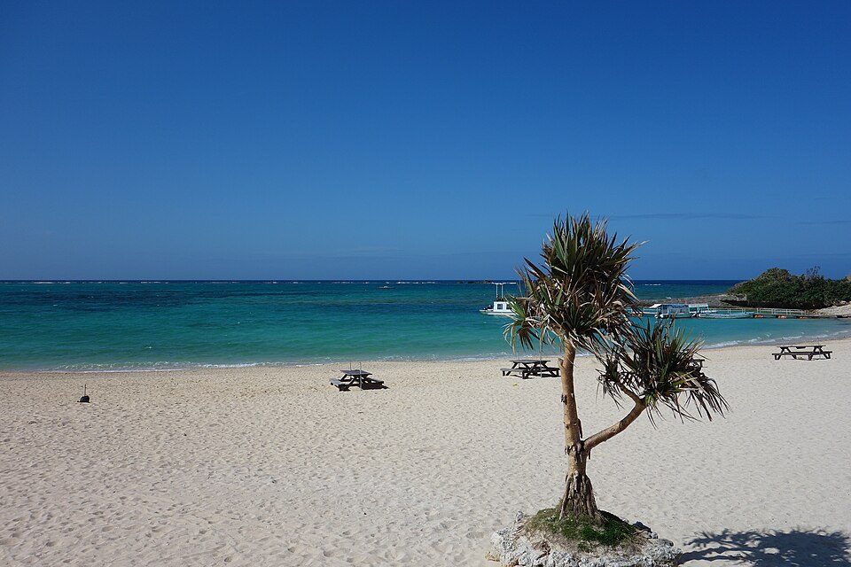
Yomitan: A Gateway to Okinawa's Remote Islands
Yomitan, a coastal village on Okinawa Island, serves as a connection point for the Okinawa Remote Islands submarine cable. While Japan boasts 68 landing points hosting 51 submarine cables, Yomitan stands out for its singular role in linking Okinawa's smaller, remote islands to the larger national and regional network.The Okinawa Remote Islands Cable
The Okinawa Remote Islands cable, operational since 2017, spans 915 kilometers and connects Yomitan to eight other landing points across the Okinawa archipelago: Aguni, Ama, Hateruma, Itoman, Kumejima, Tarama, Tokashiki, and Yonaguni. This cable does not extend beyond Japan's borders, focusing entirely on domestic connectivity. Its purpose is clear: to stitch together the scattered islands of Okinawa with reliable communication links, ensuring residents and businesses in these remote areas stay connected to the broader national infrastructure. Yomitan plays a central role in this chain, acting as the primary gateway for data traveling between Okinawa's smaller islands and the mainland. From Yomitan, data flows into Japan's extensive submarine cable network, which includes high-capacity international cables landing at major hubs like Shima (12 cables), Maruyama (9 cables), and Chikura (8 cables).Latency and Performance
GeoCables’ monitoring reveals an average round-trip latency of 291 milliseconds for connections to Yomitan, with the best observed latency at 242 milliseconds. These figures reflect the cable's focus on serving regional needs rather than competing with the ultra-low latencies of international cables. For the residents of Okinawa's remote islands, this latency is more than sufficient to support daily communication, business operations, and access to digital services.Yomitan's Role in Regional Connectivity
Unlike major landing points such as Shima or Maruyama, which host multiple cables and serve as international hubs, Yomitan is a domestic link dedicated to Okinawa's unique geography. The Okinawa Remote Islands cable ensures that even the smallest and most isolated communities-like Hateruma and Yonaguni-have access to modern connectivity. This is particularly important for these islands, where tourism, agriculture, and local industries depend on reliable communication with Okinawa's main island and the rest of Japan.Conclusion
Yomitan may not rival Japan's larger cable hubs in scale or international reach, but its role within Okinawa's regional network is undeniable. By connecting the remote islands to the mainland, Yomitan enables communities across Okinawa to participate in Japan's digital economy and stay linked to the outside world. For a landing point hosting just one cable, its impact on local connectivity is profound.What next: Yomitan, Japan in the global directory of cable landing points; see surrounding routes on the interactive submarine cable map or follow live network monitoring.
Other Landing Points in Japan
JP Aguni, Japan
26.5872°N 127.2290°E
JP Ajigaura, Japan
36.3836°N 140.6123°E
JP Akita, Japan
39.7167°N 140.1167°E
JP Ama, Japan
26.2310°N 127.2923°E
JP Aogashima, Japan
32.4572°N 139.7656°E
JP Awashimaura, Japan
38.4646°N 139.2528°E
JP Chichijima, Japan
27.0665°N 142.2041°E
JP Chikura, Japan
34.9767°N 139.9547°E
JP Emi, Japan
35.0624°N 140.0611°E
JP Fukuoka, Japan
33.5904°N 130.4017°E
JP Gusukube, Japan
24.7515°N 125.3873°E
JP Hachijo, Japan
33.1123°N 139.7968°E
Landing Point
- CountryJP Japan
- Coordinates26.4020°N 127.7438°E
- Connected Cables1
See Real Cable Routes
View actual submarine cable routing from Yomitan, Japan - with backbone nodes, distance calculations, and latency estimates
Open Calculator →
Submarine cables
Land fiber
Live probes