Shantou, China
Landing Point · CN China
Connected Cables
| Cable | Status |
|---|---|
| APCN-2 | Active |
| Asia Direct Cable (ADC) | Active |
| Southeast Asia-Japan Cable (SJC) | Active |
Live Performance
RTT measurements to this landing point from 2026-03-07 through 2026-08-07 - live ICMP round-trip time via our monitoring probes. Recomputed daily. ✓ No anomalies detected in the monitored period.
Measurement sources
| Probe | Location | Samples | Avg |
|---|---|---|---|
| own probe | Almaty KZ | 5 | 196.9 ms |
| own probe | Tbilisi GE | 5 | 371.4 ms |
| #6410 own probe | Sao Paulo BR | 3 | 335.3 ms |
| #6487 | control probe | 3 | 129.8 ms |
| #7062 own probe | Cape Town ZA | 3 | 316.4 ms |
| #52332 | control probe | 2 | 60.4 ms |
| #1002025 | control probe | 2 | 302.5 ms |
| #1004868 | control probe | 2 | 137.5 ms |
| own probe | Minsk BY | 2 | 186.0 ms |
| own probe | Jerusalem IL | 1 | 238.2 ms |
| own probe | Moscow RU | 1 | 176.4 ms |
About Shantou, China
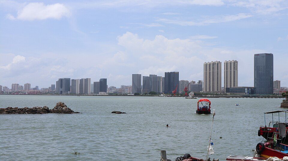
Shantou, China is a submarine cable landing point in China (coordinates 23.3546°, 116.6755°). It serves 3 submarine cable systems, making it a multi-cable landing site in China's international connectivity infrastructure.
Shantou, alternately romanized as Swatow and sometimes known as Santow, is a prefecture-level city on the eastern coast of Guangdong, China, with a total population of 5,502,031 as of the 2020 census and an administrative area of 2,248.39 square kilometres (868.11 sq mi). However, its built-up area is much bigger with 12,543,024 inhabitants including Rongcheng and Jiedong districts, Jiexi county and Puning city in Jieyang plus all of Chaozhou city largely conurbated. This is de facto the 5th built-up area in mainland China between Hangzhou-Shaoxing, Xi'an-Xianyang and Tianjin. Wikipedia
Connected submarine cables
| Cable | RFS | Length | Owners |
|---|---|---|---|
| Asia Direct Cable (ADC) | 2024 | 9,988 km | China Telecom, China Unicom, National Telecom, … |
| Southeast Asia-Japan Cable (SJC) | 2013 | 8,900 km | China Mobile, China Telecom, Chunghwa Telecom, … |
| APCN-2 | 2001 | 19,000 km | AT&T, BT, China Telecom, … |
Operators landing at Shantou, China
Cables landing at Shantou, China are operated by 29 distinct consortium partners and carriers, including AT&T, BT, China Mobile, China Telecom, China Unicom, Chunghwa Telecom, Globe Telecom, Google, HKBN, KDDI, and 19 others. Each cable is typically jointly owned by a consortium of tier-one carriers and hyperscale operators who share construction costs and capacity; the operator mix reflects both regional incumbents and global players with interest in the routes served by this landing point.
Connectivity profile
From Shantou, China, international traffic can reach 10 countries through 3 cable systems. Destinations include Brunei, China, Japan, Malaysia, Philippines, Singapore, South Korea, Taiwan and 2 more.
Monitoring status
GeoCables recorded 1 monitoring event on cables serving Shantou, China in the past 90 days. Our monitoring network continuously samples latency from external probes to targets reachable via these cables.
About the cables
- Asia Direct Cable (ADC) (2024) - Asia Direct Cable (ADC) is a major intercontinental submarine cable system spanning 6 countries across Southeast Asia, East Asia. With 7 landing points - including Batangas, Chung Hom Kok, Maruyama, Quy Nhon, Shantou, and 2 more - it forms one of the backbone links carrying international internet traffic between continents. Read more →
- Southeast Asia-Japan Cable (SJC) (2013) - Southeast Asia-Japan Cable (SJC) is a cross-regional submarine cable connecting Japan, China, Philippines, Brunei, Singapore. Its 6 landing points at Chikura, Chung Hom Kok, Nasugbu, Shantou, Telisai, and 1 more bridge the networks of East Asia, Southeast Asia, providing an important path for international data traffic. Read more →
- APCN-2 (2001) - APCN-2 is a major intercontinental submarine cable system spanning 7 countries across Southeast Asia, East Asia. With 10 landing points - including Batangas, Busan, Cherating, Chikura, Chongming, and 5 more - it forms one of the backbone links carrying international internet traffic between continents. Read more →
What next: Shantou, China in the global directory of cable landing points; see surrounding routes on the interactive submarine cable map or follow live network monitoring.
Other Landing Points in China
FAQ
Landing Point
- CountryCN China
- Coordinates23.3546°N 116.6755°E
- Connected Cables3
See Real Cable Routes
View actual submarine cable routing from Shantou, China - with backbone nodes, distance calculations, and latency estimates
Open Calculator →