Cape D’Aguilar, China
Landing Point · CN China
Connected Cables
| Cable | Status |
|---|---|
| Asia Africa Europe-1 (AAE-1) | Active |
Live Performance
RTT measurements to this landing point from 2026-04-01 through 2026-09-28 - live ICMP round-trip time via our monitoring probes. Recomputed daily. ✓ No anomalies detected in the monitored period.
Measurement sources
| Probe | Location | Samples | Avg |
|---|---|---|---|
| #1014589 own probe | Almaty KZ | 92 | 277.2 ms |
| #6410 own probe | Sao Paulo BR | 90 | 320.2 ms |
| #6487 | control probe | 54 | 34.0 ms |
| #1014597 own probe | Tbilisi GE | 39 | 304.9 ms |
| #7062 own probe | Cape Town ZA | 3 | 345.0 ms |
| #1014473 own probe | Minsk BY | 3 | 197.7 ms |
| #1014969 own probe | Jerusalem IL | 3 | 177.4 ms |
| #1015313 own probe | Sevastopol UA | 2 | 245.2 ms |
| #21915 | control probe | 1 | 337.8 ms |
| #1002025 | control probe | 1 | 261.1 ms |
| #1015523 own probe | Moscow RU | 1 | 204.4 ms |
| #1015893 own probe | Rostov RU | 1 | 246.3 ms |
About Cape D’Aguilar, China
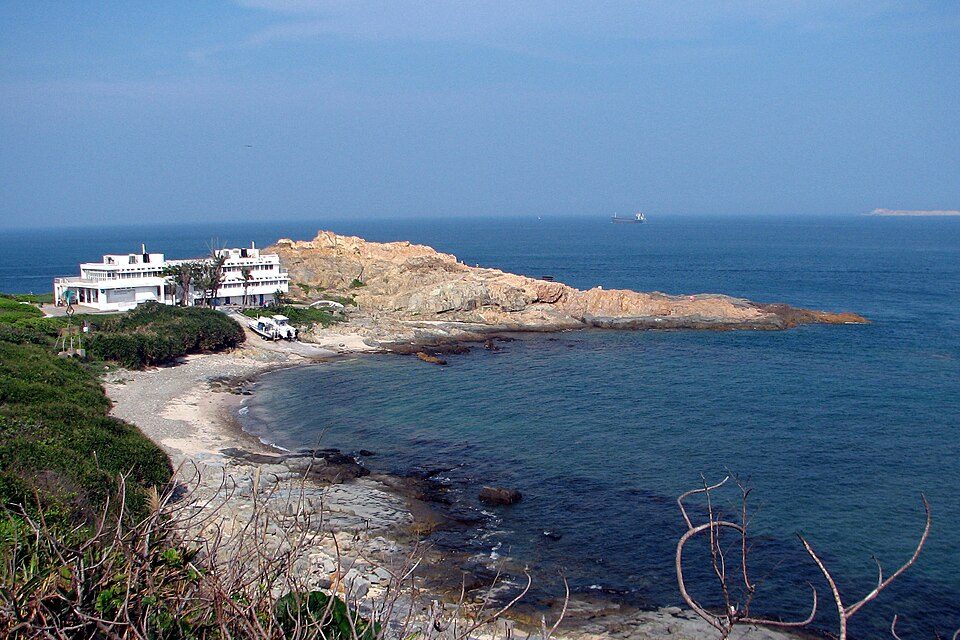
Cape D'Aguilar, China: Submarine Cable Landing Point
Cape D'Aguilar is a cape situated on the southeastern tip of D'Aguilar Peninsula, on Hong Kong Island. As a submarine cable landing point, it connects China to one of the longest and most geographically far-reaching cable systems in the eastern hemisphere. One submarine cable lands at Cape D'Aguilar, extending its reach across multiple continents and linking China to destinations in Southeast Asia, the Indian subcontinent, the Horn of Africa, and Southern Europe.
The single cable landing at Cape D'Aguilar is the Asia Africa Europe-1 (AAE-1) system, a transcontinental route that, as its name indicates, spans Asia, Africa, and Europe. This gives Cape D'Aguilar a role in an intercontinental corridor connecting China to countries including Cambodia, India, Djibouti, Egypt, Greece, and France. The corridor enabled by AAE-1 is one of the longest such connections landing anywhere on the Chinese coast.
Cables Landing at Cape D'Aguilar
Asia Africa Europe-1 (AAE-1) is a submarine cable system measuring 25,000 km in length, which reached ready-for-service (RFS) status in 2017. In addition to Cape D'Aguilar in China, the cable connects Cambodia, Djibouti, Egypt, France, Greece, and India. The system spans from East Asia through Southeast Asia, crosses the Indian Ocean, transits the Red Sea into the Horn of Africa, passes through the Suez corridor and into the Mediterranean, and terminates in Western Europe. At 25,000 km, AAE-1 is significantly longer than the average submarine cable landing in China, which stands at approximately 10,860 km.
Regional Context
Among China's 24 submarine cable landing points, Cape D'Aguilar hosts one cable, placing it in the top 63% of Chinese landing points by cable count. Within Hong Kong specifically, it sits alongside more densely connected peers: Chung Hom Kok and Tseung Kwan O each host six cables, while Chongming and Nanhui host four apiece. Shantou serves three cables, and Lantau Island hosts two, making Cape D'Aguilar one of the less densely served landing points in the broader Chinese cable geography.
Network Role
Cape D'Aguilar functions as a single-cable terminus rather than a multi-cable hub. Its role is defined entirely by the AAE-1 system, which connects it to an intercontinental corridor stretching from East Asia to Western Europe via Southeast Asia, the Indian subcontinent, and the African coast. The landing point brings a long-haul, multi-region route into the Hong Kong portion of China's submarine cable infrastructure, complementing the higher-density hubs found elsewhere along the coast.
In the regional submarine cable graph, Cape D'Aguilar represents a direct point of entry into one of the longest submarine cable systems serving China, extending the country's cable reach deep into Europe and Africa through a single, continuous undersea route.
What next: Cape D’Aguilar, China in the global directory of cable landing points; see surrounding routes on the interactive submarine cable map or follow live network monitoring.
Other Landing Points in China
Landing Point
- CountryCN China
- Coordinates22.2081°N 114.2603°E
- Connected Cables1
See Real Cable Routes
View actual submarine cable routing from Cape D’Aguilar, China - with backbone nodes, distance calculations, and latency estimates
Open Calculator →