Chai Wan, China
Landing Point · CN China
Connected Cables
| Cable | Status |
|---|---|
| TKO Connect | Active |
Live Performance
RTT measurements to this landing point from 2026-04-14 through 2026-09-12 - live ICMP round-trip time via our monitoring probes. Recomputed daily. ✓ No anomalies detected in the monitored period.
Measurement sources
| Probe | Location | Samples | Avg |
|---|---|---|---|
| own probe | Almaty KZ | 26 | 249.9 ms |
| #6410 own probe | Sao Paulo BR | 23 | 324.2 ms |
| #6487 | control probe | 20 | 46.3 ms |
| own probe | Tbilisi GE | 10 | 323.7 ms |
| own probe | Minsk BY | 5 | 184.2 ms |
| #7062 own probe | Cape Town ZA | 4 | 315.1 ms |
| own probe | Jerusalem IL | 4 | 228.8 ms |
| own probe | Moscow RU | 4 | 194.2 ms |
| #1002025 | control probe | 3 | 256.8 ms |
| #1016992 | control probe | 2 | 114.6 ms |
| #54778 | control probe | 1 | 60.8 ms |
| own probe | Sevastopol UA | 1 | 195.2 ms |
| own probe | Saint Petersburg RU | 1 | 212.0 ms |
| own probe | Rostov RU | 1 | 260.0 ms |
About Chai Wan, China
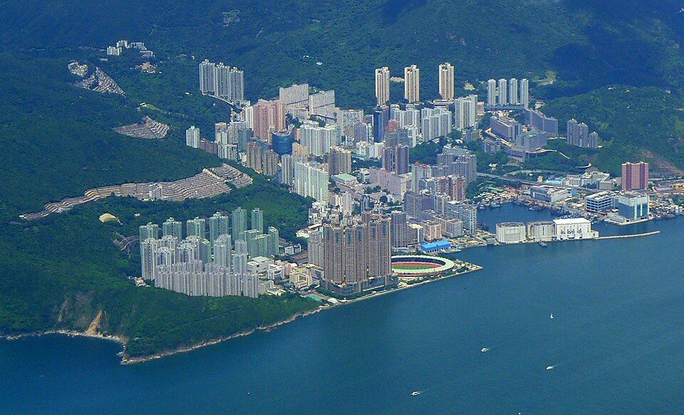
Chai Wan: Submarine Cable Landing Point
Chai Wan is a district situated at the eastern end of Hong Kong Island, forming part of China's submarine cable infrastructure along its southern coastline. The area, administratively within the Eastern District, serves as a landing point for one submarine cable, connecting it into China's broader intra-regional cable network. As a single-cable landing point, Chai Wan plays a focused role in the domestic connectivity fabric rather than functioning as a multi-cable international hub.
The cable landing here, TKO Connect, is a short intra-national link, reflecting Chai Wan's current role as a point of local rather than intercontinental cable connectivity. With China hosting 24 submarine cables across 24 landing points, Chai Wan ranks within the top 63 percent of Chinese landing points by cable count, placing it among the more modestly scaled nodes in the country's overall submarine cable geography.
Cables Landing at Chai Wan
TKO Connect is a submarine cable with a total length of 6 km, reaching ready-for-service status in 2023 as a draft system. The cable connects Chai Wan to other endpoints within China, making it a short-haul, intra-national link rather than an intercontinental route. Its compact length distinguishes it from the broader Chinese cable average of approximately 10,860 km, underscoring its function as a local connectivity solution within the domestic network.
Regional Context
Within China's submarine cable landscape, Chai Wan sits at the lower end of the scale when compared to major landing points such as Chung Hom Kok and Tseung Kwan O, each of which hosts six cables, or Chongming and Nanhui, which each accommodate four. Other peers, including Shantou with three cables and Lantau Island with two, similarly surpass Chai Wan's single-cable presence. This positions Chai Wan as one of China's more specialised landing points, defined by a narrow and specific connectivity function rather than broad multi-cable aggregation.
Network Role
Chai Wan operates as a single-cable terminus rather than a multi-cable hub, with its sole connection - TKO Connect - serving a local, intra-Chinese routing function. The cable's very short span of 6 km suggests it links nearby domestic nodes within the Hong Kong portion of China's network, supporting internal data routing between proximate landing points or cable stations rather than bridging international corridors.
Within the regional submarine cable graph, Chai Wan's significance lies in providing a dedicated domestic connection point on Hong Kong Island's eastern shore, complementing the denser cable activity found at nearby landing points and contributing to the granular internal structure of China's submarine cable ecosystem.
What next: Chai Wan, China in the global directory of cable landing points; see surrounding routes on the interactive submarine cable map or follow live network monitoring.
Our measurements to Chai Wan
Traceroutes from our own measurement points over the last 30 days: usual delay and number of network hops on the way to Chai Wan.
- From Minsk: 162 ms, 16 hops, 14 traces
- From Moscow: 162 ms, 12 hops, 14 traces
- From Kyiv: 177 ms, 9 hops, 7 traces
- From Odessa: 191 ms, 14 hops, 13 traces
- From Jerusalem: 194 ms, 15 hops, 14 traces
- From Tbilisi: 199 ms, 16 hops, 14 traces
- From Rostov: 201 ms, 14 hops, 14 traces
- From Saint Petersburg: 209 ms, 16 hops, 14 traces
- From Sevastopol: 210 ms, 15 hops, 14 traces
- From Almaty: 212 ms, 16 hops, 14 traces
- From Ekaterinburg: 232 ms, 11 hops, 5 traces
Last trace: 2026-10-15. Live network map
Other Landing Points in China
Landing Point
- CountryCN China
- Coordinates22.2689°N 114.2394°E
- Connected Cables1
See Real Cable Routes
View actual submarine cable routing from Chai Wan, China - with backbone nodes, distance calculations, and latency estimates
Open Calculator →