Hachinohe, Japan
Landing Point · JP Japan
Connected Cables
| Cable | Status |
|---|---|
| Muroran-Hachinohe | Active |
Live Performance
RTT measurements to this landing point from 2026-03-14 through 2026-08-24 - live ICMP round-trip time via our monitoring probes. Recomputed daily. ✓ No anomalies detected in the monitored period.
Measurement sources
| Probe | Location | Samples | Avg |
|---|---|---|---|
| own probe | Almaty KZ | 5 | 307.5 ms |
| own probe | Minsk BY | 3 | 290.5 ms |
| own probe | Tbilisi GE | 3 | 299.2 ms |
| own probe | Moscow RU | 3 | 256.2 ms |
| #6410 own probe | Sao Paulo BR | 2 | 287.0 ms |
| #6487 | control probe | 2 | 78.5 ms |
| #7062 own probe | Cape Town ZA | 2 | 201.6 ms |
| #29036 | control probe | 2 | 7.7 ms |
| #52844 | control probe | 2 | 27.9 ms |
| own probe | Jerusalem IL | 2 | 298.3 ms |
| own probe | Sevastopol UA | 1 | 317.3 ms |
About Hachinohe, Japan
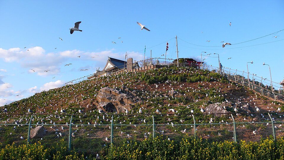
Hachinohe: Submarine Cable Landing Point
Hachinohe is a city in Aomori Prefecture, on the northeastern coast of Honshu, Japan. As a submarine cable landing point, it serves as the eastern terminus of a domestic inter-city cable connection along Japan's Pacific-facing coastline. One submarine cable lands at Hachinohe, linking it directly to another point within Japan and placing it within the broader national submarine cable network that spans 51 cables across 68 landing points throughout the country.
The single cable landing here connects Hachinohe to Muroran, a city on the southern coast of Hokkaido, establishing a domestic intra-Japan corridor. This route runs along the northeastern margin of Honshu and crosses into Hokkaido, supporting connectivity between Japan's main island and its northernmost major island. The corridor is entirely domestic in character, with no international endpoints on this cable.
Cables Landing at Hachinohe
Muroran-Hachinohe is a domestic submarine cable with a length of 280 km, reaching ready-for-service status in 2002 on a draft basis. It connects Hachinohe in Aomori Prefecture with Muroran in Hokkaido, linking two points on opposite sides of the Tsugaru Strait region along Japan's northeastern seaboard. Both endpoints are located within Japan, making this an entirely intra-national cable route.
Regional Context
Within Japan, Hachinohe is one of 68 submarine cable landing points and hosts a single cable, placing it at the lower end of the national landing point hierarchy by cable count. Major Japanese landing points such as Shima, with 12 cables, Maruyama with 9, and Chikura with 8 are considerably more active hubs, reflecting the concentration of international cable traffic at a smaller number of gateway locations. Hachinohe's role is more specialized, supporting a specific domestic route rather than serving as a multi-cable international gateway.
Network Role
Hachinohe functions as a single-cable terminus, serving the domestic link between Honshu and Hokkaido via the Muroran-Hachinohe cable. This 280 km route provides a direct undersea path between Aomori Prefecture and Hokkaido, complementing overland and other submarine connections that tie Japan's northern island into the national network. The landing point does not serve intercontinental or inter-regional international traffic based on its current cable infrastructure.
Within the Japanese submarine cable graph, Hachinohe represents a focused domestic node rather than a convergence point for multiple routes. Its presence nonetheless illustrates how Japan's 68 landing points collectively distribute connectivity across the country's island geography, with smaller single-cable points like Hachinohe filling specific geographic gaps that larger hubs do not directly address.
What next: Hachinohe, Japan in the global directory of cable landing points; see surrounding routes on the interactive submarine cable map or follow live network monitoring.
Other Landing Points in Japan
Landing Point
- CountryJP Japan
- Coordinates40.4767°N 141.5005°E
- Connected Cables1
See Real Cable Routes
View actual submarine cable routing from Hachinohe, Japan - with backbone nodes, distance calculations, and latency estimates
Open Calculator →