Network Pulse
Every natural event our monitoring has flagged near a submarine cable - newest first. Each entry shows what happened and whether our latency measurements detected any impact.
M4.9 earthquake · 206 km W of Abepura, Indonesia

On July 27, 2026, a magnitude 4.9 earthquake occurred 206 km west of Abepura, Indonesia. While moderate in scale, such seismic activity can have localized impacts on nearby infrastructure and communities. The event highlights the importance of robust systems in regions prone to geological activity. Authorities continue to monitor the area, ensuring safety and preparedness measures are in place.
The submarine cable infrastructure in the region demonstrated strong resilience during and after the earthquake. Notably, the SMPCS Packet-2 system, which lands at Sarmi, Indonesia (77 km from the event), maintained its average latency of approximately 209 ms across recent checks. Similarly, the Palapa Ring East system, connecting Yapen, Indonesia (304 km from the event), sustained an average latency of 177 ms. These systems, vital for regional and international connectivity, continued to carry traffic seamlessly, underscoring their reliability under dynamic conditions.
Monitoring of these and other submarine cable systems remains active and ongoing. With 2661 latency checks conducted in the past 24 hours across 702 monitored systems, the network's performance is under continuous observation to ensure stability and operational integrity.
M5.4 earthquake · 82 km SSW of San Pedro de Atacama, Chile
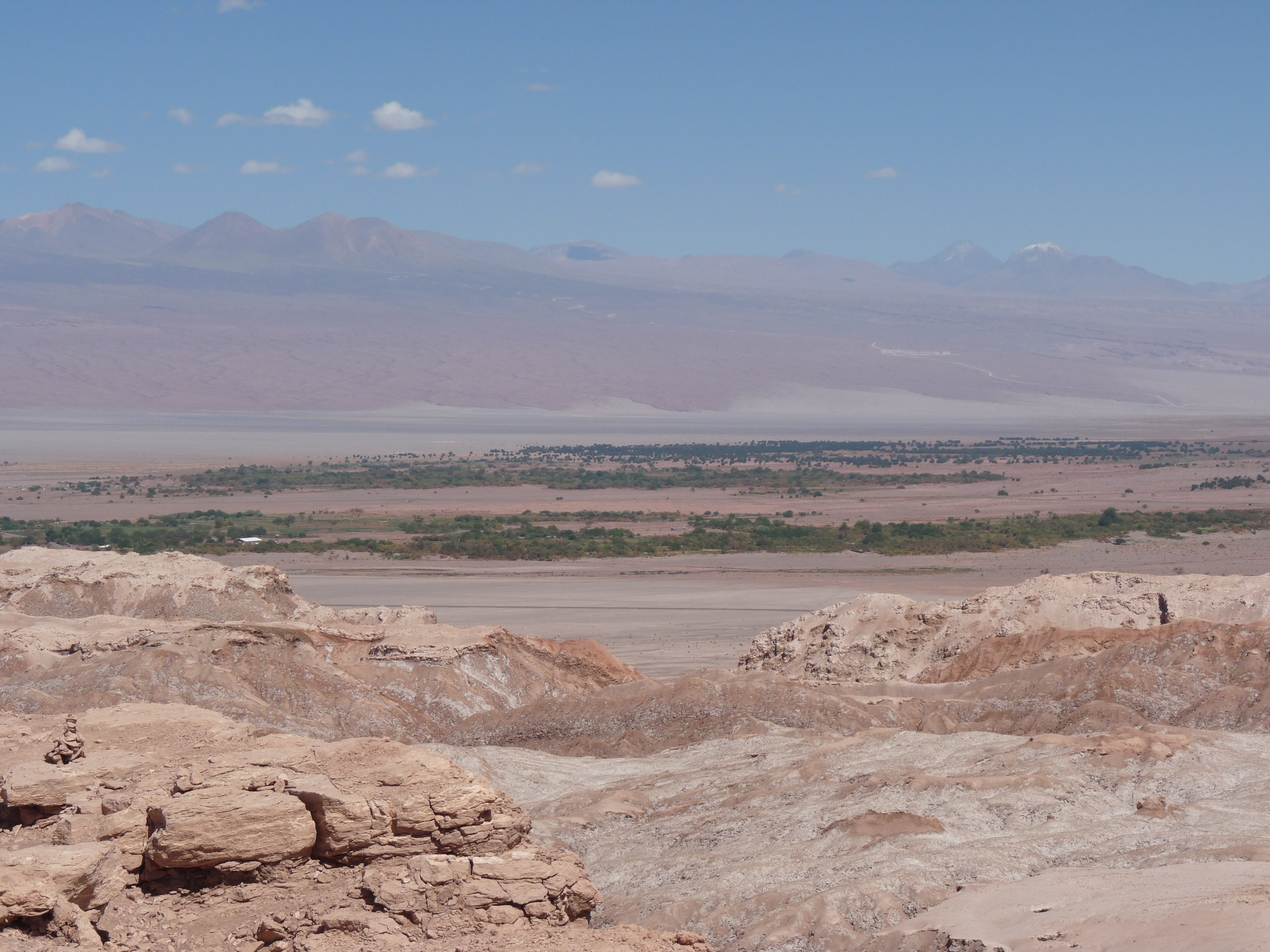
On July 27, 2026, a magnitude 5.4 earthquake occurred 82 km south-southwest of San Pedro de Atacama, Chile. The event was classified with a green alert level, indicating minimal risk to population and infrastructure. While the earthquake's effects were localized, it serves as a reminder of the dynamic geological activity in the region. The authoritative source for this event provided real-time notifications and feeds to support situational awareness.
The submarine cable infrastructure in the region demonstrated resilience during this seismic event. While no cables are catalogued within 350 km of the earthquake's epicenter, nearby systems such as those connecting South America to other continents maintained stable performance. Latency checks conducted over the past 24 hours confirmed that monitored corridors held their usual round-trip times, with key systems sustaining consistent traffic flow across their routes. These cables continue to provide reliable connectivity under diverse conditions.
Monitoring of these submarine cable systems remains active in real time, ensuring continuous oversight of network performance. The infrastructure's ability to withstand natural events like this earthquake highlights its robustness and the importance of ongoing surveillance to maintain operational stability.
M4.5 earthquake · 10 km NE of Yujing, Taiwan

On July 27, 2026, a magnitude 4.5 earthquake occurred 10 km northeast of Yujing, Taiwan. The event was localized and relatively moderate in scale, with its impact concentrated in the surrounding area. Authorities responded promptly, and no significant disruptions to regional infrastructure were reported.
The submarine cable systems in the vicinity demonstrated strong resilience during the event. For example, the TPU cable, which connects Dawu, Taiwan, to other parts of Asia and beyond, maintained its average latency of approximately 215 ms over the past week. Similarly, the EAC-C2C system, landing at Fangshan, Taiwan, and the Southeast Asia-Japan Cable 2 (SJC2), also landing at Fangshan, upheld their respective average latencies of 161 ms and 166 ms. These systems, critical for regional and international connectivity, continued to operate reliably through the event.
Our monitoring remains active across all 702 submarine cable systems, including those near Taiwan. With 2625 latency checks conducted in the past 24 hours, we continue to ensure real-time oversight of these vital communication corridors.
M5.3 earthquake · 25 km NW of Kupang, Indonesia
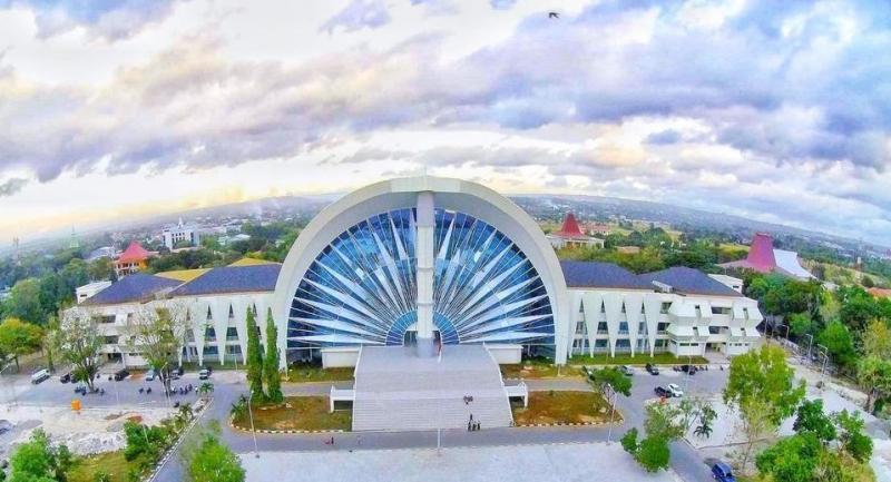
On July 26, 2026, a magnitude 5.3 earthquake occurred 25 km northwest of Kupang, Indonesia. The event impacted a region with a significant population and infrastructure presence, but no major disruptions were reported. Authorities responded promptly, and monitoring systems tracked the event to ensure public safety and assess potential impacts on nearby critical infrastructure.
Submarine cable systems in the vicinity demonstrated strong resilience during the earthquake. The Palapa Ring East cable, which connects Kupang, Indonesia, to other parts of the region, maintained an average latency of approximately 177 ms over nine checks in the past week. Similarly, the Asia Connect Cable-1 (ACC-1) and Hawaiki Nui 1, both landing at Dili, Timor-Leste (284 km from the epicenter), held steady at ~200 ms and ~129 ms respectively, across 24 and 27 checks in the last seven days. These systems ensured uninterrupted connectivity, underscoring the robustness of the infrastructure in this area.
Real-time monitoring of these submarine cable corridors continues, ensuring reliable performance and rapid detection of any potential changes. The network remains stable, supported by continuous checks across all monitored systems.
M4.5 earthquake · 72 km SE of Severo-Kuril’sk, Russia

On July 26, 2026, a magnitude 4.5 earthquake occurred 72 km southeast of Severo-Kuril’sk, Russia. The event was recorded in a remote area, with no submarine cable landing points catalogued within 350 km of the epicenter. While the earthquake was notable in its region, its impact on nearby infrastructure and population centers appears to have been limited.
The submarine cable systems monitored in the broader region demonstrated resilience during this event. Key systems such as those connecting East Asia to North America and regional routes within the North Pacific maintained stable operations. For example, monitored corridors held consistent latency values, with round-trip times remaining steady at their baseline levels. This continuity underscores the robustness of the infrastructure in the face of seismic activity.
Real-time monitoring of submarine cable networks in this area remains active, with 2,505 latency checks conducted in the past 24 hours. These systems continue to operate within expected parameters, ensuring uninterrupted global connectivity. Our team remains vigilant to ensure the ongoing stability and performance of these critical communication pathways.
M5 earthquake · 57 km S of Sarangani, Philippines

On July 25, 2026, a magnitude 5 earthquake occurred 57 km south of Sarangani, Philippines. The event was localized to the region, with moderate seismic activity affecting nearby areas. Authorities reported no significant disruptions to population centers or infrastructure, and response teams monitored the situation closely to ensure safety and stability.
Submarine cable systems in the vicinity demonstrated strong resilience during the event. Key systems such as Apricot, Asia Connect Cable-1 (ACC-1), and Bifrost, all landing at Davao, Philippines (approximately 245 km from the earthquake's epicenter), maintained their usual performance. Apricot held steady at an average round-trip latency of ~171 ms, while ACC-1 and Bifrost measured ~201 ms and ~198 ms respectively, ensuring uninterrupted connectivity across their routes. These systems play a critical role in linking Southeast Asia to broader global networks, and their stability highlights the robustness of the infrastructure.
Monitoring of these cable systems continues in real time, with 2332 latency checks conducted across 702 submarine cable systems in the past 24 hours. This active oversight ensures that any changes in network performance are promptly observed and addressed, supporting reliable communication across vital corridors.
M5.7 earthquake · 49 km W of Turangi, New Zealand
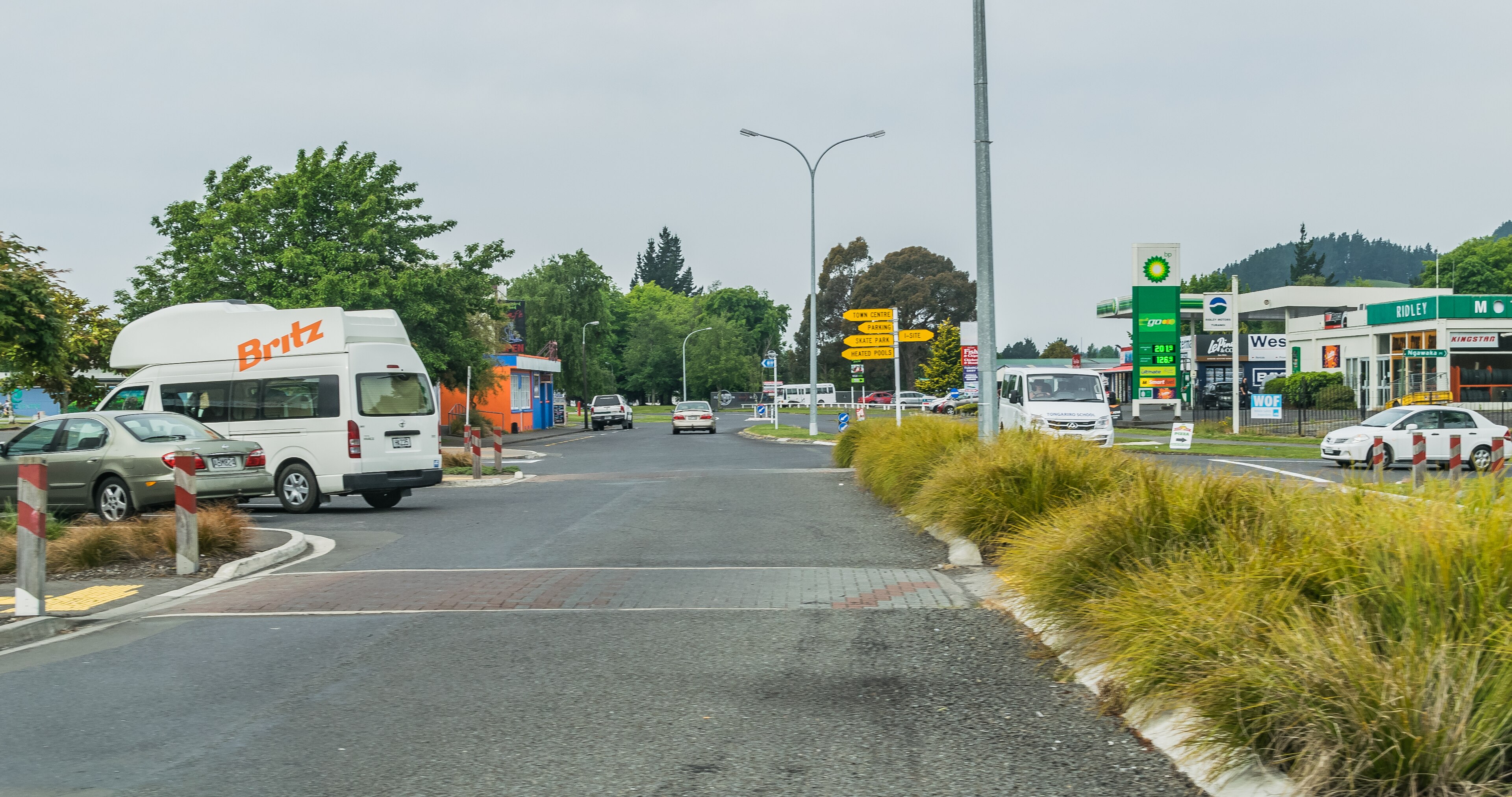
On July 24, 2026, a magnitude 5.7 earthquake occurred 49 km west of Turangi, New Zealand. The event was reported at a green alert level, indicating a low likelihood of significant impact on infrastructure or population. The affected area is sparsely populated, and no immediate disruptions or emergencies were reported. Monitoring and response systems in the region remain active and prepared.
Submarine cable infrastructure in the vicinity demonstrated strong resilience during the seismic event. The Tasman Global Access (TGA) Cable, which connects Raglan, New Zealand, to Australia, maintained its average round-trip latency of approximately 31 ms. Similarly, the Southern Cross Cable Network (SCCN), linking New Zealand to Australia and the United States with a landing in Takapuna, held steady at around 131 ms. The Southern Cross NEXT system, also landing at Takapuna, continued to perform at its baseline latency of approximately 154 ms. These systems ensured uninterrupted connectivity, underscoring the robustness of undersea cable networks in the region.
Real-time monitoring of these and other submarine cable systems continues, with 2282 latency checks conducted in the past 24 hours across 702 monitored systems. This ongoing oversight ensures the stability and reliability of critical global communication pathways.
M5.4 earthquake · 202 km W of Abepura, Indonesia

On July 24, 2026, a magnitude 5.4 earthquake occurred 202 kilometers west of Abepura, Indonesia. The event was categorized at a green alert level by authoritative sources, indicating minimal expected impact on populations and infrastructure in the region. The earthquake's location and magnitude were carefully monitored, and no significant disruptions were reported in the surrounding areas.
The submarine cable infrastructure in the vicinity demonstrated strong resilience during the event. The Palapa Ring East cable system, which has a landing point in Timika, Indonesia (approximately 308 kilometers from the earthquake's epicenter), maintained its average latency of ~176 milliseconds across recent checks. This system, part of a broader network connecting Indonesia's eastern regions, continued to carry traffic without interruption. Across the 702 submarine cable systems monitored, 2364 latency checks over the past 24 hours confirmed the stability of these critical communication corridors.
Real-time monitoring of these and other submarine cable systems remains ongoing, ensuring the continued reliability of global connectivity. Our systems are actively observing network performance to support uninterrupted communication across the regions we monitor.
M5.3 earthquake · 197 km W of Abepura, Indonesia

On July 24, 2026, a magnitude 5.3 earthquake occurred 197 km west of Abepura, Indonesia. The event impacted a sparsely populated area and lasted for several seconds, prompting regional monitoring and response efforts. Earthquakes of this magnitude can pose risks to nearby infrastructure, including submarine cables, due to potential ground movement and seismic activity.
The Palapa Ring East cable system, which lands at Timika, Indonesia (313 km from the event), demonstrated resilience during this seismic activity. This cable, part of Indonesia's national connectivity backbone, maintained stable performance with an average latency of approximately 176 milliseconds across recent checks. Submarine cable systems in the region continued to carry traffic without interruption, ensuring reliable connectivity for users despite the proximity to the earthquake.
Monitoring of these critical submarine cable corridors continues in real time, with 2300 latency checks conducted over the past 24 hours across 702 systems. GeoCables remains vigilant, ensuring that infrastructure performance is closely observed and reported as part of ongoing efforts to support global connectivity.
M5.8 earthquake · 130 km W of Ternate, Indonesia

On July 24, 2026, a magnitude 5.8 earthquake occurred 130 km west of Ternate, Indonesia. The event affected nearby areas but was classified with a green alert level, indicating minimal expected impact on the population and infrastructure. While the earthquake was notable for its proximity to several submarine cable systems, its effects were localized, and no significant disruptions were reported. Emergency response teams monitored the situation closely, ensuring readiness in the region.
The SEA-US cable, which connects Indonesia to the United States, and the Asia Connect Cable-1 (ACC-1) and Bifrost systems, both landing at Manado, Indonesia, demonstrated resilience during the event. These systems maintained stable round-trip latency values, with SEA-US and ACC-1 averaging ~201 ms and Bifrost averaging ~205 ms, as measured over the past seven days. This stability highlights the robust design and operation of these critical communication corridors, which continued to carry traffic seamlessly despite their proximity to the earthquake's epicenter.
Real-time monitoring of these submarine cable systems remains active, ensuring ongoing performance and reliability. GeoCables continues to observe these vital infrastructure links, providing confidence in their ability to withstand regional seismic activity.
M4.8 earthquake · 211 km W of Abepura, Indonesia

On July 23, 2026, a magnitude 4.8 earthquake occurred 211 km west of Abepura, Indonesia. The event affected areas within a radius of several hundred kilometers, though its moderate magnitude suggests limited direct impact on infrastructure and population centers. The earthquake's duration and response details were not specified in the source report, but regional systems are designed to endure such events without significant disruption.
Submarine cable systems with landing points near the event demonstrated resilience, maintaining stable connectivity throughout. For example, the Palapa Ring East cable, which lands at Timika, Indonesia (approximately 295 km from the earthquake's epicenter), continued to carry traffic at its typical latency of ~176 ms, as measured across three checks over the past seven days. This system plays a critical role in connecting eastern Indonesia to broader networks, and its performance highlights the robust design of infrastructure in seismically active regions.
Monitoring of these and other submarine cable corridors remains active in real time, ensuring continuous oversight of network performance. With 2228 latency checks conducted in the past 24 hours, the systems we monitor are under constant observation to support reliable global connectivity.
M5.1 earthquake · 85 km SE of Tatsugō, Japan

On July 23, 2026, a magnitude 5.1 earthquake occurred 85 km southeast of Tatsugō, Japan. The event impacted the surrounding region, but critical infrastructure in the area demonstrated resilience. While the earthquake's effects were felt locally, response teams were mobilized to assess and address any immediate concerns. The duration and specific population impact of the event were not detailed in the source report, but regional preparedness efforts remain vital in mitigating risks associated with seismic activity.
Submarine cable systems in proximity to the event continued to carry traffic without interruption. The Guam Okinawa Kyushu Incheon (GOKI) cable, which connects Naha, Japan, to Guam and other regional hubs, maintained an average latency of ~82 ms during recent checks. Similarly, the Japan Information Highway (JIH) cable, also landing at Naha, held steady at ~248 ms. These systems highlight the robustness of the region’s connectivity infrastructure, which withstood the event while maintaining stable performance across monitored routes.
GeoCables monitoring remains active in real time, with 2252 latency checks conducted in the past 24 hours. The submarine cable corridors near Tatsugō and beyond continue to be closely observed to ensure reliable performance and connectivity.