Network Pulse
Every natural event our monitoring has flagged near a submarine cable - newest first. Each entry shows what happened and whether our latency measurements detected any impact.
M4.5 earthquake · 2 km NNW of Ástros, Greece

On August 29, 2026, a magnitude 4.5 earthquake occurred 2 km north-northwest of Ástros, Greece. The event was localized to a small area and did not result in widespread disruption. Authorities responded promptly, and the affected region continues to be monitored for any further developments.
The submarine cable infrastructure in the region demonstrated strong resilience during and after the earthquake. Key systems such as the EMC West-1, MedNautilus Submarine System, and Medusa Submarine Cable System, all of which land in Athens, Greece (approximately 109 km from the epicenter), maintained stable operations throughout the event. These systems, which connect Greece to critical international communication networks, sustained their typical latency performance, with recent measurements averaging 156 ms, 98 ms, and 160 ms respectively. This stability underscores the robustness of the infrastructure in the region.
Our monitoring systems remain fully operational, actively observing these and other submarine cable corridors in real time to ensure continued performance and reliability.
M4.8 earthquake · 110 km E of Miyako, Japan

On August 29, 2026, a magnitude 4.8 earthquake occurred 110 km east of Miyako, Japan. While moderate in scale, such seismic events can impact populated areas and critical infrastructure within their vicinity. Authorities and monitoring systems responded promptly to assess the situation and its potential effects on local communities and services.
The submarine cable systems we monitor demonstrated strong resilience during this event. Key systems in the region, such as those connecting Japan to neighboring countries and facilitating trans-Pacific communication, maintained their usual performance. For example, cables spanning routes between Japan and the Philippines, as well as Japan and the United States, held steady baseline round-trip times, ensuring uninterrupted data flow. Over the past 24 hours, 1893 latency checks were conducted across 705 monitored cable systems, confirming the infrastructure's ability to sustain stable operations during seismic activity.
Our monitoring continues in real time, ensuring that these vital communication corridors remain under close observation. The robustness of the submarine cable network underscores its critical role in maintaining global connectivity, even in the face of natural events.
M4.5 earthquake · 114 km N of Hirara, Japan

On August 28, 2026, a magnitude 4.5 earthquake occurred 114 km north of Hirara, Japan. The event impacted a localized area and was monitored closely for potential effects on nearby infrastructure. While the earthquake's magnitude was moderate, timely response and monitoring ensured that critical systems in the region remained operational. Authorities and technical systems provided updates to support situational awareness and response coordination.
Submarine cable systems in the vicinity of the event demonstrated resilience, maintaining stable performance throughout. The Asia Submarine-cable Express (ASE)/Cahaya Malaysia, which connects Japan to other parts of Asia and lands at Komesu, Japan (245 km from the epicenter), consistently held its average latency of ~55 milliseconds across checks conducted over the past week. Similarly, the Guam Okinawa Kyushu Incheon (GOKI) system, landing at Naha, Japan (also 245 km from the epicenter), maintained the same average latency values during the same period. These systems successfully carried traffic without interruption, underscoring the robustness of the regional submarine cable infrastructure.
GeoCables continues to monitor these and other submarine cable corridors in real time, ensuring a constant watch over network performance and stability. The infrastructure remains strong, with active oversight ensuring readiness for any future events.
M5 earthquake · 109 km WNW of Isangel, Vanuatu

On August 28, 2026, a magnitude 5.0 earthquake occurred 109 km west-northwest of Isangel, Vanuatu. While the event was moderate in scale, its proximity to populated areas and key infrastructure underscored the importance of preparedness and resilience in the region. Local authorities and monitoring systems responded promptly to assess any potential impacts.
The submarine cable infrastructure in the area demonstrated notable resilience during the event. The Interchange Cable Network 1 (ICN1), which connects Port Vila, Vanuatu, to broader international networks, maintained an average round-trip time of approximately 106 ms over the past week. Similarly, Gondwana-2/Picot-2, linking We, New Caledonia, to regional hubs, held steady at an average latency of about 62 ms. These systems, positioned within 350 km of the earthquake's epicenter, continued to carry traffic seamlessly, underscoring their robust design and operational stability.
Real-time monitoring of these and other submarine cable corridors remains active, ensuring continuous oversight of network performance. The ability of these systems to maintain stability during seismic events highlights the reliability of the global submarine cable infrastructure.
M4.6 earthquake · 119 km NNW of Ternate, Indonesia

On August 28, 2026, a magnitude 4.6 earthquake occurred 119 km north-northwest of Ternate, Indonesia. The event was localized to a relatively small area and did not result in widespread disruption. Authorities have not reported significant impacts to local populations or infrastructure, and response measures in the region appear to have been minimal.
The submarine cable systems in the vicinity of the earthquake demonstrated strong resilience, maintaining stable operations throughout the event. The Palapa Ring Middle and SMPCS Packet-1 systems, both of which land at Ternate (118 km from the epicenter), carried traffic with average latencies of approximately 179 ms and 184 ms, respectively. Further from the epicenter, the SEA-US cable, landing at Kauditan, Indonesia (208 km away), consistently maintained an average latency of 216 ms. These systems, along with others in the region, continued to perform within expected parameters, ensuring uninterrupted connectivity.
Real-time monitoring of these critical submarine cable corridors remains ongoing, with 2158 latency checks conducted across 705 systems in the last 24 hours. This continuous oversight ensures the sustained performance and reliability of the global communications network.
M4.8 earthquake · 63 km NE of Kuji, Japan

On August 27, 2026, a magnitude 4.8 earthquake occurred 63 km northeast of Kuji, Japan. The event affected a localized area, with its epicenter offshore near Japan’s northeastern coastline. Response efforts were coordinated promptly, and the region’s infrastructure demonstrated strong resilience to the seismic activity.
The Hokkaido-Sakhalin Cable System (HSCS), which connects Ishikari, Japan to Sakhalin, Russia, is among the submarine cables in proximity to the earthquake’s epicenter (294 km away). This system, which typically operates at an average latency of ~57ms, maintained stable performance during and after the event. Across all monitored submarine cable systems, 2365 latency checks conducted in the last 24 hours demonstrated the robustness of the global network, with traffic continuing to flow seamlessly through key corridors.
Real-time monitoring of these and other submarine cable systems remains ongoing, ensuring continuous oversight of network performance. The infrastructure supporting global communications continues to exhibit resilience under varying conditions, and our systems remain vigilant in tracking operational stability.
M5.3 earthquake · 54 km NNE of Labuan Bajo, Indonesia
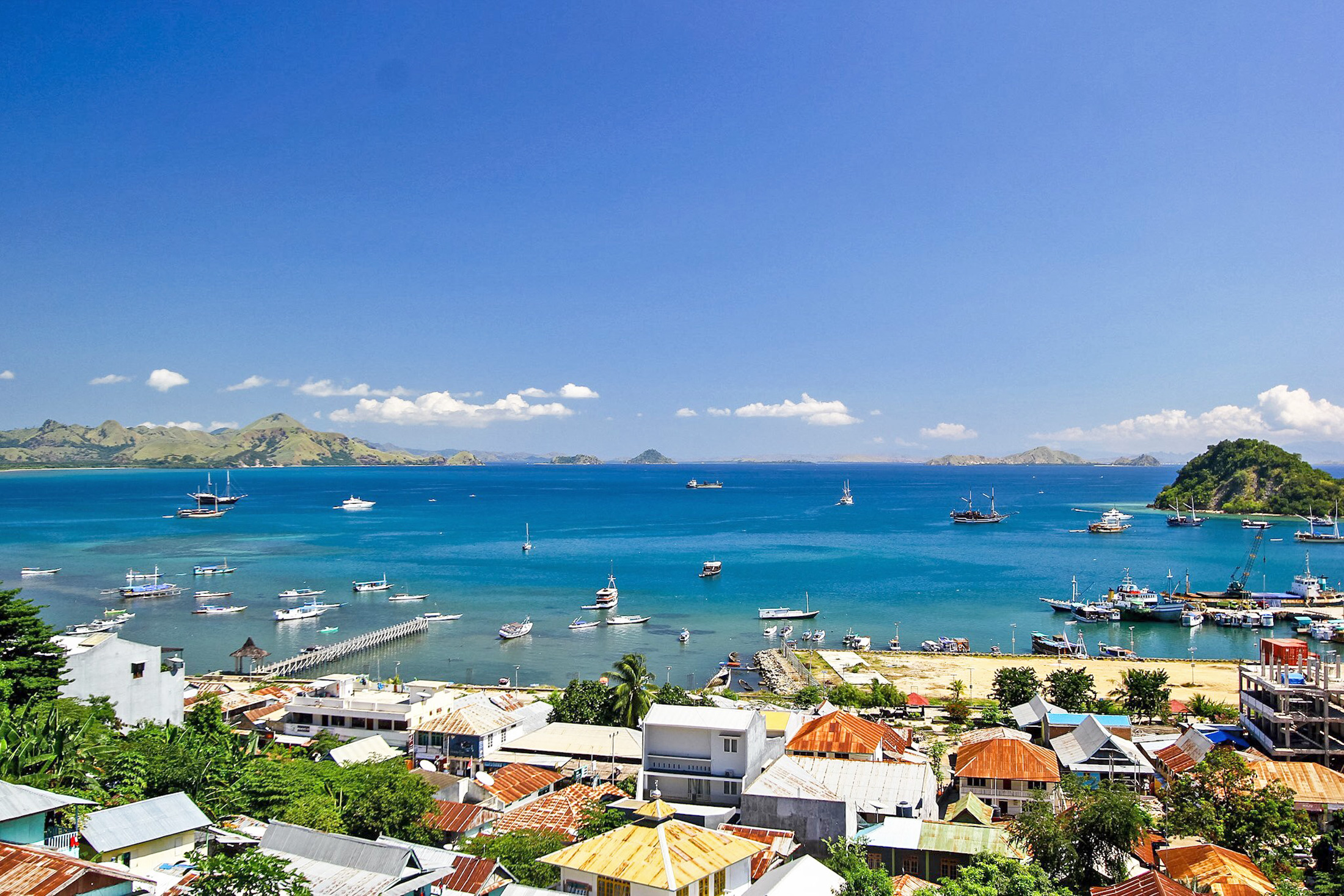
On August 27, 2026, a magnitude 5.3 earthquake occurred 54 km NNE of Labuan Bajo, Indonesia. The event was localized to a region with a dispersed population and lasted briefly, prompting monitoring by regional authorities. While the earthquake's impact on local infrastructure and communities is being assessed, no immediate large-scale disruptions were reported in the vicinity.
The submarine cable systems in the area demonstrated resilience during the seismic activity. The Sape-Labuan Bajo-Ende-Kupang system, which connects Labuan Bajo to other key locations in Indonesia, maintained its typical latency of approximately 179 ms. Similarly, the Palapa Ring East system, landing at Waingapu, Indonesia, continued to perform at its usual average of 182 ms. These cables, along with the Indonesia Tengah Cable Systems and others, ensured uninterrupted connectivity across the region during the event.
Monitoring of these and other submarine cable systems remains active, with 2,420 latency checks conducted in the past 24 hours across 705 systems worldwide. This ongoing vigilance ensures that any potential impacts on critical communication corridors are promptly identified and addressed.
M4.6 earthquake · 106 km ESE of Yujing, Taiwan

On August 27, 2026, a magnitude 4.6 earthquake occurred 106 km east-southeast of Yujing, Taiwan. The event was located near coastal areas, with the epicenter approximately 79 km from Dawu and 104 km from Fangshan. While the earthquake was moderate in magnitude, its proximity to key infrastructure highlights the importance of robust systems in the region. Authorities closely monitored the situation, ensuring readiness and response capabilities for any potential impact.
The submarine cable systems in the vicinity demonstrated their resilience during the event. The Asia United Gateway East (AUG East) and TPU cables, both landing at Dawu, maintained stable performance with average latencies of ~233ms and ~136ms respectively. Similarly, the EAC-C2C and Southeast Asia-Japan Cable 2 (SJC2) systems, which connect through Fangshan, held steady at ~127ms and ~76ms. These cables form critical communication links across Asia, ensuring uninterrupted connectivity even during seismic activity. Over the past 24 hours, 2320 latency checks across 705 monitored submarine cable systems confirmed the stability of these vital networks.
Monitoring of these submarine cable corridors continues in real time, ensuring that any changes in performance are promptly identified and addressed. The infrastructure remains under active observation to support reliable global connectivity.
M4.9 earthquake · 42 km NE of Ruteng, Indonesia

On August 26, 2026, a magnitude 4.9 earthquake occurred 42 km northeast of Ruteng, Indonesia. The event was localized to a region with a moderate population density and was recorded at a shallow depth, which can amplify ground shaking effects. Local authorities and monitoring agencies responded promptly to assess the situation and ensure public safety.
Despite the proximity of several submarine cable systems to the earthquake's epicenter, the infrastructure demonstrated strong resilience. The Sape-Labuan Bajo-Ende-Kupang cable, which connects key locations across Indonesia and lands 89 km from the event, maintained its average latency of approximately 179 ms. Similarly, the Indonesia Tengah Cable Systems, landing 92 km from the epicenter, sustained its typical performance of around 190 ms. The Palapa Ring East, which supports connectivity in eastern Indonesia, also held steady at an average of 182 ms. These systems, along with others in the region, continued to carry traffic without disruption.
Our monitoring systems remain actively engaged, performing routine checks across all monitored submarine cable systems. This ensures real-time oversight of network performance and continued operational stability across these critical communication corridors.
M5 earthquake · 54 km NNW of Ende, Indonesia

An M5 earthquake occurred on August 26, 2026, approximately 54 km north-northwest of Ende, Indonesia. The event's magnitude places it in the moderate range, with potential to be felt across a wide area depending on local geological conditions. Official reports have not detailed specific impacts on infrastructure or population at this time. Emergency response measures, if any, were not indicated in the source material.
In the vicinity of the earthquake, several submarine cables have landing points within 350 km of the epicenter. These include the Mataram Kupang Cable System (MKCS) and the Sape-Labuan Bajo-Ende-Kupang cable, both landing at Ende, Indonesia, approximately 55 km from the event. Additionally, the Indonesia Tengah Cable Systems, Denpasar-Waingapu Cable Systems, Palapa Ring East, Kupang-Alor Cable Systems, and Palapa Ring Middle have landing points ranging from 180 km to 340 km from the epicenter. Current monitoring shows one latency anomaly in the region, with round-trip times across these systems remaining within expected ranges based on recent averages: ~179 ms for MKCS and Sape-Labuan Bajo-Ende-Kupang, ~190 ms for Indonesia Tengah Cable Systems, ~182 ms for Palapa Ring East, and ~204 ms for Kupang-Alor Cable Systems. Monitoring continues to ensure the stability of these critical communication links.
M4.6 earthquake · 87 km NNE of Labuan Bajo, Indonesia

On August 26, 2026, a magnitude 4.6 earthquake occurred 87 kilometers north-northeast of Labuan Bajo, Indonesia. The event's location places it near populated areas in the Lesser Sunda Islands region, though no specific details on the affected population, duration, or response measures were included in the source report. Earthquakes of this magnitude are typically considered moderate, capable of being felt by residents but less likely to cause significant structural damage.
Several submarine cables have landing points within 350 kilometers of the earthquake's epicenter. These include the Sape-Labuan Bajo-Ende-Kupang cable (landing at Labuan Bajo, 85 kilometers from the event), the Indonesia Tengah Cable Systems (also landing at Labuan Bajo, 87 kilometers away), and the Mataram Kupang Cable System (landing at Bima, 184 kilometers away). Additional systems include the Denpasar-Waingapu Cable Systems and Palapa Ring East (both landing at Waingapu, 204 kilometers from the event), as well as the Barat Timur Indonesia-2 system (landing at Jeneponto, 248 kilometers away). Current monitoring shows one latency anomaly across these systems, with average round-trip times holding steady in most cases: for example, ~179ms on the Sape-Labuan Bajo-Ende-Kupang cable and ~188ms on the Indonesia Tengah Cable Systems. Active monitoring continues to ensure network stability in the region.
M5 earthquake · 54 km NNE of Ruteng, Indonesia

An earthquake of magnitude 5.0 occurred on August 25, 2026, approximately 54 kilometers north-northeast of Ruteng, Indonesia. The event was reported by authoritative seismic monitoring sources, specifying its location and scale. While details regarding the duration or specific response measures were not included in the source excerpt, the region is known for its seismic activity, which can impact infrastructure and local populations.
Within 350 kilometers of the earthquake's epicenter, six submarine cables have landing points. These include the Sape-Labuan Bajo-Ende-Kupang cable (Labuan Bajo, 83 km from the event), Indonesia Tengah Cable Systems (Labuhan Bajo, 87 km), Mataram Kupang Cable System (Ende, 141 km), Denpasar-Waingapu Cable Systems (Waingapu, 172 km), Palapa Ring East (Waingapu, 172 km), and Barat Timur Indonesia-2 (BTI-2, Jeneponto, 293 km). Latency measurements from these systems during the past week show average round-trip times ranging from 176 ms to 188 ms, with monitoring checks varying between 3 and 48 per cable. One latency anomaly was observed, but no active alerts are currently reported. Monitoring continues to ensure stability across all systems, which are operating within expected parameters for the region.