Union Island, Saint Vincent and the Grenadines
Point d'atterrissage · VC Saint Vincent and the Grenadines
Câbles connectés
| Câble | Statut |
|---|---|
| Caribbean Regional Communications Infrastructure Program (CARCIP) | Actif |
📡 Performance en direct
Mesures RTT vers ce point du 2026-06-24 au 2026-07-12 - RTT ICMP en direct via nos sondes de mesure. Recalculé quotidiennement. ✓ Aucune anomalie détectée sur la période.
Sources de mesure
| Sonde | Emplacement | Mesures | Moy. |
|---|---|---|---|
| #6410 sonde propre | Sao Paulo BR | 2 | 175.3 ms |
| #6427 sonde propre | Sydney AU | 2 | 324.0 ms |
| #6487 sonde propre | Singapore SG | 2 | 255.9 ms |
| #1014473 sonde propre | Minsk BY | 2 | 204.1 ms |
| #1016031 sonde propre | Kyiv UA | 2 | 215.7 ms |
| #1015563 sonde propre | Saint Petersburg RU | 1 | 249.7 ms |
À propos Union Island, Saint Vincent and the Grenadines
Union Island, Saint Vincent and les Grenadines : Point d'atterrissage du câble sous-marin
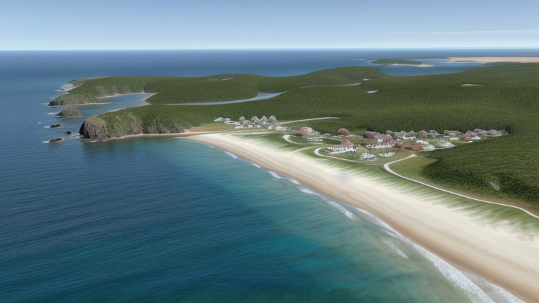
Union Island est une petite île de 9 kilomètres carrés environ située dans le sud des Grenadines, faisant partie de la nation de Saint-Vincent-et-les-Grenadines. Elle se trouve près de la frontière avec la Grande-Bretagne, avec les îles Carriacou et la côte grenadaise visible au sud. En tant que point d'atterrissage, Union Island est connecté au réseau régional de câbles sous-marins, avec un seul câble sous-marin actuellement atterré sur l'île.
Le seul câble desservant Union Island est le Programme régional des infrastructures de communications Caraïbes (CARCIP), un système régional qui relie les îles au sein et entre Saint-Vincent-et-les-Grenadines et la Grande-Bretagne. Sa proximité avec la Grande-Bretagne rend Union Island un nœud naturel du sud dans cette corridor inter-île, servant la connectivité entre ces deux nations caraïbes voisines.
Câbles Atterrissant à Union Island, Saint-Vincent-et-les-Grenadines
Le Programme régional des infrastructures de communications Caraïbes (CARCIP) est un système de câble sous-marin avec une longueur totale de 225 kilomètres, qui a atteint l'état de mise en service (RFS) en 2019, avec un désignation provisoire. Le câble relie les points d'atterrissage dans Saint-Vincent-et-les-Grenadines et la Grande-Bretagne, formant une courte liaison inter-île entre ces deux nations caraïbes voisines. Union Island, située au bout sud des Grenadines Vincentiennes, sert comme l'un des points d'atterrissage du câble, étendant ainsi le rayonnement du système à cette communauté insulaire éloignée.
Contexte régional
Dans Saint-Vincent-et-les-Grenadines, Union Island est l'un de plusieurs îles points d'atterrissage, aux côtés de Bequia, Canouan, Chateaubelair, Mustique et Owia, chacun desquels accueille également un seul câble sous-marin. Le principal centre d'activité du câble sous-marin dans le pays est Kingstown, qui sert de point d'atterrissage pour trois câbles. Union Island partage donc sa situation avec la majorité des points d'atterrissage insulaires éloignés du pays, reflétant une approche distribuée de la connectivité à travers l'archipel des Grenadines.
Rôle du réseau
Union Island fonctionne comme un terminus unique dans le graphique régional des câbles sous-marins, connecté exclusivement par le biais du système CARCIP aux autres points d'atterrissage dans Saint-Vincent-et-les-Grenadines et en Grande-Bretagne. Cela positionne l'île au sein d'un corridor inter-île régional plutôt qu'une route intercontinentale. Le câble permet un lien sous-marin direct entre les Grenadines du sud et la nation voisine de la Grande-Bretagne, une connexion facilitée par la position géographique proche des chaînes d'îles grenadines d'Union Island.
En tant que terminus sur un câble régional axé sur la région, Union Island représente l'extension sud-est du réseau de câbles sous-marins de Saint-Vincent-et-les-Grenadines, illustrant comment les petites nations insulaires de l'Est des Caraïbes utilisent des systèmes régionaux relativement courts pour relier communautés géographiquement dispersées en un réseau partagé de connectivité.
Autres points d'atterrissage en Saint Vincent and the Grenadines
Point d'atterrissage
- PaysVC Saint Vincent and the Grenadines
- Coordonnées12.6114°N 61.4432°W
- Câbles connectés1
Voir les routes réelles
Visualisez le routage réel des câbles sous-marins depuis Union Island, Saint Vincent and the Grenadines - avec nœuds, distances et latence
Ouvrir le calculateur →