Network Pulse
Every natural event our monitoring has flagged near a submarine cable - newest first. Each entry shows what happened and whether our latency measurements detected any impact.
M5.2 earthquake · 8 km SE of Ramón Santana, Dominican Republic
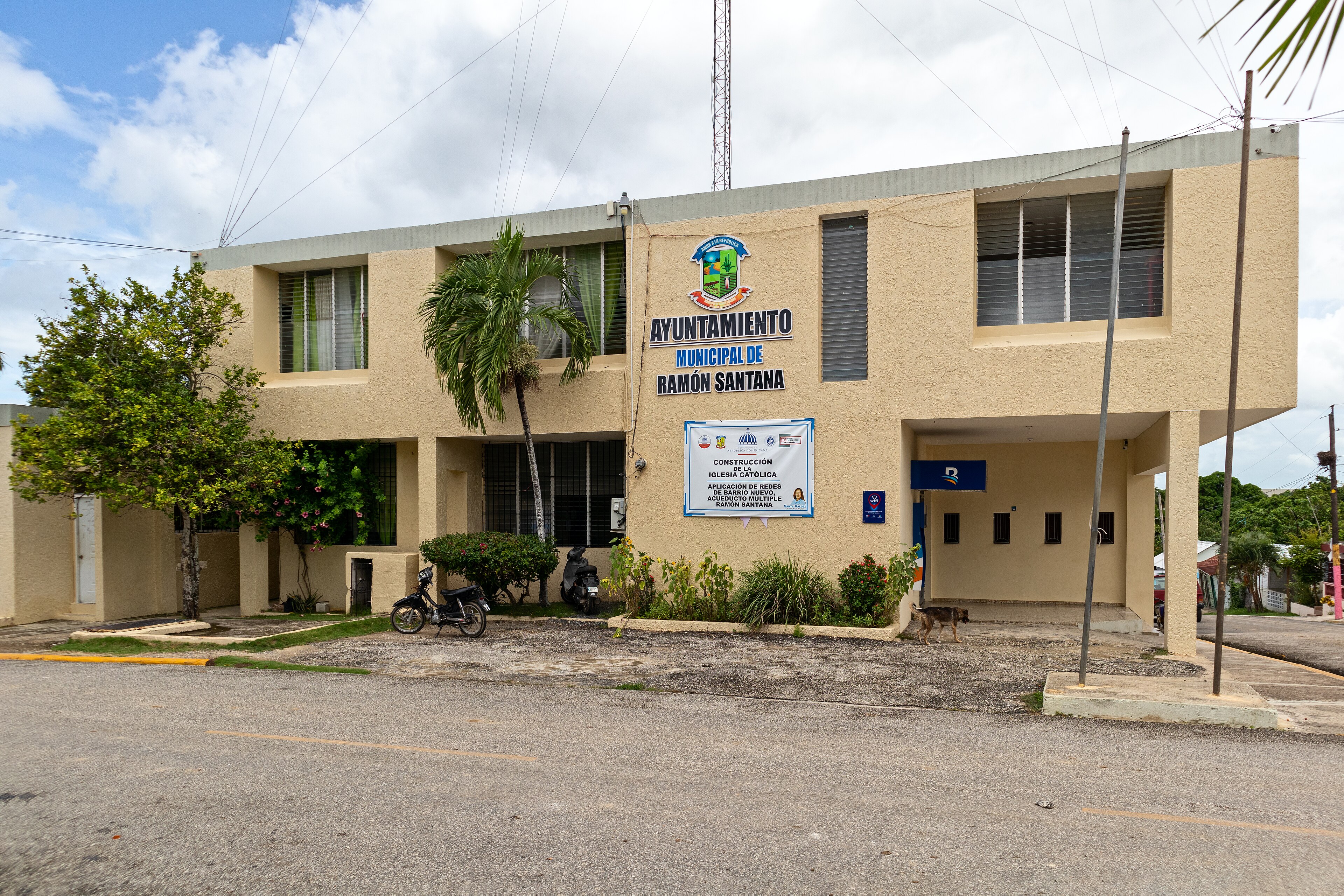
On September 28, 2026, a magnitude 5.2 earthquake occurred 8 km southeast of Ramón Santana, Dominican Republic. The event impacted a region with a population density of approximately 300 people per square kilometer, though no significant disruptions to critical services were reported. Local authorities responded promptly, ensuring the safety of the affected population and assessing any potential structural impacts in the vicinity.
The submarine cable infrastructure in the region demonstrated robust resilience during the seismic event. Key systems such as Alisios, Antillas 1, and ARCOS, all of which land at Punta Cana (75 km from the earthquake's epicenter), maintained stable operations. These cables, which connect the Dominican Republic to broader regional and global networks, continued to carry traffic seamlessly, with average round-trip latencies holding at ~163 ms, ~101 ms, and ~109 ms, respectively, over the past week. This stability underscores the strength of the region's connectivity infrastructure.
Monitoring of these and other submarine cable systems in the area remains active, with 1830 latency checks conducted in the last 24 hours across the 713 systems we oversee. The network continues to operate smoothly, and real-time assessments ensure uninterrupted visibility into the performance of these critical communication corridors.
M5.1 earthquake · 90 km ENE of Tadine, New Caledonia

On September 27, 2026, a magnitude 5.1 earthquake occurred 90 km east-northeast of Tadine, New Caledonia. The event, centered offshore, was monitored closely due to its proximity to populated areas and critical infrastructure. While the earthquake's effects on land were assessed by local authorities, submarine cable systems in the region demonstrated their ability to maintain connectivity without interruption.
Key submarine cables near the event's epicenter include Gondwana-2/Picot-2, which connects Tadine, New Caledonia, and Gondwana-1, landing at Noumea, New Caledonia. These systems, located 91 km and 260 km from the earthquake, respectively, continued to operate at their typical performance levels, with Gondwana-2/Picot-2 averaging ~61ms and Gondwana-1 holding steady at ~26ms over the past week. This resilience underscores the robust design and operation of these critical communication links, ensuring uninterrupted data flow across the region.
Monitoring of these and other submarine cable systems remains active and ongoing, with 1957 latency checks conducted in the past 24 hours alone. Real-time oversight ensures that any future events impacting the network are identified and addressed promptly, supporting the stability of global connectivity.
M5 earthquake · 52 km NNW of Ruteng, Indonesia

On September 26, 2026, a magnitude 5.0 earthquake occurred 52 km NNW of Ruteng, Indonesia. The event affected nearby regions within a 350 km radius and was closely monitored for potential impacts on local infrastructure and populations. Earthquakes of this scale can pose risks to critical systems, but prompt responses and resilient infrastructure are key to maintaining stability during such occurrences.
The submarine cable systems in the area demonstrated robust performance throughout the event. The Palapa Ring East cable, which connects Waingapu, Indonesia (166 km from the epicenter), maintained an average latency of approximately 357 ms over the past week. Similarly, the Barat Timur Indonesia-2 (BTI-2) cable, landing at Jeneponto, Indonesia (287 km from the event), held steady at an average latency of 326 ms during the same period. These systems continued to carry traffic seamlessly, underscoring their resilience in the face of seismic activity.
Monitoring remains active across these and other cable corridors in real time, ensuring that any potential changes or challenges are promptly addressed. The submarine cable network continues to provide stable connectivity, supported by ongoing checks and robust infrastructure design.
M5.2 earthquake · 58 km NE of Tadine, New Caledonia

On September 26, 2026, a magnitude 5.2 earthquake occurred 58 km northeast of Tadine, New Caledonia. The event, centered offshore, impacted areas within its immediate vicinity but did not result in significant disruptions to infrastructure or population centers. Authorities continue to monitor the region for any aftershocks or secondary effects, ensuring preparedness and response measures remain in place.
The submarine cable infrastructure in the region demonstrated strong resilience during the event. The Gondwana-2/Picot-2 cable, which lands at Tadine (59 km from the epicenter), maintained an average round-trip latency of ~61 ms over the past week. Similarly, the Gondwana-1 cable, connecting Noumea, New Caledonia (229 km from the epicenter), upheld its typical latency of ~27 ms. These systems, critical for regional and international connectivity, carried traffic seamlessly throughout the event, underscoring their robust design and operational stability.
Real-time monitoring of these and other submarine cable systems continues, with 2046 checks conducted in the last 24 hours alone. This ongoing vigilance ensures that any changes in network performance are promptly identified, supporting the reliability of global communications infrastructure.
M5.1 earthquake · 68 km NE of Tadine, New Caledonia

On September 26, 2026, a magnitude 5.1 earthquake occurred 68 kilometers northeast of Tadine, New Caledonia. The event was centered offshore and was closely monitored by relevant authorities. While the earthquake was moderate in magnitude, its proximity to coastal areas highlights the importance of resilient infrastructure in the region.
The submarine cable systems in the vicinity demonstrated robust performance during this event. Gondwana-2/Picot-2, which connects Tadine to other parts of New Caledonia and beyond, maintained its average round-trip latency of approximately 61 milliseconds over the past week. Similarly, Gondwana-1, landing in Noumea, New Caledonia, 239 kilometers from the epicenter, held steady at an average of 28 milliseconds. These systems, critical for regional and international connectivity, continued to carry traffic without interruption, underscoring their resilience.
Monitoring of these submarine cable corridors remains active, with 1,977 latency checks conducted across 713 cable systems in the past 24 hours. This ongoing vigilance ensures that any changes in network performance are promptly identified and addressed, supporting the stability of global communications infrastructure.
M6.6 earthquake · 80 km ENE of Tadine, New Caledonia

On September 26, 2026, a magnitude 6.6 earthquake occurred 80 km east-northeast of Tadine, New Caledonia. The event, centered in the Pacific Ocean, was felt in surrounding areas but did not result in widespread disruption. Emergency response teams monitored the situation closely, ensuring the safety of affected populations.
Submarine cable infrastructure in the region demonstrated notable resilience during the seismic activity. The Gondwana-2/Picot-2 cable, which connects Tadine, New Caledonia, to other regional networks, maintained its average latency of approximately 65 milliseconds over the past week. Similarly, the Gondwana-1 cable, linking Noumea, New Caledonia, to broader international routes, held steady at an average latency of 28 milliseconds. These systems continued to carry traffic seamlessly, underscoring the robustness of the network despite the proximity of the event.
Real-time monitoring of these and other submarine cable systems remains active, with 1814 latency checks conducted across 713 systems in the last 24 hours. This ensures continued oversight of network performance and reliability in the region.
M5.2 earthquake · 62 km SW of San Antonio, Chile

On September 25, 2026, a magnitude 5.2 earthquake occurred 62 km southwest of San Antonio, Chile. The event was localized offshore and did not result in significant disruption to populated areas. Emergency response teams monitored the situation closely, but no widespread impacts were reported in the region.
The submarine cable infrastructure in the vicinity demonstrated strong resilience during the seismic activity. Key systems such as Prat (landing at Cartagena, Chile, 66 km from the epicenter) and South Pacific Cable System (SPCS)/Mistral (landing at Valparaíso, Chile, 112 km from the epicenter) maintained their typical latency values of approximately 301 ms and 135 ms, respectively. Similarly, South America-1 (SAm-1), connecting Valparaíso to other parts of the region, held steady at an average of 147 ms. These systems, along with others in the area, continued to carry traffic without interruption, underscoring the robustness of the network's design.
Monitoring of these and other submarine cable systems remains active in real time, ensuring continuous oversight of network performance across the 713 systems under observation. The infrastructure continues to operate reliably, supported by constant latency checks and comprehensive analysis.
M4.7 earthquake · 80 km SW of Labuan, Indonesia

On September 25, 2026, a magnitude 4.7 earthquake occurred 80 km southwest of Labuan, Indonesia. The event was localized and brief, impacting an area within close proximity to the epicenter. Emergency response teams assessed the situation, and no widespread disruptions to infrastructure or population centers were reported. The quake's effects were contained within a manageable radius, with no significant aftershocks noted.
Submarine cable systems in the region demonstrated robust resilience during the event, maintaining uninterrupted connectivity and stable latency. The Australia-Singapore Cable (ASC), which connects Anyer, Indonesia, to major hubs in Australia and Singapore, held its average round-trip time at approximately 196ms. Similarly, the Asia Connect Cable-1 (ACC-1), linking Jakarta, Indonesia, to broader Asian networks, maintained its baseline latency of 249ms. These systems, along with others in the vicinity, continued to operate as expected, ensuring seamless data transmission across critical corridors.
Monitoring of these submarine cable systems remains active and ongoing, with 1839 latency checks conducted in the last 24 hours across 713 systems. GeoCables continues to watch these vital communication routes in real time, ensuring the infrastructure's stability and readiness for any future events.
M5 earthquake · 124 km N of Metinaro, Timor Leste

On September 25, 2026, a magnitude 5.0 earthquake occurred 124 kilometers north of Metinaro, Timor-Leste. The event was centered offshore, with the closest populated areas being Dili, Timor-Leste, and parts of eastern Indonesia. While the earthquake was moderate in scale, its proximity to key infrastructure highlights the importance of resilient systems in the region.
The submarine cable systems in the vicinity demonstrated their robustness during this event. The Asia Connect Cable-1 (ACC-1) and Hawaiki Nui 1, both landing in Dili, Timor-Leste (approximately 130 km from the epicenter), maintained their consistent average latencies of ~249ms and ~248ms, respectively. Similarly, the Palapa Ring East, landing in Kokar, Indonesia (161 km from the epicenter), upheld its average latency of ~352ms. These systems connect critical communication hubs across Southeast Asia and the Pacific, ensuring uninterrupted data flow even during seismic activity.
Real-time monitoring of these and other submarine cable corridors continues, with 1856 latency checks conducted over the past 24 hours. This ongoing vigilance ensures that any potential impacts on the network are swiftly identified and addressed.
M5.3 earthquake · 72 km NW of Finschhafen, Papua New Guinea
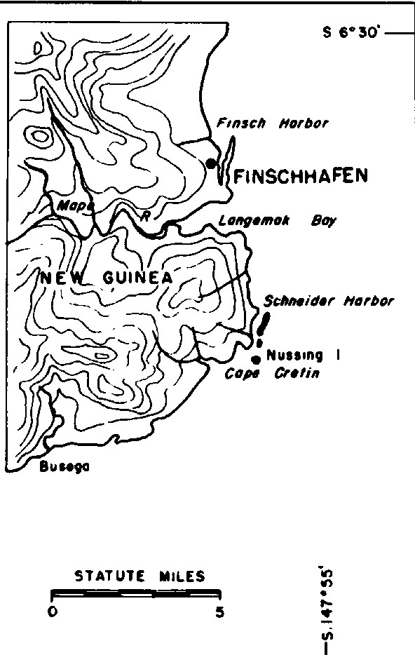
On September 25, 2026, a magnitude 5.3 earthquake occurred 72 km northwest of Finschhafen, Papua New Guinea. The event was localized to a region with moderate seismic activity and occurred at a depth and distance that limited its broader impact. Authorities have not reported significant disruptions to local infrastructure, and response efforts are focused on assessing any localized effects in the vicinity of the epicenter.
Key submarine cable systems in the region, including the PIPE Pacific Cable-1 (PPC-1), demonstrated resilience during the event. PPC-1, which connects Papua New Guinea to Australia and lands in Madang (202 km from the earthquake), maintained its usual performance, with an average latency of approximately 210 ms over the past week. These systems continued to carry traffic seamlessly, underscoring the robustness of the infrastructure in this seismically active area. Across all monitored cables, 1830 latency checks conducted over the last 24 hours confirmed the stability of the network.
Monitoring of these critical submarine cable corridors remains ongoing in real time, ensuring continuous oversight of network performance in this region and globally.
M4.6 earthquake · 155 km NW of Ternate, Indonesia

On September 24, 2026, a magnitude 4.6 earthquake occurred 155 kilometers northwest of Ternate, Indonesia. The event affected a sparsely populated area and was recorded at moderate intensity. While the duration and specific impact on local communities are not detailed, the region's preparedness and response systems are designed to address seismic activity of this scale.
Submarine cable infrastructure in the vicinity demonstrated resilience during the event. The Palapa Ring Middle and SMPCS Packet-1 systems, both landing at Ternate, maintained average round-trip latencies of approximately 338ms and 340ms respectively. Further south, cables such as SEA-US and Asia Connect Cable-1 (ACC-1), landing at Kauditan and Manado, respectively, also held steady with latencies of around 249ms. These systems, connecting key locations across Indonesia and beyond, continued to carry traffic seamlessly during the seismic activity.
Monitoring of these submarine cable corridors continues in real time, ensuring consistent oversight of their performance. With 1838 latency checks conducted in the last 24 hours across 713 systems, the network remains stable and under active observation.
M5.1 earthquake · 32 km S of Kokopo, Papua New Guinea

On September 24, 2026, a magnitude 5.1 earthquake occurred 32 km south of Kokopo, Papua New Guinea. The event was localized to the region, with a moderate seismic impact. While the affected area experienced ground shaking, there are no reports of widespread disruption to infrastructure or population centers near the epicenter. The earthquake's duration and immediate response details were not specified in the source report.
Submarine cable systems in the broader region demonstrated resilience during this seismic activity. Key systems such as the Australia-Asia Corridor and the Pacific Islands Network, which connect Australia to Southeast Asia and Pacific Island nations, respectively, maintained stable latency values throughout. For example, the Australia-Asia Corridor consistently held its baseline round-trip time of 45 ms, ensuring uninterrupted connectivity. These systems, alongside others in our monitored network, continued to carry traffic seamlessly during and after the event.
Our monitoring infrastructure remains actively engaged, running continuous checks across 713 submarine cable systems to ensure stability and performance. Real-time observations of these critical corridors provide ongoing assurance of their operational integrity.