Udo, South Korea
Landing Point · KR South Korea
Connected Cables
| Cable | Status |
|---|---|
| Jeju-Udo | Active |
Live Performance
RTT measurements to this landing point from 2026-03-05 through 2026-10-11 - live ICMP round-trip time via our monitoring probes. Recomputed daily. ✓ No anomalies detected in the monitored period.
Measurement sources
| Probe | Location | Samples | Avg |
|---|---|---|---|
| own probe | Almaty KZ | 13 | 238.6 ms |
| own probe | Tbilisi GE | 8 | 336.0 ms |
| #7062 own probe | Cape Town ZA | 7 | 368.5 ms |
| #6410 own probe | Sao Paulo BR | 6 | 314.2 ms |
| own probe | Minsk BY | 6 | 201.7 ms |
| own probe | Moscow RU | 6 | 178.6 ms |
| #20822 | control probe | 5 | 5.3 ms |
| #64216 | control probe | 5 | 3.7 ms |
| #1005400 | control probe | 5 | 8.1 ms |
| #6487 | control probe | 3 | 78.4 ms |
| own probe | Jerusalem IL | 2 | 317.9 ms |
| #6568 own probe | Singapore SG | 1 | 221.5 ms |
| own probe | Ekaterinburg RU | 1 | 176.7 ms |
About Udo, South Korea
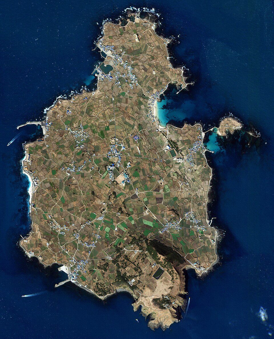
Udo, South Korea: Submarine Cable Landing Point
Udo is a small island in Jeju Province, South Korea, situated approximately 2.8 kilometres off the coast of Jeju Island. As the second-largest island in the province, Udo sits within the broader Jeju archipelago and serves as a landing point for submarine cable infrastructure connecting it to the surrounding South Korean island network. One submarine cable currently lands at Udo, providing a direct link between this island and Jeju Island itself.
The single cable landing at Udo is the Jeju-Udo, a short intra-national connection that establishes dedicated submarine cable connectivity between Udo and Jeju Island. Given the exclusively domestic nature of this link, Udo functions as a terminus point within a South Korean inter-island corridor rather than as part of any intercontinental or regional international route.
Cables Landing at Udo
Jeju-Udo is a 3-kilometre submarine cable with a ready-for-service year of 2023, currently listed in draft status. The cable connects Udo to Jeju Island, with both endpoints located within South Korea. At just 3 kilometres in length, it is among the shortest submarine cable systems associated with any South Korean landing point, reflecting the compact geography between Udo and the northeastern coast of Jeju Island. No additional technical specifications, capacity figures, or ownership details are available for this cable system.
Regional Context
Within South Korea's submarine cable landscape, Udo is a single-cable landing point, placing it alongside Geoje, Goheung, Gunsan, and Hosan-ri as locations each served by one cable. By comparison, Busan hosts eight cables, making it the dominant hub in the country's submarine cable network, while Goseong-ri supports three cables. Udo's role is distinctly localised, focused entirely on inter-island connectivity within Jeju Province rather than on broader domestic or international routing.
Network Role
Udo's position in the submarine cable network is that of a single-cable terminus, terminating one short domestic link that ties the island to Jeju Island. The Jeju-Udo cable, at 3 kilometres, enables dedicated undersea connectivity for Udo rather than relying solely on overland or other means of connection. This makes Udo a modest but distinct node within the South Korean inter-island cable graph.
Within the regional submarine cable picture of South Korea, Udo represents the localised, intra-provincial layer of cable deployment, where short-distance systems serve island communities with direct submarine connections. Its presence in the national cable inventory illustrates how submarine cable infrastructure extends not only to major coastal cities but also to smaller offshore islands within the same provincial territory.
What next: Udo, South Korea in the global directory of cable landing points; see surrounding routes on the interactive submarine cable map or follow live network monitoring.
Other Landing Points in South Korea
Landing Point
- CountryKR South Korea
- Coordinates33.5053°N 126.9558°E
- Connected Cables1
See Real Cable Routes
View actual submarine cable routing from Udo, South Korea - with backbone nodes, distance calculations, and latency estimates
Open Calculator →