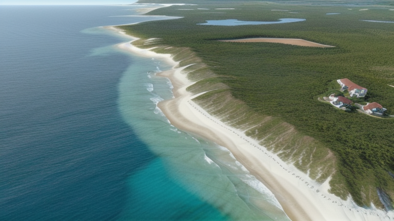
Tomakomai, Japan
Landing Point · JP Japan
Connected Cables
| Cable | Status |
|---|---|
| E2A | Planned |
📡 Live Performance
RTT measurements to this landing point from 2026-04-17 through 2026-06-19 - live ICMP round-trip time via our monitoring probes. Recomputed daily. ✓ No anomalies detected in the monitored period.
Measurement sources
| Probe | Location | Samples | Avg |
|---|---|---|---|
| #1014589 own probe | Almaty KZ | 4 | 298.8 ms |
| #1015523 own probe | Moscow RU | 3 | 261.8 ms |
| #6410 own probe | Sao Paulo BR | 2 | 247.3 ms |
| #6487 own probe | Singapore SG | 2 | 79.5 ms |
| #7062 own probe | Cape Town ZA | 2 | 411.6 ms |
| #1014473 own probe | Minsk BY | 2 | 259.7 ms |
| #1014597 own probe | Tbilisi GE | 2 | 281.6 ms |
| #1014969 own probe | Jerusalem IL | 2 | 291.1 ms |
| #1015313 own probe | Sevastopol UA | 1 | 291.9 ms |
About Tomakomai, Japan
Tomakomai, Japan: Submarine Cable Landing Point
Tomakomai is a port city located on the southern coast of Hokkaido, Japan's northernmost main island. Its position on Hokkaido's Pacific-facing coastline makes it a geographically distinct landing point within Japan's submarine cable network, separated from the concentration of cable infrastructure found on Honshu. One submarine cable lands at Tomakomai, connecting it to a trans-Pacific and intra-regional corridor that spans multiple economies across East Asia and the Pacific.
That cable, E2A, links Tomakomai to landing points in South Korea, Taiwan, and the United States, as well as additional points within Japan itself. With a draft ready-for-service date of 2029, E2A represents a forthcoming addition to Japan's international submarine cable capacity, and Tomakomai serves as its northernmost Japanese terminus. The cable establishes a corridor that is simultaneously intercontinental — crossing to the United States — and intra-regional, connecting the major East Asian economies of Japan, South Korea, and Taiwan.
Cables Landing at Tomakomai
E2A is a submarine cable system with a total length of 12,500 km, with a draft ready-for-service date of 2029. It connects landing points across Japan, South Korea, Taiwan, and the United States. Tomakomai represents one of the Japanese landing points on this system, which spans a trans-Pacific route as well as regional connections between the Northeast Asian economies along its path. As of its current status, E2A remains in the draft phase of development.
Regional Context
Among Japan's 46 submarine cable landing points, Tomakomai hosts one cable, placing it in the lower range of connectivity relative to high-density hubs such as Shima (11 cables), Maruyama (9 cables), and Chikura (8 cables). It is comparable in scale to single- or small-count landing points distributed across the country, and its location on Hokkaido distinguishes it geographically from the cluster of landing points concentrated on Honshu. Japan as a whole hosts 38 submarine cables across its landing points, and Tomakomai contributes one scheduled future system to that total.
Network Role
Tomakomai functions as a single-cable terminus within Japan's submarine cable network, designated as a landing point for the E2A system upon its completion in 2029. Through E2A, it participates in a corridor that connects Japan northward and outward — linking to South Korea and Taiwan in the regional East Asian network, and extending across the Pacific to the United States. This dual character, regional and intercontinental, gives the landing point a range that is disproportionate to its single-cable status.
Within the broader submarine cable graph of the Pacific, Tomakomai's role as a Hokkaido landing point introduces geographic diversity into Japan's cable infrastructure, which is otherwise heavily concentrated at points further south. Its inclusion in a long-haul, multi-country system positions it as a northern node in a corridor that ties Northeast Asia to North America.
Other Landing Points in Japan
Landing Point
- CountryJP Japan
- Coordinates42.6361°N 141.6032°E
- Connected Cables1
See Real Cable Routes
View actual submarine cable routing from Tomakomai, Japan - with backbone nodes, distance calculations, and latency estimates
Open Calculator →