Codroy, NL, Canada
Landing Point · CA Canada
Connected Cables
| Cable | Status |
|---|---|
| APOCS 2 | Active |
Live Performance
RTT measurements to this landing point from 2026-03-02 through 2026-09-25 - live ICMP round-trip time via our monitoring probes. Recomputed daily. ✓ No anomalies detected in the monitored period.
Measurement sources
| Probe | Location | Samples | Avg |
|---|---|---|---|
| own probe | Minsk BY | 7 | 106.4 ms |
| #6427 own probe | Sydney AU | 4 | 163.5 ms |
| #6487 | control probe | 3 | 180.7 ms |
| #35641 | control probe | 3 | 54.7 ms |
| own probe | Almaty KZ | 3 | 166.0 ms |
| own probe | Tbilisi GE | 3 | 133.6 ms |
| #1015498 | control probe | 3 | 37.6 ms |
| own probe | Moscow RU | 3 | 110.3 ms |
| #60681 | control probe | 2 | 25.0 ms |
| own probe | Saint Petersburg RU | 2 | 102.4 ms |
| own probe | Kyiv UA | 2 | 113.0 ms |
| #7062 own probe | Cape Town ZA | 1 | 213.1 ms |
| own probe | Jerusalem IL | 1 | 136.2 ms |
| #1015300 | control probe | 1 | 14.7 ms |
| own probe | Sevastopol UA | 1 | 140.3 ms |
| own probe | Odessa UA | 1 | 117.5 ms |
About Codroy, NL, Canada
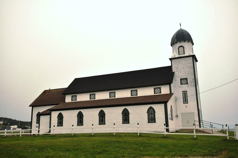
How the Internet Reaches Codroy, NL, Canada
Codroy is a small coastal community on the southwestern shore of Newfoundland, the island province that forms Canada's easternmost landmass. Its position on the Atlantic coast places it at the edge of Canada's submarine cable network, where a single undersea cable connects the community to the mainland provinces across the Gulf of St. Lawrence.
International internet traffic reaching Codroy arrives through this domestic submarine cable link, which ties Newfoundland to the Canadian mainland rather than providing a direct route to international networks. Codroy functions as a single-cable terminus - one end of a regional connection that runs entirely within Canadian waters, linking several coastal communities along the Atlantic seaboard.
The Cable Serving Codroy, NL, Canada
The APOCS 2 cable, which entered service in 1995, is the sole submarine cable landing at Codroy. It connects the community to three other Canadian landing points: Aylesford, NS and Dingwall, NS in Nova Scotia, and St. Martins, NB in New Brunswick. This cable traces a regional route across the Gulf of St. Lawrence and the Bay of Fundy corridor, linking Newfoundland to the Maritime provinces. All four landing points on APOCS 2 are within Canada, making it an entirely domestic cable serving inter-provincial connectivity rather than international routing.
Regional Context
Canada hosts 18 submarine cables across 44 landing points, with an average cable length of 877 km - a network that has been in service since 1991. Codroy represents one of the smaller, single-cable terminuses within that national picture. Nearby regional peers include Halifax, NS, which benefits from two cable connections, offering greater redundancy than Codroy's single link. Further afield, landing points such as Kangiqsujuaq, QC and Puvirnituq, QC each also serve two cables, reflecting the broader pattern of coastal Canadian communities relying on submarine infrastructure to maintain connectivity across the country's vast geography.
What This Means for Connectivity
Because Codroy is served by a single submarine cable, all external traffic from the community flows through APOCS 2. An outage on this cable would sever the community's submarine link to the Maritime provinces entirely. The traffic carried is inter-provincial in nature - connecting Newfoundland to Nova Scotia and New Brunswick - rather than directly intercontinental.
Codroy's position as a single-cable, domestically oriented terminus illustrates how submarine infrastructure in Canada extends well beyond international connections, serving the practical need to bridge island and coastal communities to the broader national network. Understanding this distinction - between cables that connect nations across oceans and cables that stitch together a single country's dispersed coastline - is essential to reading Canada's submarine cable topology accurately.
What next: Codroy, NL, Canada in the global directory of cable landing points; see surrounding routes on the interactive submarine cable map or follow live network monitoring.
Other Landing Points in Canada
Landing Point
- CountryCA Canada
- Coordinates47.8816°N 59.3919°W
- Connected Cables1
See Real Cable Routes
View actual submarine cable routing from Codroy, NL, Canada - with backbone nodes, distance calculations, and latency estimates
Open Calculator →