Capraia Isola, Italy
Landing Point · IT Italy
Connected Cables
| Cable | Status |
|---|---|
| Piano Isole Minori | Active |
Live Performance
RTT measurements to this landing point from 2026-04-18 through 2026-08-25 - live ICMP round-trip time via our monitoring probes. Recomputed daily. ✓ No anomalies detected in the monitored period.
Measurement sources
| Probe | Location | Samples | Avg |
|---|---|---|---|
| own probe | Minsk BY | 4 | 82.2 ms |
| #6427 own probe | Sydney AU | 3 | 627.8 ms |
| #6487 | control probe | 3 | 739.2 ms |
| own probe | Odessa UA | 3 | 855.7 ms |
| own probe | Kyiv UA | 3 | 1068.9 ms |
| own probe | Almaty KZ | 1 | 122.0 ms |
| own probe | Tbilisi GE | 1 | 71.3 ms |
| own probe | Jerusalem IL | 1 | 69.9 ms |
| own probe | Sevastopol UA | 1 | 99.7 ms |
About Capraia Isola, Italy
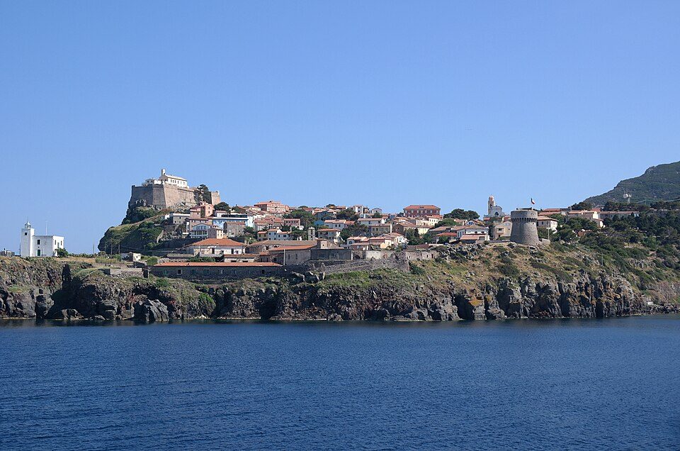
Capraia Isola: Submarine Cable Landing Point
Capraia Isola is a municipality located on the island of the same name, part of the Tuscan Archipelago in the Province of Livorno, in the Italian region of Tuscany. As an island community within Italian waters, it is served by submarine cable infrastructure that connects it to the broader Italian national network. One submarine cable currently lands at Capraia Isola, linking this small island location to other points within Italy.
The single cable serving Capraia Isola, the Piano Isole Minori, is a domestic Italian cable, meaning the corridor it enables is an intra-national one - connecting Italian islands and coastal communities rather than spanning international or intercontinental routes. This positions Capraia Isola as a regionally oriented landing point focused on inter-island and island-to-mainland connectivity within Italy.
Cables Landing at Capraia Isola
Piano Isole Minori is an 830-kilometre submarine cable with a Ready for Service (RFS) year of 2024, currently in draft status. The cable connects multiple landing points entirely within Italy, making it a domestic inter-island and coastal connectivity project. Its name - which translates broadly to "Minor Islands Plan" - reflects its purpose of extending submarine cable connectivity to smaller Italian island communities, of which Capraia Isola is one. At 830 kilometres in length, the cable represents a significant domestic infrastructure effort to bring multiple island locations within the Italian network.
Regional Context
Within Italy's submarine cable landscape, which spans 37 cables across 55 landing points, Capraia Isola hosts a single cable and ranks within the top 80 percent of Italian landing points by cable count. Compared to major Italian hubs such as Mazara del Vallo with nine cables, Genoa with seven, and Catania with five, Capraia Isola is a more modest landing point. It is comparable in cable count to other Italian island landing points such as Lampedusa, which also hosts two or fewer cables, reflecting the smaller scale typically associated with minor island communities in the Italian archipelago.
Network Role
Capraia Isola functions as a single-cable terminus in the Italian submarine cable network, with its connectivity entirely oriented toward domestic inter-island routes through the Piano Isole Minori cable. Rather than serving as a gateway for international or intercontinental traffic, this landing point plays a role in extending national network reach to an island community in the Tuscan Archipelago that would otherwise depend on alternative means of connectivity.
As Italy continues to develop infrastructure connecting its minor islands - a goal directly reflected in the Piano Isole Minori project - landing points like Capraia Isola represent the extension of the Italian submarine cable network into smaller, geographically dispersed communities, broadening the overall footprint of the country's 55-landing-point submarine cable system.
What next: Capraia Isola, Italy in the global directory of cable landing points; see surrounding routes on the interactive submarine cable map or follow live network monitoring.
Other Landing Points in Italy
Landing Point
- CountryIT Italy
- Coordinates43.0483°N 9.8422°E
- Connected Cables1
See Real Cable Routes
View actual submarine cable routing from Capraia Isola, Italy - with backbone nodes, distance calculations, and latency estimates
Open Calculator →