Otranto, Italy
Landing Point · IT Italy
Connected Cables
| Cable | Status |
|---|---|
| Italy-Greece 1 (IG-1) | Active |
Live Performance
RTT measurements to this landing point from 2026-03-07 through 2026-10-16 - live ICMP round-trip time via our monitoring probes. Recomputed daily. ✓ No anomalies detected in the monitored period.
Measurement sources
| Probe | Location | Samples | Avg |
|---|---|---|---|
| #62913 | control probe | 177 | 56.9 ms |
| own probe | Odessa UA | 76 | 256.5 ms |
| #6427 own probe | Sydney AU | 75 | 411.1 ms |
| own probe | Sevastopol UA | 44 | 107.2 ms |
| own probe | Kyiv UA | 31 | 135.2 ms |
| #17554 | control probe | 21 | 43.1 ms |
| own probe | Minsk BY | 14 | 481.9 ms |
| own probe | Tbilisi GE | 10 | 67.7 ms |
| own probe | Almaty KZ | 9 | 126.6 ms |
| own probe | Jerusalem IL | 8 | 76.8 ms |
| #6410 own probe | Sao Paulo BR | 5 | 2368.5 ms |
| #1014324 | control probe | 2 | 35.3 ms |
| own probe | Moscow RU | 1 | 64.3 ms |
| own probe | Balancer IL | 1 | 3164.4 ms |
About Otranto, Italy
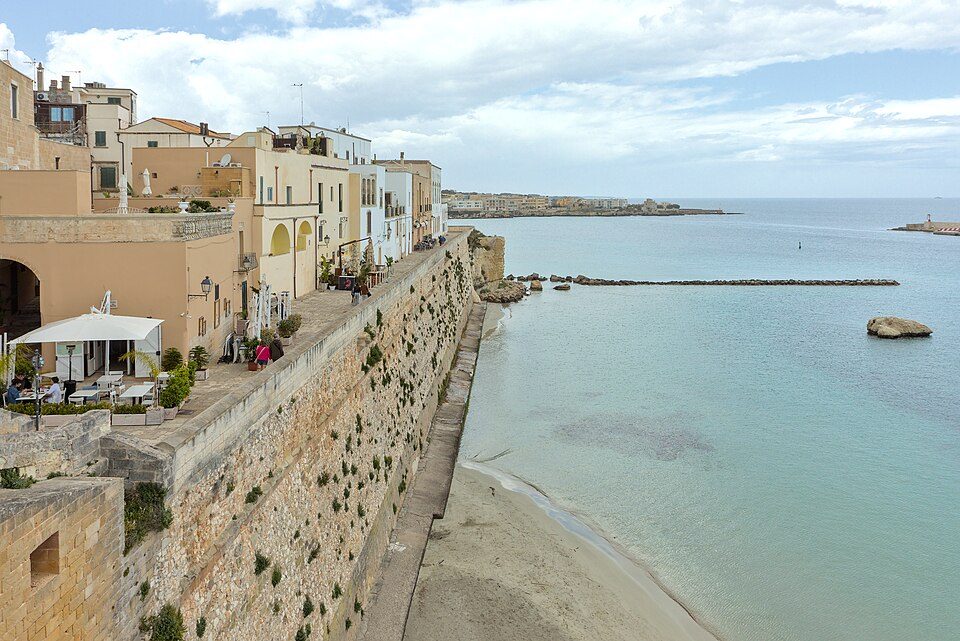
Otranto, Italy: Submarine Cable Landing Point
Otranto is a coastal town and port in the province of Lecce, situated on the heel of the Italian peninsula in the Apulia region. Its position on the Adriatic coast places it directly opposite the Greek coast across the Strait of Otranto, one of the narrowest passages between Italy and Greece. This geographic alignment makes Otranto a natural terminus for submarine cable infrastructure connecting the two countries.
One submarine cable lands at Otranto, the Italy-Greece 1 (IG-1) system, which links Italy directly to Greece. This connection represents a short, focused bilateral corridor across the southern Adriatic, enabling direct submarine connectivity between the two neighboring nations.
Cables Landing at Otranto
Italy-Greece 1 (IG-1) is a 169-kilometre submarine cable that became ready for service in 1995. Connecting Italy and Greece, it is one of the earlier submarine cable systems in the Italian national cable network, which saw its first cable enter service in 1994. The relatively short length of the IG-1 system reflects the narrow channel it crosses - the Strait of Otranto - making it one of the more compact international submarine cable routes in the Mediterranean region.
Regional Context
Within Italy's submarine cable infrastructure, which spans 37 cables across 55 landing points, Otranto hosts a single cable and ranks within the top 80 percent of Italian landing points by cable count. By comparison, major Italian hubs such as Mazara del Vallo, Genoa, and Catania serve significantly larger numbers of cables - nine, seven, and five respectively - while nearby Bari hosts four cables. Otranto's single-cable profile places it alongside Civitavecchia and Lampedusa as a more specialised landing point rather than a multi-cable hub.
Network Role
Otranto functions as a single-cable terminus, serving the specific bilateral corridor between Italy and Greece via the IG-1 system. Its role is focused rather than broadly aggregating: it provides a direct, short-distance submarine link across the Strait of Otranto rather than acting as a convergence point for multiple international or intercontinental routes. The 169-kilometre IG-1 cable stands as a dedicated connection between two neighboring European nations, established in the mid-1990s when modern submarine cable infrastructure in Italy was in its earliest phase of development.
In the broader Italian submarine cable graph, Otranto represents the southeasternmost expression of Italy's Adriatic-facing connectivity, offering a direct Italy-Greece path that complements the denser cable ecosystems found at larger hubs along the country's other coastlines.
What next: Otranto, Italy in the global directory of cable landing points; see surrounding routes on the interactive submarine cable map or follow live network monitoring.
Our measurements to Otranto
Traceroutes from our own measurement points over the last 30 days: usual delay and number of network hops on the way to Otranto.
- From RIPE Atlas probes: 43 ms, 16 hops, 21 traces
Last trace: 2026-10-16. Live network map
Other Landing Points in Italy
Landing Point
- CountryIT Italy
- Coordinates40.1481°N 18.4857°E
- Connected Cables1
See Real Cable Routes
View actual submarine cable routing from Otranto, Italy - with backbone nodes, distance calculations, and latency estimates
Open Calculator →