Morowali, Indonesia
Landing Point · ID Indonesia
Connected Cables
| Cable | Status |
|---|---|
| Indonesia Tengah Cable Systems | Planned |
Live Performance
RTT measurements to this landing point from 2026-07-12 through 2026-10-14 - live ICMP round-trip time via our monitoring probes. Recomputed daily. ✓ No anomalies detected in the monitored period.
Measurement sources
| Probe | Location | Samples | Avg |
|---|---|---|---|
| #6410 own probe | Sao Paulo BR | 8 | 369.9 ms |
| #6427 own probe | Sydney AU | 8 | 155.5 ms |
| #7062 own probe | Cape Town ZA | 8 | 312.1 ms |
| own probe | Almaty KZ | 8 | 286.4 ms |
| #6487 | control probe | 6 | 29.0 ms |
| #6568 own probe | Singapore SG | 2 | 52.6 ms |
| own probe | Tbilisi GE | 2 | 347.6 ms |
About Morowali, Indonesia
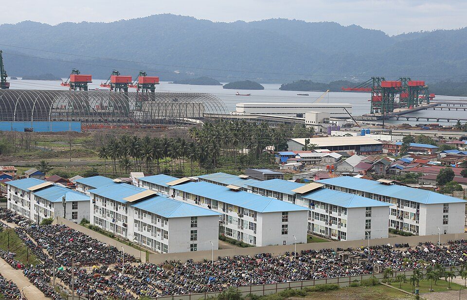
Morowali: Submarine Cable Landing Point
Morowali is a regency located in Central Sulawesi Province, Indonesia, situated along the eastern coast of Sulawesi island. As a landing point within one of the world's most extensive submarine cable nations - where 70 cables reach shore across 139 landing points - Morowali represents an emerging node in Indonesia's domestic connectivity infrastructure. One submarine cable is scheduled to land here, connecting Morowali into the broader intra-Indonesian cable network.
The sole cable serving Morowali is the Indonesia Tengah Cable Systems, a domestic route that links locations entirely within Indonesia. This positions Morowali as a participant in a corridor designed to strengthen inter-island connectivity across the Indonesian archipelago, rather than as a gateway to international or intercontinental routes. The cable's planned ready-for-service date places Morowali among Indonesia's newer generation of landing points, extending domestic submarine cable infrastructure further into the Central Sulawesi region.
Cables Landing at Morowali
The Indonesia Tengah Cable Systems is a domestic submarine cable with a total length of 2,641 kilometres. Currently in draft status with a projected ready-for-service year of 2027, this cable connects multiple landing points within Indonesia. Its route is entirely intra-national, linking Indonesian locations across the archipelago without connecting to any foreign country. Upon completion, it will serve as the primary submarine cable infrastructure at the Morowali landing point.
Regional Context
Within Indonesia's submarine cable landscape, Morowali hosts a single cable, placing it among the smaller landing points in the country. Major hubs such as Batam with 20 cables and Jakarta with 9 cables represent significantly higher concentrations of cable infrastructure, while landing points like Makassar - also on Sulawesi - host 6 cables. Nevertheless, Morowali's inclusion in the Indonesia Tengah Cable Systems reflects ongoing efforts to extend submarine cable reach to less-served parts of Sulawesi and the broader central Indonesian region.
Network Role
Morowali functions as a single-cable terminus within Indonesia's domestic submarine cable graph. Its connection via the Indonesia Tengah Cable Systems enables intra-Indonesian submarine data routing across a cable spanning 2,641 kilometres, contributing to the inter-island connectivity fabric of the archipelago. The landing point does not currently serve any international cable corridor.
As a newer addition to Indonesia's 139 landing points, Morowali extends submarine cable access into Central Sulawesi, a province whose regencies - including the Morowali Regency with its far-flung Menui Islands - stand to benefit from improved domestic submarine connectivity once the cable reaches its 2027 ready-for-service target. Its place in the regional cable graph illustrates how Indonesia continues to deepen intra-national submarine infrastructure beyond its established international gateway cities.
What next: Morowali, Indonesia in the global directory of cable landing points; see surrounding routes on the interactive submarine cable map or follow live network monitoring.
Other Landing Points in Indonesia
Landing Point
- CountryID Indonesia
- Coordinates2.8299°S 122.1675°E
- Connected Cables1
See Real Cable Routes
View actual submarine cable routing from Morowali, Indonesia - with backbone nodes, distance calculations, and latency estimates
Open Calculator →