Alor, Indonesia
Landing Point · ID Indonesia
Connected Cables
| Cable | Status |
|---|---|
| Kupang-Alor Cable Systems | Active |
📡 Live Performance
RTT measurements to this landing point from 2026-04-11 through 2026-07-14 - live ICMP round-trip time via our monitoring probes. Recomputed daily. ✓ No anomalies detected in the monitored period.
Measurement sources
| Probe | Location | Samples | Avg |
|---|---|---|---|
| #1014589 own probe | Almaty KZ | 4 | 275.7 ms |
| #6410 own probe | Sao Paulo BR | 3 | 385.5 ms |
| #6427 own probe | Sydney AU | 3 | 133.6 ms |
| #6487 own probe | Singapore SG | 3 | 46.2 ms |
| #1014473 own probe | Minsk BY | 3 | 257.9 ms |
| #1014597 own probe | Tbilisi GE | 3 | 308.6 ms |
| #26109 | control probe | 1 | 44.7 ms |
| #51835 | control probe | 1 | 45.4 ms |
| #62242 | control probe | 1 | 48.9 ms |
| #1014969 own probe | Jerusalem IL | 1 | 235.6 ms |
About Alor, Indonesia
Alor, Indonesia: Submarine Cable Landing Point
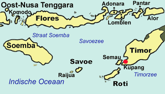
Alor is the largest island in the Alor Archipelago, situated at the eastern end of the Lesser Sunda Islands chain in southeastern Indonesia. It is among Indonesia's 92 officially listed outlying islands, reflecting its position as a geographically distinct and relatively remote part of the national territory. As a submarine cable landing point, Alor is connected to Indonesia's broader national network through one submarine cable system, the Kupang-Alor Cable Systems.
The single cable landing here links Alor to another point within Indonesia, making this an intra-national, inter-island connection rather than an intercontinental corridor. This reflects the geographic reality of Indonesia as an archipelagic state, where submarine cables play an important role in bridging connectivity between dispersed island communities and larger regional centers on the Indonesian mainland or adjacent islands.
Cables Landing at Alor, Indonesia
The Kupang-Alor Cable Systems is the sole submarine cable landing at Alor. Spanning 273 kilometers, this cable reached ready-for-service (RFS) status in 2019, with its status noted as draft. Both endpoints of the cable are located within Indonesia, connecting Alor to Kupang, the provincial capital of East Nusa Tenggara on the island of Timor. This relatively short cable is characteristic of the inter-island domestic links that form a significant portion of Indonesia's submarine cable network, serving to connect outlying islands to larger administrative and economic centers within the country.
Regional Context
Within Indonesia's submarine cable landscape — which encompasses 70 submarine cables across 139 landing points — Alor ranks in the top 62% of landing points by cable count, hosting one cable. This places it well behind major Indonesian hubs such as Batam (20 cables), Jakarta (9 cables), Tanjung Pakis (9 cables), Manado (8 cables), Dumai (7 cables), and Makassar (6 cables). Alor's single-cable profile is consistent with its character as a remote outlying island rather than a high-traffic national gateway.
Network Role
Alor functions as a single-cable terminus within Indonesia's domestic inter-island submarine cable network. The Kupang-Alor Cable Systems provides a direct submarine link between Alor and Kupang, connecting this easternmost part of the Lesser Sunda Islands chain to a significant regional center on Timor. The cable's 273-kilometer length is notably shorter than Indonesia's national average cable length of 2,814 kilometers, underscoring its purpose as a targeted local connectivity link rather than a long-haul route.
As a single-cable landing point, Alor does not serve as a transit hub or multi-route junction within the broader submarine cable graph. Nevertheless, its place within the network illustrates the scale of Indonesia's effort to extend submarine cable connectivity to its many outlying islands, ensuring that even geographically remote communities in the Alor Archipelago have a dedicated submarine link to the national communications infrastructure.
What next: Alor, Indonesia in the global directory of cable landing points; see surrounding routes on the interactive submarine cable map or follow live network monitoring.
Other Landing Points in Indonesia
Landing Point
- CountryID Indonesia
- Coordinates8.3207°S 124.4038°E
- Connected Cables1
See Real Cable Routes
View actual submarine cable routing from Alor, Indonesia - with backbone nodes, distance calculations, and latency estimates
Open Calculator →