Manokwari, Indonesia
Landing Point · ID Indonesia
Connected Cables
| Cable | Status |
|---|---|
| Palapa Ring East | Active |
| Patara-2 | Active |
| SMPCS Packet-2 | Active |
Live Performance
RTT measurements to this landing point from 2026-06-16 through 2026-10-11 - live ICMP round-trip time via our monitoring probes. Recomputed daily. ✓ No anomalies detected in the monitored period.
Measurement sources
| Probe | Location | Samples | Avg |
|---|---|---|---|
| #6410 own probe | Sao Paulo BR | 52 | 307.4 ms |
| #6427 own probe | Sydney AU | 52 | 225.3 ms |
| own probe | Almaty KZ | 37 | 382.5 ms |
| #6487 | control probe | 14 | 112.1 ms |
| #7062 own probe | Cape Town ZA | 8 | 321.5 ms |
| #6568 own probe | Singapore SG | 7 | 107.9 ms |
| own probe | Tbilisi GE | 1 | 309.2 ms |
| own probe | Moscow RU | 1 | 221.2 ms |
| own probe | Rostov RU | 1 | 230.6 ms |
About Manokwari, Indonesia
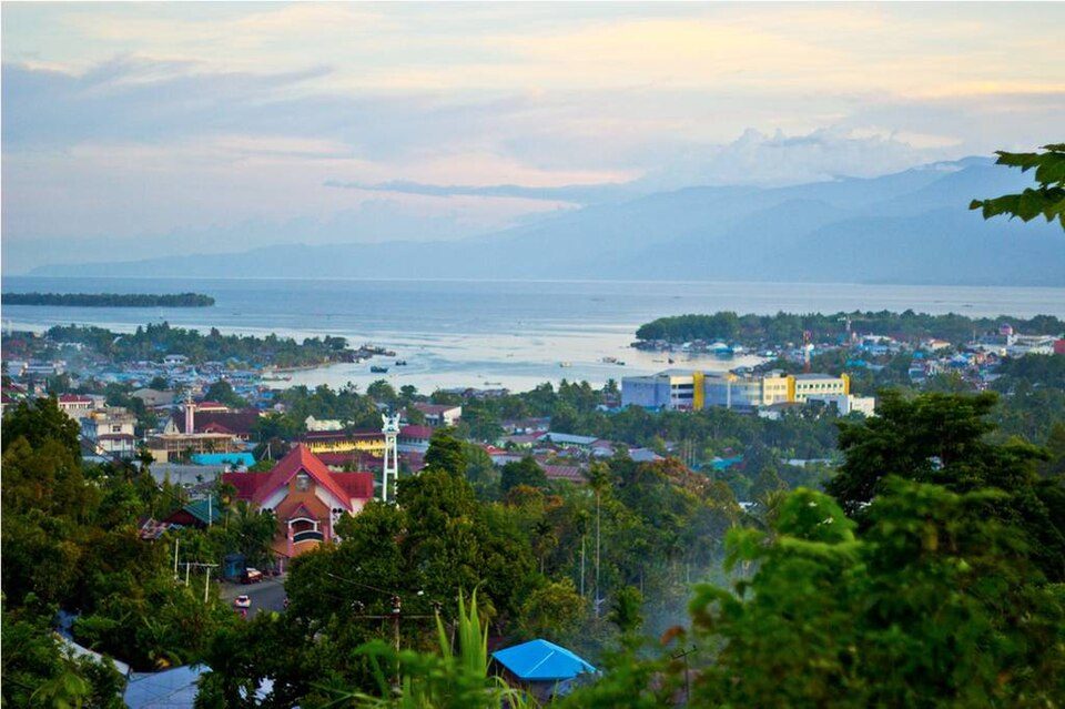
Manokwari, Indonesia is a submarine cable landing point in Indonesia (coordinates -0.8615°, 134.0620°). It serves 3 submarine cable systems, making it a multi-cable landing site in Indonesia's international connectivity infrastructure.
Manokwari is a coastal town and the capital of the Indonesian province of West Papua. It is one of only seven provincial capitals of Indonesia without a city status. It is also the administrative seat of Manokwari Regency. Under proposals under consideration by the Indonesian Parliament, it was planned to split Manokwari town off from the regency and turn it into a separate city; however this process has been suspended in the light of the Government moratorium since 2013 on the creation of new regencies and cities. The majority of Manokwari residents are Christians and the town is one of the seats of the Roman Catholic Diocese of Manokwari-Sorong. The town was formerly known by Europeans as Dory, Doréry or Dorey. Wikipedia
Connected submarine cables
| Cable | RFS | Length | Owners |
|---|---|---|---|
| Patara-2 | 2023 | 1,200 km | Telin |
| Palapa Ring East | 2019 | 6,300 km | Indonesian Government, Moratelindo, Telekom PT SmartFren |
| SMPCS Packet-2 | 2015 | 3,498 km | Telkom Indonesia |
Operators landing at Manokwari, Indonesia
Cables landing at Manokwari, Indonesia are operated by 5 distinct consortium partners and carriers, including Indonesian Government, Moratelindo, Telekom PT SmartFren, Telin, Telkom Indonesia. Each cable is typically jointly owned by a consortium of tier-one carriers and hyperscale operators who share construction costs and capacity; the operator mix reflects both regional incumbents and global players with interest in the routes served by this landing point.
Connectivity profile
From Manokwari, Indonesia, international traffic can reach 1 countries through 3 cable systems. Destinations include Indonesia.
Monitoring status
No monitoring incidents were recorded on cables serving Manokwari, Indonesia in the past 90 days - all connected systems remained within normal latency thresholds. Our monitoring network continuously samples latency from external probes to targets reachable via these cables.
About the cables
- Patara-2 (2023) - Patara-2 is a submarine cable system operating within Indonesia, with landing points at Manokwari, Supiori, Waisai. It provides dedicated submarine fiber capacity between these locations, supporting telecommunications, internet access, and enterprise connectivity. Read more →
- Palapa Ring East (2019) - Palapa Ring East is a domestic submarine cable network within Indonesia, connecting 18 coastal and island locations including Agats, Baa, Kep. Aru, Kokar, Kota Mappi, and 13 more. The system provides essential telecommunications infrastructure for communities that would otherwise depend entirely on satellite or microwave links. Read more →
- SMPCS Packet-2 (2015) - SMPCS Packet-2 is a domestic submarine cable network within Indonesia, connecting 11 coastal and island locations including Biak, Fakfak, Jayapura, Kaimana, Manokwari, and 6 more. The system provides essential telecommunications infrastructure for communities that would otherwise depend entirely on satellite or microwave links. Read more →
What next: Manokwari, Indonesia in the global directory of cable landing points; see surrounding routes on the interactive submarine cable map or follow live network monitoring.
Our measurements to Manokwari
Traceroutes from our own measurement points over the last 30 days: usual delay and number of network hops on the way to Manokwari.
- From RIPE Atlas probes: 299 ms, 16 hops, 41 traces
Last trace: 2026-10-11. Live network map
Other Landing Points in Indonesia
FAQ
Landing Point
- CountryID Indonesia
- Coordinates0.8615°S 134.0620°E
- Connected Cables3
See Real Cable Routes
View actual submarine cable routing from Manokwari, Indonesia - with backbone nodes, distance calculations, and latency estimates
Open Calculator →