Lamaline, NL, Canada
Landing Point · CA Canada
Connected Cables
| Cable | Status |
|---|---|
| St. Pierre and Miquelon Cable | Active |
Live Performance
RTT measurements to this landing point from 2026-05-13 through 2026-10-02 - live ICMP round-trip time via our monitoring probes. Recomputed daily. ✓ No anomalies detected in the monitored period.
Measurement sources
| Probe | Location | Samples | Avg |
|---|---|---|---|
| own probe | Minsk BY | 5 | 115.5 ms |
| #6427 own probe | Sydney AU | 4 | 164.4 ms |
| own probe | Kyiv UA | 4 | 117.8 ms |
| own probe | Moscow RU | 3 | 106.1 ms |
| #6487 | control probe | 2 | 188.8 ms |
| #7062 own probe | Cape Town ZA | 2 | 216.3 ms |
| #35641 | control probe | 2 | 43.9 ms |
| #62492 | control probe | 2 | 34.3 ms |
| #1015498 | control probe | 2 | 58.8 ms |
| own probe | Saint Petersburg RU | 2 | 107.6 ms |
| own probe | Almaty KZ | 1 | 178.5 ms |
| own probe | Tbilisi GE | 1 | 135.0 ms |
| own probe | Jerusalem IL | 1 | 130.2 ms |
About Lamaline, NL, Canada
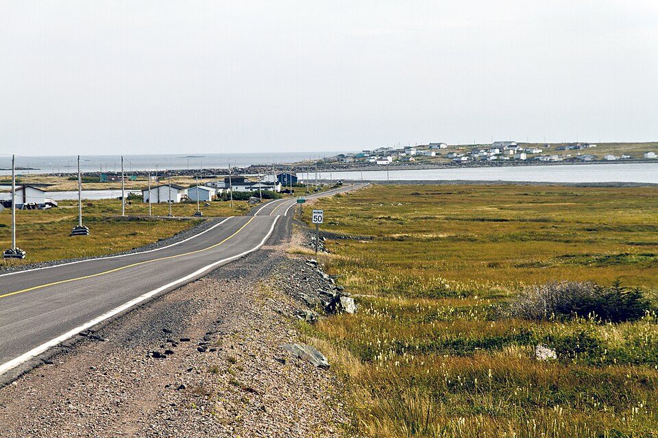
Lamaline, NL, Canada: Submarine Cable Landing Point
Lamaline is a town in Newfoundland and Labrador, Canada, situated on the southern tip of the Burin Peninsula. As a coastal community, it serves as a submarine cable landing point connecting Canada to the nearby French overseas collectivity of Saint Pierre and Miquelon. One submarine cable lands at Lamaline, the St. Pierre and Miquelon Cable, which provides a direct undersea link across the short stretch of water separating the Canadian province from the French archipelago.
The corridor enabled by this landing point is a short regional one, linking two distinct national territories - Canada and Saint Pierre and Miquelon - that lie in close geographic proximity off the coast of Newfoundland. Despite the modest scale of the connection, it represents a dedicated submarine infrastructure link between Canada and a French overseas territory in the northwest Atlantic.
Cables Landing at Lamaline, NL, Canada
The St. Pierre and Miquelon Cable is the single submarine cable landing at Lamaline. Spanning approximately 200 kilometres, this cable reached ready-for-service (RFS) status in 2018 and carries connectivity between Canada and Saint Pierre and Miquelon. The cable's two endpoint countries reflect its purpose as a bilateral link between the Canadian province of Newfoundland and Labrador and the French collectivity of Saint Pierre and Miquelon, providing the archipelago with an undersea connection to the North American mainland.
Regional Context
Within Canada's submarine cable landscape, Lamaline is one of 155 landing points spread across the country, which collectively host 21 submarine cables. With a single cable, Lamaline is comparable in scale to Addenbroke Island, BC, which also hosts one cable, while larger Canadian landing points such as Halifax, NS, Vancouver, BC, Prince Rupert, BC, Kangiqsujuaq, QC, and Puvirnituq, QC each host two cables. Lamaline's role is therefore a focused, single-route terminus rather than a multi-cable hub.
Network Role
Lamaline functions as a single-cable terminus, anchoring the Canadian end of the St. Pierre and Miquelon Cable. Its network role is specifically oriented toward the short cross-water corridor between Newfoundland and Labrador and the French overseas collectivity of Saint Pierre and Miquelon, rather than serving intercontinental or long-haul routes. The landing point does not aggregate multiple cable systems and is distinct in its purpose from Canada's larger, multi-cable hubs.
Within the regional submarine cable graph, Lamaline represents the point at which Saint Pierre and Miquelon's undersea connectivity ties into the Canadian landmass, making it the geographic anchor for that bilateral link on the Canadian side.
What next: Lamaline, NL, Canada in the global directory of cable landing points; see surrounding routes on the interactive submarine cable map or follow live network monitoring.
Other Landing Points in Canada
Landing Point
- CountryCA Canada
- Coordinates46.8690°N 55.8033°W
- Connected Cables1
See Real Cable Routes
View actual submarine cable routing from Lamaline, NL, Canada - with backbone nodes, distance calculations, and latency estimates
Open Calculator →