Higuerote, Venezuela
Landing Point · VE Venezuela
Connected Cables
| Cable | Status |
|---|---|
| Venezuelan Festoon | Active |
Live Performance
RTT measurements to this landing point from 2026-04-06 through 2026-09-24 - live ICMP round-trip time via our monitoring probes. Recomputed daily. ✓ No anomalies detected in the monitored period.
Measurement sources
| Probe | Location | Samples | Avg |
|---|---|---|---|
| own probe | Minsk BY | 12 | 155.8 ms |
| #6410 own probe | Sao Paulo BR | 7 | 128.0 ms |
| #6427 own probe | Sydney AU | 6 | 274.9 ms |
| own probe | Saint Petersburg RU | 6 | 157.0 ms |
| #6487 | control probe | 5 | 271.0 ms |
| #7388 | control probe | 5 | 21.5 ms |
| #1005868 | control probe | 5 | 49.4 ms |
| own probe | Almaty KZ | 5 | 204.6 ms |
| own probe | Tbilisi GE | 5 | 172.3 ms |
| own probe | Jerusalem IL | 5 | 166.6 ms |
| #30045 | control probe | 4 | 57.5 ms |
| own probe | Sevastopol UA | 2 | 178.7 ms |
| own probe | Moscow RU | 2 | 147.5 ms |
| own probe | Kyiv UA | 1 | 190.8 ms |
About Higuerote, Venezuela
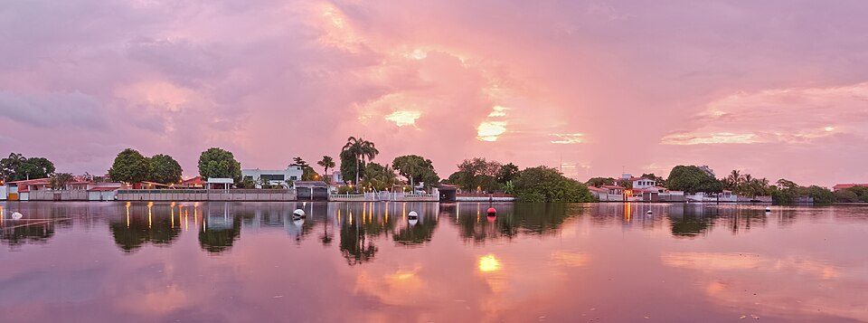
Higuerote, Venezuela: Submarine Cable Landing Point
Higuerote is a coastal city in the Barlovento region of Miranda state, Venezuela, serving as the capital of Brión Municipality. Situated along Venezuela's northern Caribbean coastline approximately an hour and a half from Caracas, Higuerote is home to one submarine cable landing. That cable, the Venezuelan Festoon, connects multiple points along Venezuela's own coastline, making Higuerote a node within a domestic intra-national submarine cable corridor.
As a single-cable landing point, Higuerote's submarine connectivity is oriented entirely toward the Venezuelan national network rather than toward intercontinental or broader regional links. The Venezuelan Festoon, commissioned in 1998, was among the earliest submarine cable deployments in the country and reflects an infrastructure approach that used undersea cable technology to link Venezuelan coastal communities with one another.
Cables Landing at Higuerote
The Venezuelan Festoon is the sole submarine cable landing at Higuerote. Spanning approximately 1,200 kilometres, the cable reached its ready-for-service date in 1998 and carries a draft designation reflecting its early operational status. All endpoints of the Venezuelan Festoon are located within Venezuela, meaning the cable functions as a domestic coastal festoon system linking multiple Venezuelan landing points rather than connecting Venezuela to other countries. Higuerote represents one stop along this national undersea route.
Regional Context
Within Venezuela's submarine cable infrastructure, which comprises five cables distributed across fifteen landing points, Higuerote sits alongside several other single-cable landing points including Cabimas, Camuri, Carúpano, Chichiriviche, and Coro. Punto Fijo is the most connected landing point in Venezuela with two cables, while Higuerote, like the majority of Venezuelan landing points, hosts a single cable. Higuerote's cable count places it within the top 93 percent of Venezuelan landing points by cable count, reflecting how evenly modest connectivity is distributed along the Venezuelan coastline.
Network Role
Higuerote functions as a single-cable terminus on the Venezuelan Festoon, a domestic coastal cable that forms part of Venezuela's intra-national undersea network. Rather than serving as a gateway to international connectivity, Higuerote's role is to extend the Venezuelan Festoon's reach along the northern coast, integrating the Barlovento coastal zone into the national cable system that was established beginning in 1998.
As one of several Venezuelan coastal cities sharing participation in this domestic festoon arrangement, Higuerote illustrates how submarine cable infrastructure in Venezuela has been used not only for intercontinental capacity but also to stitch together geographically dispersed points along a single national coastline. Its presence in the regional submarine cable graph anchors the eastern stretch of Venezuela's northern coastal cable network.
What next: Higuerote, Venezuela in the global directory of cable landing points; see surrounding routes on the interactive submarine cable map or follow live network monitoring.
Other Landing Points in Venezuela
Landing Point
- CountryVE Venezuela
- Coordinates10.4803°N 66.0981°W
- Connected Cables1
See Real Cable Routes
View actual submarine cable routing from Higuerote, Venezuela - with backbone nodes, distance calculations, and latency estimates
Open Calculator →