Greenbank, WA, United States
Landing Point · US United States
Connected Cables
| Cable | Status |
|---|---|
| Whidbey Island-Camano Island | Active |
Live Performance
RTT measurements to this landing point from 2026-05-31 through 2026-10-01 - live ICMP round-trip time via our monitoring probes. Recomputed daily. ✓ No anomalies detected in the monitored period.
Measurement sources
| Probe | Location | Samples | Avg |
|---|---|---|---|
| #7062 own probe | Cape Town ZA | 6 | 258.1 ms |
| own probe | Minsk BY | 6 | 136.3 ms |
| own probe | Moscow RU | 6 | 132.6 ms |
| #6487 | control probe | 5 | 230.6 ms |
| #7499 | control probe | 3 | 43.9 ms |
| #10486 | control probe | 3 | 71.6 ms |
| #55692 | control probe | 3 | 46.5 ms |
| own probe | Saint Petersburg RU | 2 | 135.1 ms |
| #6427 own probe | Sydney AU | 1 | 188.0 ms |
| own probe | Sevastopol UA | 1 | 186.4 ms |
| own probe | Odessa UA | 1 | 149.0 ms |
| own probe | Kyiv UA | 1 | 146.3 ms |
About Greenbank, WA, United States
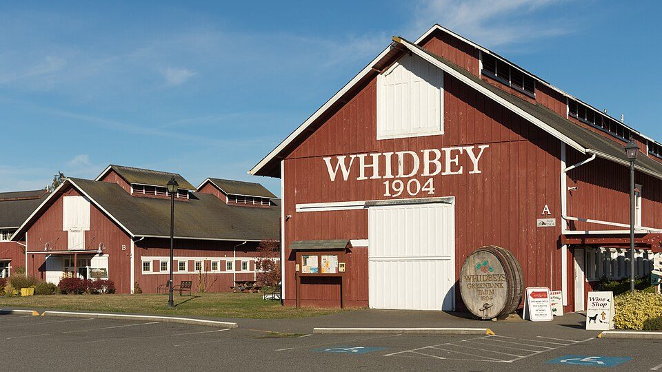
Greenbank, WA: Submarine Cable Landing Point
Greenbank is an unincorporated community situated on Whidbey Island in Island County, Washington State, on the Pacific coast of the United States. As a landing point, Greenbank hosts one submarine cable that connects it to another location also within the United States, making it a domestic inter-island link rather than an intercontinental or international gateway. The single cable landing here reflects the localized connectivity role that Greenbank plays within the broader submarine cable geography of Washington State and the surrounding Puget Sound region.
The United States as a whole supports a substantial submarine cable network, with 113 cables landing across 160 landing points nationwide. Within that landscape, Greenbank's single cable places it among the smaller landing points by cable count, though it ranks within the top 69% of all United States landing points, reflecting the large number of lightly served coastal localities that form part of the country's distributed coastal infrastructure.
Cables Landing at Greenbank, WA
The Whidbey Island-Camano Island cable is the sole submarine cable landing at Greenbank. Stretching approximately 4 kilometers, it is one of the shortest submarine cables in the United States network. The cable reached its ready-for-service date in 1999 and carries a draft status. Both endpoints of the cable are located within the United States, linking Whidbey Island - where Greenbank is situated - to Camano Island, a neighboring island in the same regional waterway system. The cable does not connect to any foreign country and serves an exclusively domestic, inter-island function.
Regional Context
Among the notable United States landing points, Greenbank stands apart from higher-volume hubs such as Boca Raton, FL, and San Juan, PR, each of which serves eight cables, or Hermosa Beach, CA, Kapolei, HI, Myrtle Beach, SC, and Grover Beach, CA, which each host four to five cables. Greenbank's single short-haul, domestic cable reflects a narrowly defined connectivity purpose rather than the multi-corridor role seen at those larger landing points.
Network Role
Greenbank functions as a terminus in a two-point, intra-national submarine link, enabling fixed connectivity between Whidbey Island and Camano Island across the short water crossing that separates them. With only one cable and no international connections, it operates as a single-cable terminus rather than a multi-cable hub. The 4-kilometer Whidbey Island-Camano Island cable represents the kind of short, purpose-built inter-island segment that fills geographic gaps in terrestrial network coverage where overland routes are impractical.
In the wider United States submarine cable graph, Greenbank illustrates how the country's 160 landing points span a broad range of scales - from high-capacity international hubs handling intercontinental traffic to compact domestic links serving island communities where underwater cable routes provide the most direct path between two points of land.
What next: Greenbank, WA, United States in the global directory of cable landing points; see surrounding routes on the interactive submarine cable map or follow live network monitoring.
Other Landing Points in United States
Landing Point
- CountryUS United States
- Coordinates48.0987°N 122.5737°W
- Connected Cables1
See Real Cable Routes
View actual submarine cable routing from Greenbank, WA, United States - with backbone nodes, distance calculations, and latency estimates
Open Calculator →