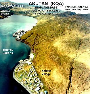
Akutan, AK, United States
Landing Point · US United States
Connected Cables
| Cable | Status |
|---|---|
| AU-Aleutian | Active |
📡 Live Performance
RTT measurements to this landing point from 2026-04-12 through 2026-07-11 - live ICMP round-trip time via our monitoring probes. Recomputed daily. ✓ No anomalies detected in the monitored period.
Measurement sources
| Probe | Location | Samples | Avg |
|---|---|---|---|
| #1014589 own probe | Almaty KZ | 2 | 252.8 ms |
| #6410 own probe | Sao Paulo BR | 1 | 215.7 ms |
| #7062 own probe | Cape Town ZA | 1 | 324.2 ms |
| #1014473 own probe | Minsk BY | 1 | 254.2 ms |
| #1014597 own probe | Tbilisi GE | 1 | 162.4 ms |
| #1014969 own probe | Jerusalem IL | 1 | 177.4 ms |
| #1015313 own probe | Sevastopol UA | 1 | 168.2 ms |
| #1015523 own probe | Moscow RU | 1 | 203.8 ms |
| #1015563 own probe | Saint Petersburg RU | 1 | 209.5 ms |
About Akutan, AK, United States
Akutan, AK: Submarine Cable Landing Point
Akutan is a city located on Akutan Island in the Aleutians East Borough of Alaska, United States. Situated in the Aleutian Islands chain, it represents one of the more remote submarine cable landing points within the United States, serving as an endpoint for undersea fiber infrastructure in the North Pacific. One submarine cable lands at Akutan, connecting it to the broader domestic network of submarine communications infrastructure across the country.
The single cable serving Akutan is the AU-Aleutian system, a domestically routed cable that links points within the United States along the Aleutian corridor. This makes Akutan a terminus in a regionally significant intra-national cable route, providing submarine connectivity to one of Alaska's island communities in the remote North Pacific.
Cables Landing at Akutan, AK
The AU-Aleutian cable is the sole submarine cable landing at Akutan. With a total length of 1,491 kilometers, the system received its ready-for-service (RFS) designation in 2022, currently carrying a draft status. All endpoints on the AU-Aleutian cable are located within the United States, making it a domestic submarine cable route. At 1,491 km, the AU-Aleutian is notably shorter than the United States average cable length of approximately 4,957 km, reflecting its role as a regional connector rather than a long-haul intercontinental system. The cable serves communities along the Aleutian Islands, of which Akutan is one anchor point.
Regional Context
Among submarine cable landing points in the United States, Akutan hosts one cable, placing it in the top 69% of the country's 160 active landing points by cable count. Major United States landing points such as Boca Raton, FL, and San Juan, PR each host eight cables, while Hermosa Beach, CA, Kapolei, HI, and Myrtle Beach, SC each serve five. Akutan's profile reflects its geography as a remote Alaskan island community, where even a single submarine cable represents a meaningful extension of the national undersea network into one of the country's most isolated regions.
Network Role
Akutan functions as a single-cable terminus within the domestic United States submarine cable network. The AU-Aleutian system connects Akutan to other American endpoints along the Aleutian island chain, enabling submarine fiber connectivity across a corridor that is otherwise difficult to serve through terrestrial means. As a 2022 RFS system, the AU-Aleutian represents relatively recent investment in Aleutian Islands connectivity.
Within the broader submarine cable graph of the United States — which spans 113 cables across 160 landing points — Akutan occupies a specialized position as a remote domestic endpoint. Its inclusion in the national submarine cable network illustrates how undersea systems serve not only intercontinental and major metropolitan routes, but also geographically isolated island communities that depend on marine cable corridors for connectivity.
What next: Akutan, AK, United States in the global directory of cable landing points; see surrounding routes on the interactive submarine cable map or follow live network monitoring.
Other Landing Points in United States
Landing Point
- CountryUS United States
- Coordinates54.1356°N 165.7731°W
- Connected Cables1
See Real Cable Routes
View actual submarine cable routing from Akutan, AK, United States - with backbone nodes, distance calculations, and latency estimates
Open Calculator →