Claveria, Philippines
Landing Point · PH Philippines
Connected Cables
| Cable | Status |
|---|---|
| TPU | Active |
Live Performance
RTT measurements to this landing point from 2026-03-05 through 2026-10-16 - live ICMP round-trip time via our monitoring probes. Recomputed daily. ✓ No anomalies detected in the monitored period.
Measurement sources
| Probe | Location | Samples | Avg |
|---|---|---|---|
| #16862 | control probe | 218 | 189.5 ms |
| own probe | Almaty KZ | 117 | 289.1 ms |
| #6410 own probe | Sao Paulo BR | 115 | 352.7 ms |
| #6487 | control probe | 113 | 35.4 ms |
| #6427 own probe | Sydney AU | 10 | 156.9 ms |
| own probe | Tbilisi GE | 9 | 294.6 ms |
| own probe | Minsk BY | 8 | 270.5 ms |
| own probe | Jerusalem IL | 6 | 312.1 ms |
| own probe | Moscow RU | 2 | 241.7 ms |
| #7052 | control probe | 1 | 187.6 ms |
| #7062 own probe | Cape Town ZA | 1 | 320.4 ms |
| #1011592 | control probe | 1 | 64.1 ms |
| own probe | Sevastopol UA | 1 | 271.1 ms |
| #1015467 | control probe | 1 | 64.9 ms |
| #1016859 | control probe | 1 | 63.1 ms |
About Claveria, Philippines
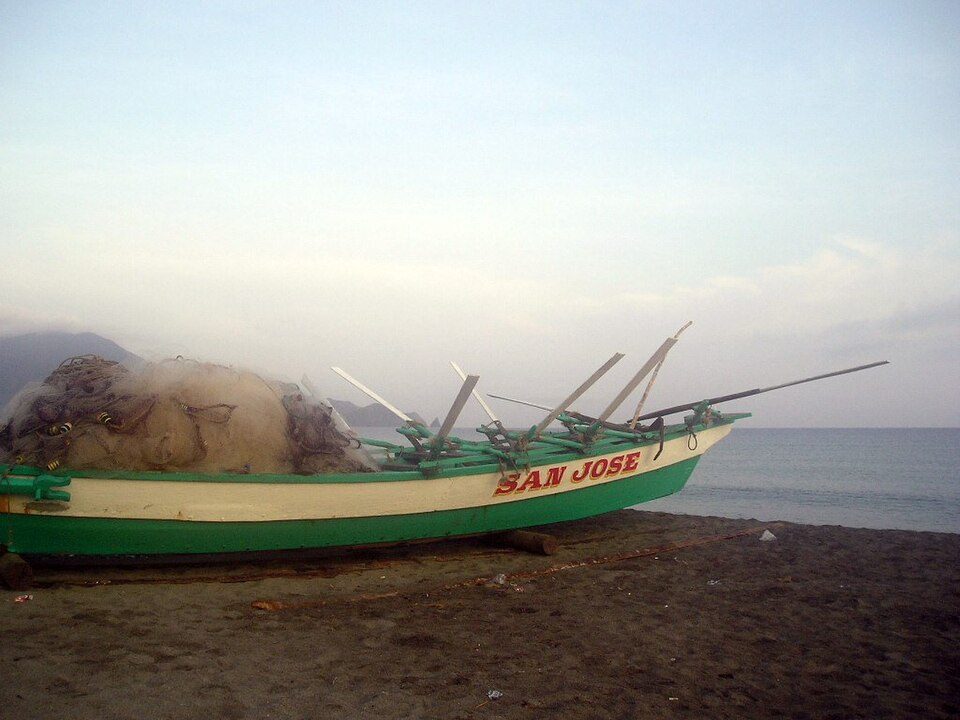
Claveria, Philippines: Submarine Cable Landing Point
Claveria is a municipality in the province of Cagayan, located in the northern Philippines. Its position along the Philippine coastline places it on a transpacific corridor, connecting the Philippines to destinations across the Pacific Ocean. One submarine cable lands at Claveria, linking the municipality directly to Guam, the Northern Mariana Islands, Taiwan, and the United States.
The single cable landing here, TPU, establishes Claveria as a transpacific landing point, enabling connectivity between the Philippines and key Pacific island territories as well as the continental United States. This corridor spans both island-hopping segments across the western Pacific and a longer intercontinental reach toward North America.
Cables Landing at Claveria
TPU is a submarine cable system stretching 13,470 km, with a ready-for-service date scheduled for 2026, currently in draft status. In addition to Claveria in the Philippines, TPU connects to landing points in Guam, the Northern Mariana Islands, Taiwan, and the United States. This makes TPU a transpacific system linking Southeast Asia and East Asia to the broader Pacific island network and, ultimately, to the US mainland.
Regional Context
Among submarine cable landing points in the Philippines, Claveria currently hosts one cable, placing it among the smaller landing points in the country compared to hubs such as Batangas, which serves four cables, or multi-cable sites like Cagayan de Oro, Davao, Dumaguete, Nasugbu, and Pinamalayan, each of which hosts three cables. Claveria's distinction lies in its northern geographic position and its direct connection to the transpacific TPU system, which differs in corridor scope from many of the cables serving the other Philippine landing points.
Network Role
Claveria functions as a single-cable terminus in the Philippine submarine cable network. Through the TPU system, it provides a direct transpacific link from the northern Philippines to Guam, the Northern Mariana Islands, Taiwan, and the United States - a corridor that spans thousands of kilometers across the Pacific. This positions Claveria not as a regional hub with multiple diverse connections, but as a focused transpacific gateway anchored at the northern tip of the Philippine archipelago.
As TPU moves toward its 2026 ready-for-service date, Claveria will add a new transpacific entry point to the Philippine cable map, complementing the more densely connected landing sites found elsewhere in the country. Its inclusion in the transpacific TPU system makes Claveria a geographically distinct node within the broader Philippine segment of the Pacific submarine cable graph.
What next: Claveria, Philippines in the global directory of cable landing points; see surrounding routes on the interactive submarine cable map or follow live network monitoring.
Other Landing Points in Philippines
Landing Point
- CountryPH Philippines
- Coordinates18.6062°N 121.0824°E
- Connected Cables1
See Real Cable Routes
View actual submarine cable routing from Claveria, Philippines - with backbone nodes, distance calculations, and latency estimates
Open Calculator →