Benghazi, Libya
Landing Point · LY Libya
Connected Cables
| Cable | Status |
|---|---|
| LFON (Libyan Fiber Optic Network) | Active |
| Medusa Submarine Cable System | Active |
Live Performance
RTT measurements to this landing point from 2026-03-01 through 2026-10-05 - live ICMP round-trip time via our monitoring probes. Recomputed daily. ✓ No anomalies detected in the monitored period.
Measurement sources
| Probe | Location | Samples | Avg |
|---|---|---|---|
| own probe | Minsk BY | 10 | 230.4 ms |
| own probe | Almaty KZ | 10 | 169.0 ms |
| own probe | Tbilisi GE | 10 | 151.5 ms |
| own probe | Jerusalem IL | 8 | 141.7 ms |
| own probe | Balancer IL | 5 | 143.0 ms |
| #6410 own probe | Sao Paulo BR | 4 | 122.4 ms |
| #6427 own probe | Sydney AU | 4 | 202.4 ms |
| own probe | Sevastopol UA | 4 | 283.9 ms |
| own probe | Odessa UA | 4 | 126.5 ms |
| own probe | Moscow RU | 2 | 179.3 ms |
| own probe | DVM IL | 1 | 135.3 ms |
About Benghazi, Libya
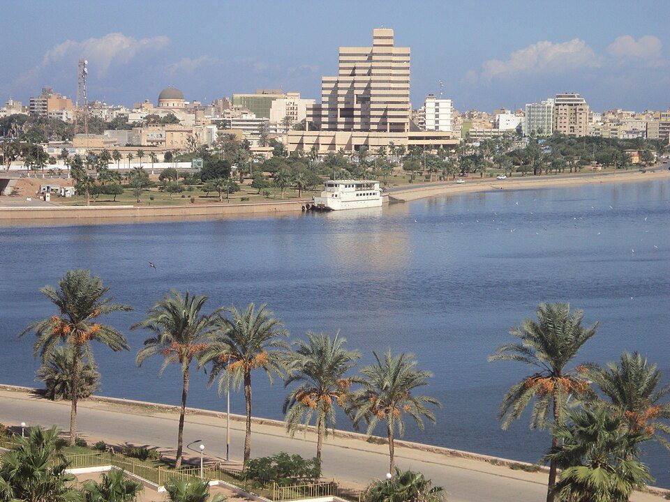
Benghazi, Libya: Submarine Cable Landing Point
Benghazi is located on the Gulf of Sidra along Libya's Mediterranean coastline, and serves as a submarine cable landing point for two undersea systems. As Libya's second-most-populous city and a major seaport, Benghazi provides a natural anchor for subsea infrastructure connecting the country to the broader Mediterranean and European telecommunications network. The two cables landing here position Benghazi as one of Libya's more significant cable endpoints by volume, sitting within a small group of landing points in the country that host two or more systems.
The most notable of Benghazi's two cables is the Medusa Submarine Cable System, a long-haul system that links Libya to multiple countries across the Mediterranean Basin, including Algeria, Cyprus, Egypt, France, Greece, and Italy. Alongside it, the LFON (Libyan Fiber Optic Network) connects Benghazi to other landing points within Libya itself, serving a domestic routing function along the Libyan coastline.
Cables Landing at Benghazi
Medusa Submarine Cable System is an 8,760 km system with a published ready-for-service date of 2026. In addition to Benghazi, it connects Algeria, Cyprus, Egypt, France, Greece, and Italy, forming a broad Mediterranean corridor that links North African shores to Southern and Western Europe as well as the Eastern Mediterranean. Benghazi represents one of its African landing points alongside Algeria and Egypt.
LFON (Libyan Fiber Optic Network) is a 1,639 km system with a ready-for-service date of 1999, making it one of the earliest submarine cable deployments in Libya. Its endpoints are entirely within Libya, functioning as a domestic coastal cable that interconnects landing points along the Libyan littoral rather than reaching beyond national borders. Benghazi is one of the Libyan cities served by this intra-national system.
Regional Context
Among Libya's 14 submarine cable landing points, Benghazi's two cables place it in the upper tier of the country's cable infrastructure, ranking alongside Derna, Misuratah, and Tobruk, which also each host two cables. Tripoli stands apart as the leading Libyan landing point with three cables, while Al Bayda and Al Khums each host a single cable. Benghazi's position reflects its standing as a significant coastal city within Libya's broader submarine cable geography.
Network Role
Benghazi functions as a dual-purpose landing point: the LFON cable ties it into Libya's domestic coastal network, while the Medusa Submarine Cable System - once ready for service in 2026 - will extend its connectivity across the Mediterranean to Algeria, Cyprus, Egypt, France, Greece, and Italy. This combination means Benghazi handles both intra-national traffic routing and intercontinental Mediterranean connectivity from a single landing location, rather than serving purely as a terminus for one type of system.
Within Libya's submarine cable graph, Benghazi is one of a small number of landing points that participates in both domestic and international cable systems. Its inclusion in the Medusa system alongside major Mediterranean economies and its longstanding connection through LFON to other Libyan cities make it a geographically and functionally distinct node on Libya's eastern Mediterranean coast.
What next: Benghazi, Libya in the global directory of cable landing points; see surrounding routes on the interactive submarine cable map or follow live network monitoring.
Incident history
Significant incidents on cables landing here, each with its own report.
- Medusa Submarine Cable System: latency up to 3.1× normal, 11 Oct 2026 (resolved)
- Medusa Submarine Cable System: latency up to 5.1× normal, 11 Oct 2026 (resolved)
Other Landing Points in Libya
FAQ
Landing Point
- CountryLY Libya
- Coordinates32.1166°N 20.0668°E
- Connected Cables2
See Real Cable Routes
View actual submarine cable routing from Benghazi, Libya - with backbone nodes, distance calculations, and latency estimates
Open Calculator →