Toweli, Indonesia
Landing Point · ID Indonesia
1
Connected Cables
ID
Country
1.14°
Latitude
119.39°
Longitude
Ctrl + Scroll to zoom
Connected Cables
| Cable | Status |
|---|---|
| JaKa2LaDeMa | Active |
Live Performance
53
measurements
12
probes
155
days monitored
194.3
ms avg RTT
0
anomalies
RTT measurements to this landing point from 2026-04-24 through 2026-09-26 - live ICMP round-trip time via our monitoring probes. Recomputed daily. ✓ No anomalies detected in the monitored period.
Measurement sources
| Probe | Location | Samples | Avg |
|---|---|---|---|
| own probe | Almaty KZ | 9 | 237.9 ms |
| #6410 own probe | Sao Paulo BR | 7 | 324.0 ms |
| #6427 own probe | Sydney AU | 7 | 164.5 ms |
| #7062 own probe | Cape Town ZA | 7 | 272.7 ms |
| #50462 | control probe | 5 | 25.2 ms |
| #6487 | control probe | 4 | 14.1 ms |
| own probe | Tbilisi GE | 4 | 263.1 ms |
| #7108 | control probe | 3 | 22.6 ms |
| own probe | Jerusalem IL | 2 | 225.2 ms |
| own probe | Sevastopol UA | 2 | 228.6 ms |
| own probe | Moscow RU | 2 | 205.4 ms |
| own probe | Minsk BY | 1 | 206.4 ms |
About Toweli, Indonesia
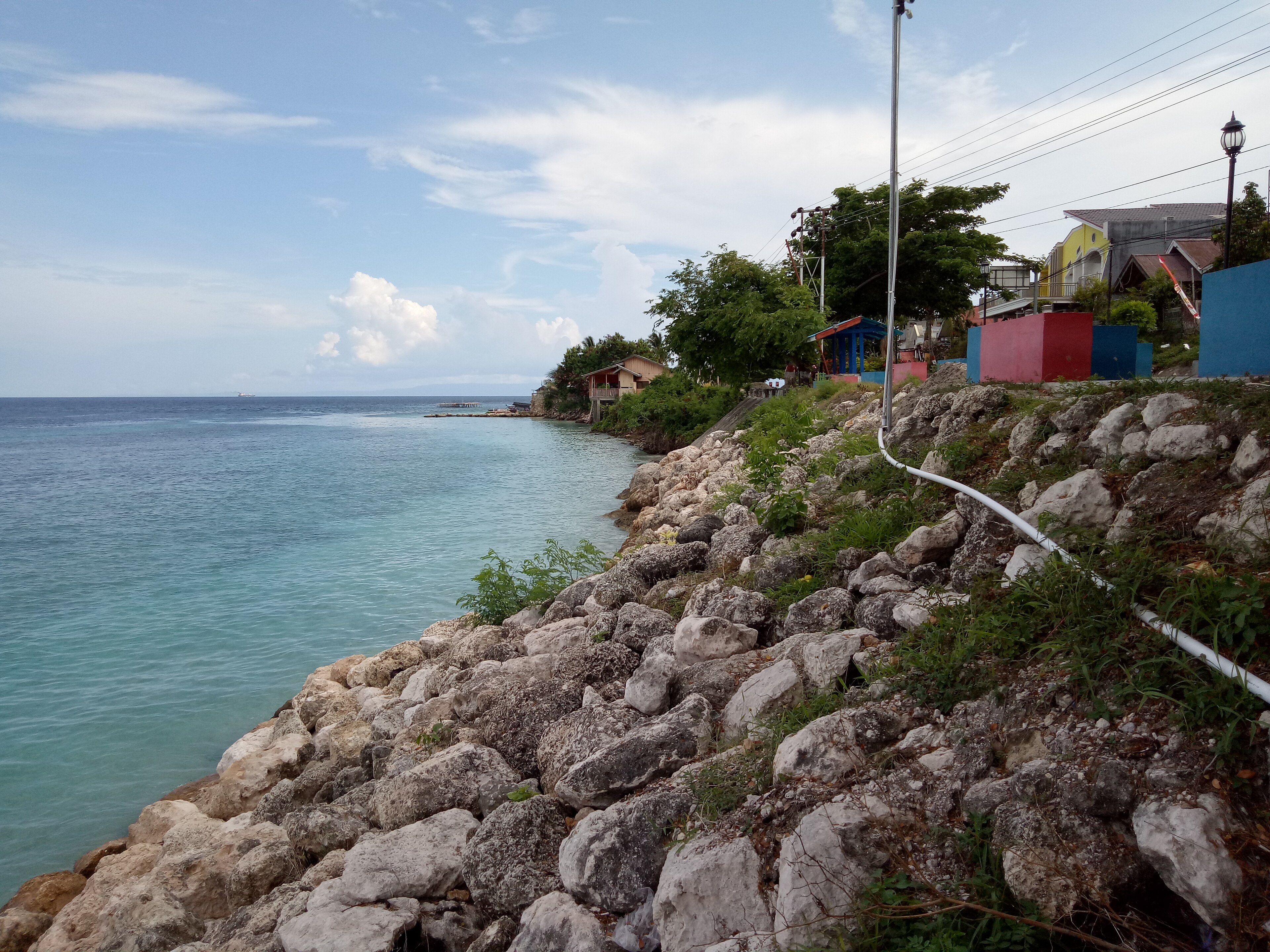
Toweli, Indonesia: A Quiet Link in a Vast Network
Toweli, a small landing point in Indonesia, is home to a single submarine cable: the JaKa2LaDeMa. While it may not boast the high connectivity of Indonesia’s major hubs like Batam (20 cables) or Jakarta (10 cables), Toweli plays a modest but steady role in the nation's intricate web of submarine cable infrastructure. The JaKa2LaDeMa cable, which became operational in 2010, connects Toweli to nine other landing points across Indonesia, stitching together regions that rely on robust domestic connectivity.The JaKa2LaDeMa Cable: Connecting Indonesia’s Islands
Spanning 1700 kilometers, the JaKa2LaDeMa cable is a domestic route that links Toweli with other Indonesian landing points, including Banjarmasin, Denpasar, Pontianak, and Mataram. This cable does not extend internationally, focusing instead on inter-island communication within Indonesia’s vast archipelago. Toweli’s position in this network ensures that even smaller or less prominent locations remain connected to larger regional centers. Toweli’s neighbors on the cable include more populous and economically active areas, such as Denpasar in Bali and Pontianak in West Kalimantan. These connections make it possible for Toweli to benefit from the shared infrastructure, even though it hosts only one cable. This interdependence highlights how Indonesia's submarine cable system supports both major hubs and smaller landing points alike.Latency and Performance: A Reliable Connection
GeoCables’ latency measurements reveal an average round-trip latency of 233 milliseconds for Toweli, with the best observed latency at 205 milliseconds. These figures reflect the cable’s efficiency in maintaining steady communication across its network. While Toweli may not be a hub for international traffic, its domestic connectivity is reliable, ensuring smooth data transmission for local needs.Positioning Toweli in Indonesia’s Cable Landscape
Indonesia is home to 70 submarine cables landing at 139 points, with an average cable length of 2797 kilometers. Toweli’s single cable places it within the top 62% of landing points by cable count, underscoring its role as a smaller but functional component of the national infrastructure. In contrast, major hubs like Batam and Jakarta dominate the landscape with multiple cables, serving as gateways for international connectivity and regional traffic. Toweli’s role is different-it is a domestic connector, linking islands and regions without directly engaging in global communication. This makes it a quieter but no less essential part of Indonesia’s efforts to connect its vast archipelago.Conclusion
Toweli may not stand out as a major landing point, but its connection through the JaKa2LaDeMa cable ensures that it remains integrated into Indonesia’s broader network. As part of a chain linking nine other points, Toweli exemplifies how submarine cables bring even smaller or remote locations into the fold of modern connectivity. Reliable latency performance further underscores the cable’s role in supporting local communication needs, making Toweli a steady link in Indonesia’s sprawling cable system.What next: Toweli, Indonesia in the global directory of cable landing points; see surrounding routes on the interactive submarine cable map or follow live network monitoring.
Other Landing Points in Indonesia
ID Aeng Batu Batu, Indonesia
5.3433°S 119.3846°E
ID Agats, Indonesia
5.5356°S 138.1214°E
ID Alor, Indonesia
8.3207°S 124.4038°E
ID Ambon, Indonesia
3.6554°S 128.1907°E
ID Ancol, Indonesia
6.1290°S 106.8334°E
ID Anyer, Indonesia
6.0737°S 105.8839°E
ID Baa, Indonesia
10.7333°S 123.0353°E
ID Bali, Indonesia
8.4101°S 115.6924°E
ID Balikpapan, Indonesia
1.2654°S 116.8312°E
ID Bandaneria, Indonesia
4.5202°S 129.8721°E
ID Bandar Lampung, Indonesia
5.4092°S 105.2541°E
ID Bangga, Indonesia
1.6003°S 123.5275°E
Landing Point
- CountryID Indonesia
- Coordinates1.1425°S 119.3884°E
- Connected Cables1
See Real Cable Routes
View actual submarine cable routing from Toweli, Indonesia - with backbone nodes, distance calculations, and latency estimates
Open Calculator →
Submarine cables
Land fiber
Live probes