Teluk, Indonesia
Landing Point · ID Indonesia
1
Connected Cables
ID
Country
2.20°
Latitude
133.48°
Longitude
Ctrl + Scroll to zoom
Connected Cables
| Cable | Status |
|---|---|
| Palapa Ring East | Active |
Live Performance
38
measurements
6
probes
75
days monitored
262.0
ms avg RTT
0
anomalies
RTT measurements to this landing point from 2026-07-14 through 2026-09-28 - live ICMP round-trip time via our monitoring probes. Recomputed daily. ✓ No anomalies detected in the monitored period.
Measurement sources
| Probe | Location | Samples | Avg |
|---|---|---|---|
| #6410 own probe | Sao Paulo BR | 8 | 376.6 ms |
| #7062 own probe | Cape Town ZA | 8 | 314.2 ms |
| #6427 own probe | Sydney AU | 7 | 194.1 ms |
| own probe | Almaty KZ | 7 | 272.4 ms |
| #6487 | control probe | 4 | 33.6 ms |
| own probe | Tbilisi GE | 4 | 257.6 ms |
About Teluk, Indonesia
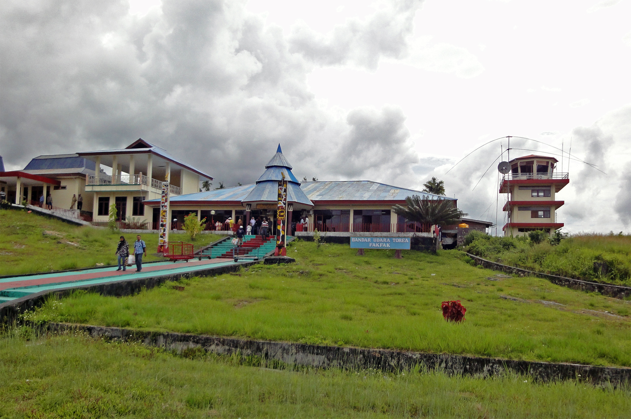
Teluk, Indonesia: A Gateway in the Palapa Ring East Network
Teluk, Indonesia, is a small but significant point in the country's vast submarine cable network. Located on the eastern side of the archipelago, Teluk serves as one of the landing points for the Palapa Ring East cable, a 6300-kilometer domestic system that became operational in 2019. While it hosts just one cable, Teluk plays a key role in connecting remote parts of Indonesia to the broader national infrastructure.The Palapa Ring East: Stitching Together Remote Islands
The Palapa Ring East cable is part of Indonesia's ambitious initiative to improve connectivity across its sprawling archipelago, which consists of over 17,000 islands. This cable links Teluk to 17 other landing points, including Agats, Timika, and Tual, creating a chain that ensures even the most isolated communities have access to reliable telecommunications. Unlike major hubs such as Batam (20 cables) or Jakarta (10 cables), Teluk is a quieter node in the network, but its presence is essential for maintaining connectivity in eastern Indonesia.Connectivity and Latency: GeoCables Insights
GeoCables has conducted 15 latency tests to Teluk from six different cities, revealing an average round-trip latency of 245 milliseconds, with the best observed latency being 48 milliseconds. These numbers highlight the efficiency of the Palapa Ring East cable in bridging distances across Indonesia's challenging geography. While Teluk may not boast the low latencies of major hubs, its performance is robust enough to support local needs.Regional Context: A Modest Landing Point in a Vast Network
Indonesia is home to 70 submarine cables landing at 139 points, making it one of the most interconnected nations in Southeast Asia. Teluk ranks in the top 62% of landing points by cable count, hosting just one cable compared to the bustling hubs of Batam, Jakarta, and Makassar. However, its role within the Palapa Ring East cable chain ensures that it remains an important link for eastern Indonesia.Why Teluk Matters
Teluk's significance lies in its role as a connecting point for underserved regions. The Palapa Ring East cable does not extend internationally; instead, it focuses on domestic connectivity, ensuring that Indonesia's eastern islands are not left behind in the digital age. For Teluk, this means being part of a network that supports local communities, industries, and services, enabling them to participate in the broader national economy.Conclusion
While Teluk may not rival Indonesia's major cable hubs, its inclusion in the Palapa Ring East network underscores the country's commitment to bridging digital divides. As one link in a chain that stitches together remote islands, Teluk exemplifies how submarine cables can transform connectivity for even the most isolated communities.What next: Teluk, Indonesia in the global directory of cable landing points; see surrounding routes on the interactive submarine cable map or follow live network monitoring.
Other Landing Points in Indonesia
ID Aeng Batu Batu, Indonesia
5.3433°S 119.3846°E
ID Agats, Indonesia
5.5356°S 138.1214°E
ID Alor, Indonesia
8.3207°S 124.4038°E
ID Ambon, Indonesia
3.6554°S 128.1907°E
ID Ancol, Indonesia
6.1290°S 106.8334°E
ID Anyer, Indonesia
6.0737°S 105.8839°E
ID Baa, Indonesia
10.7333°S 123.0353°E
ID Bali, Indonesia
8.4101°S 115.6924°E
ID Balikpapan, Indonesia
1.2654°S 116.8312°E
ID Bandaneria, Indonesia
4.5202°S 129.8721°E
ID Bandar Lampung, Indonesia
5.4092°S 105.2541°E
ID Bangga, Indonesia
1.6003°S 123.5275°E
Landing Point
- CountryID Indonesia
- Coordinates2.2024°S 133.4821°E
- Connected Cables1
See Real Cable Routes
View actual submarine cable routing from Teluk, Indonesia - with backbone nodes, distance calculations, and latency estimates
Open Calculator →
Submarine cables
Land fiber
Live probes