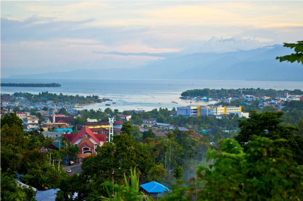
Sorong, Indonesia
Landing Point · ID Indonesia
Connected Cables
| Cable | Status |
|---|---|
| SMPCS Packet-1 | Active |
| SMPCS Packet-2 | Active |
📡 Live Performance
RTT measurements to this landing point from 2026-04-07 through 2026-06-21 - live ICMP round-trip time via our monitoring probes. Recomputed daily. ✓ No anomalies detected in the monitored period.
Measurement sources
| Probe | Location | Samples | Avg |
|---|---|---|---|
| #1014473 own probe | Minsk BY | 5 | 228.2 ms |
| #1014597 own probe | Tbilisi GE | 5 | 269.9 ms |
| #1014969 own probe | Jerusalem IL | 5 | 239.4 ms |
| #1014589 own probe | Almaty KZ | 4 | 257.3 ms |
| #1015313 own probe | Sevastopol UA | 2 | 230.3 ms |
| #1015523 own probe | Moscow RU | 2 | 206.8 ms |
| #6410 own probe | Sao Paulo BR | 1 | 339.2 ms |
| #6427 own probe | Sydney AU | 1 | 107.4 ms |
| #6487 own probe | Singapore SG | 1 | 18.2 ms |
| #7062 own probe | Cape Town ZA | 1 | 329.2 ms |
About Sorong, Indonesia
Sorong, Indonesia is a submarine cable landing point in Indonesia (coordinates -0.8821°, 131.2954°). It serves 2 submarine cable systems, making it a multi-cable landing site in Indonesia's international connectivity infrastructure.
Sorong is the largest city and the capital of the Indonesian province of Southwest Papua. The city is located on the western tip of the island of New Guinea with its only land borders being with Sorong Regency. It is the gateway to Indonesia's Raja Ampat Islands, species rich coral reef islands in an area considered the heart of the world's coral reef biodiversity. It also is the logistics hub for Indonesia's thriving eastern oil and gas frontier. Sorong experienced rapid growth during the decade from 2010, and further growth is anticipated as Sorong becomes linked by road to other frontier towns in Papua's Bird's Head Peninsula. The official estimate of population as of mid 2024 was 286,028 - comprising 150,236 males and 135,729 females. The suburban area of Sorong city contains tropical rainforest and mangrove forest that has increasingly become popular as ecotourism attractions especially for birdwatching or wildlife watching. Wikipedia
Connected submarine cables
| Cable | RFS | Length | Owners |
|---|---|---|---|
| SMPCS Packet-1 | 2015 | 3,156 km | Telkom Indonesia |
| SMPCS Packet-2 | 2015 | 3,498 km | Telkom Indonesia |
Operators landing at Sorong, Indonesia
Cables landing at Sorong, Indonesia are operated by 1 distinct consortium partners and carriers, including Telkom Indonesia. Each cable is typically jointly owned by a consortium of tier-one carriers and hyperscale operators who share construction costs and capacity; the operator mix reflects both regional incumbents and global players with interest in the routes served by this landing point.
Connectivity profile
From Sorong, Indonesia, international traffic can reach 1 countries through 2 cable systems. Destinations include Indonesia.
Monitoring status
No monitoring incidents were recorded on cables serving Sorong, Indonesia in the past 90 days — all connected systems remained within normal latency thresholds. Our monitoring network continuously samples latency from external probes to targets reachable via these cables.
About the cables
- SMPCS Packet-1 (2015) — SMPCS Packet-1 is a domestic submarine cable network within Indonesia, connecting 12 coastal and island locations including Ambon, Bandaneria, Fakfak, Kendari, Labuha, and 7 more. The system provides essential telecommunications infrastructure for communities that would otherwise depend entirely on satellite or microwave links. Read more →
- SMPCS Packet-2 (2015) — SMPCS Packet-2 is a domestic submarine cable network within Indonesia, connecting 11 coastal and island locations including Biak, Fakfak, Jayapura, Kaimana, Manokwari, and 6 more. The system provides essential telecommunications infrastructure for communities that would otherwise depend entirely on satellite or microwave links. Read more →
Other Landing Points in Indonesia
Landing Point
- CountryID Indonesia
- Coordinates0.8821°S 131.2954°E
- Connected Cables2
See Real Cable Routes
View actual submarine cable routing from Sorong, Indonesia - with backbone nodes, distance calculations, and latency estimates
Open Calculator →