São Paulo de Olivença, Brazil
Landing Point · BR Brazil
Connected Cables
| Cable | Status |
|---|---|
| Norte Conectado (Infovia 02) | Active |
Live Performance
RTT measurements to this landing point from 2026-04-21 through 2026-09-06 - live ICMP round-trip time via our monitoring probes. Recomputed daily. ✓ No anomalies detected in the monitored period.
Measurement sources
| Probe | Location | Samples | Avg |
|---|---|---|---|
| #1014473 own probe | Minsk BY | 4 | 274.5 ms |
| #6410 own probe | Sao Paulo BR | 3 | 16.0 ms |
| #7062 own probe | Cape Town ZA | 3 | 361.2 ms |
| #1014589 own probe | Almaty KZ | 3 | 314.4 ms |
| #6427 own probe | Sydney AU | 2 | 407.3 ms |
| #65263 | control probe | 2 | 119.3 ms |
| #6487 | control probe | 1 | 359.2 ms |
| #1014597 own probe | Tbilisi GE | 1 | 279.7 ms |
| #1014969 own probe | Jerusalem IL | 1 | 289.2 ms |
| #1015313 own probe | Sevastopol UA | 1 | 314.2 ms |
| #1015523 own probe | Moscow RU | 1 | 264.2 ms |
| #1015893 own probe | Rostov RU | 1 | 307.4 ms |
About São Paulo de Olivença, Brazil
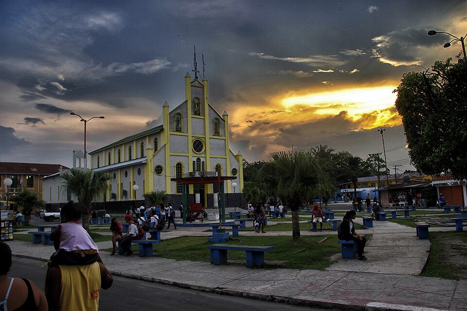
São Paulo de Olivença, Brazil: Submarine Cable Landing Point
São Paulo de Olivença is a municipality in the western reaches of the state of Amazonas, Brazil, situated near the tri-country border area. Despite its inland Amazonian setting, it functions as a submarine cable landing point, connected to Brazil's broader riverine and terrestrial cable infrastructure. One submarine cable lands here, making São Paulo de Olivença part of a network of 64 landing points distributed across Brazil.
The single cable landing at São Paulo de Olivença is Norte Conectado (Infovia 02), a domestic Brazilian cable that links multiple points within Brazil. This positions São Paulo de Olivença as a node in a national connectivity corridor rather than an international or intercontinental one. Its role is to extend submarine cable reach into the Amazonian interior, connecting a region that sits far from the country's major coastal hubs.
Cables Landing at São Paulo de Olivença
Norte Conectado (Infovia 02) is a 1,796 km submarine cable with a ready-for-service date of 2026, currently in draft status. All endpoints on this cable are located within Brazil, making it a purely domestic system. The cable is designed to bring improved connectivity to communities along Brazil's Amazonian river network, and São Paulo de Olivença is one of its landing points along this inland route.
Regional Context
Within Brazil's submarine cable landscape, São Paulo de Olivença hosts one cable, placing it among the smaller landing points in the country. Brazil's largest hubs - Fortaleza with 10 cables and Rio de Janeiro with 8 - are major international gateways, while São Paulo de Olivença serves a more localised, domestic purpose. It shares a comparable scale with other single-cable or dual-cable landing points scattered across the country's extensive geography, though its Amazonian interior position distinguishes it from most coastal peers.
Network Role
São Paulo de Olivença functions as a single-cable terminus on the Norte Conectado (Infovia 02) system, contributing to domestic connectivity within Brazil rather than linking the country to international networks. Its participation in a 1,796 km domestic cable reflects an effort to extend submarine cable infrastructure deep into the Amazon basin, reaching municipalities that lie far from Brazil's Atlantic coast where the majority of the country's international cable infrastructure is concentrated.
In the broader Brazilian submarine cable graph, São Paulo de Olivença represents the inland reach of a network that is otherwise heavily oriented toward coastal and international routes, demonstrating that submarine cable systems in Brazil extend well beyond the ocean's edge and into major river systems.
What next: São Paulo de Olivença, Brazil in the global directory of cable landing points; see surrounding routes on the interactive submarine cable map or follow live network monitoring.
Other Landing Points in Brazil
Landing Point
- CountryBR Brazil
- Coordinates3.4655°S 68.9525°W
- Connected Cables1
See Real Cable Routes
View actual submarine cable routing from São Paulo de Olivença, Brazil - with backbone nodes, distance calculations, and latency estimates
Open Calculator →