Serwaru, Indonesia
Landing Point · ID Indonesia
1
Connected Cables
ID
Country
8.16°
Latitude
127.69°
Longitude
Ctrl + Scroll to zoom
Connected Cables
| Cable | Status |
|---|---|
| Palapa Ring East | Active |
Live Performance
42
measurements
9
probes
98
days monitored
172.8
ms avg RTT
0
anomalies
RTT measurements to this landing point from 2026-06-17 through 2026-09-24 - live ICMP round-trip time via our monitoring probes. Recomputed daily. ✓ No anomalies detected in the monitored period.
Measurement sources
| Probe | Location | Samples | Avg |
|---|---|---|---|
| #6410 own probe | Sao Paulo BR | 6 | 372.3 ms |
| #6427 own probe | Sydney AU | 6 | 146.5 ms |
| own probe | Minsk BY | 6 | 236.9 ms |
| own probe | Almaty KZ | 6 | 265.0 ms |
| #6487 | control probe | 5 | 25.4 ms |
| #26109 | control probe | 4 | 51.3 ms |
| #51835 | control probe | 4 | 61.8 ms |
| #62242 | control probe | 4 | 52.4 ms |
| own probe | Tbilisi GE | 1 | 342.8 ms |
About Serwaru, Indonesia
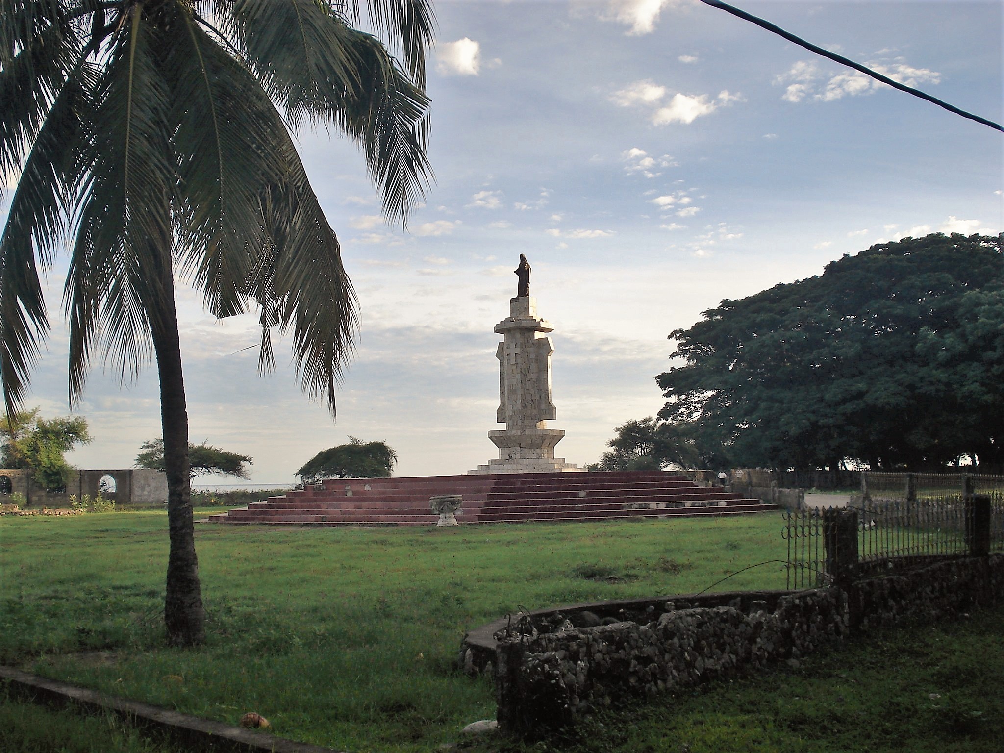
Serwaru, Indonesia: A Remote Link in the Palapa Ring East Chain
Serwaru, a small landing point in Indonesia, plays a quiet but important role in the country's connectivity landscape. Unlike major hubs such as Batam (20 cables) or Jakarta (10 cables), Serwaru hosts just one submarine cable: the Palapa Ring East. This cable, spanning an impressive 6,300 km, is part of a larger domestic network designed to connect Indonesia's far-flung islands. It became operational in 2019 and exclusively serves Indonesian locations, linking Serwaru to 17 other landing points, including Agats, Tual, and Timika.A Link in the Chain of Connectivity
The Palapa Ring East is not an international cable-it does not connect Serwaru directly to other countries. Instead, it is part of a domestic chain that stitches together Indonesia's eastern islands, many of which are remote and sparsely populated. This cable ensures that even isolated areas like Serwaru can access the national network, which in turn connects to larger hubs like Jakarta or Batam for international traffic. For Serwaru, this means reliable access to communications, data transfer, and digital services that might otherwise be out of reach.Latency Insights: A Unique Perspective
GeoCables' own latency measurements reveal intriguing details about Serwaru's connectivity. Across 11 tests from various source cities, the average round-trip latency to Serwaru was 225 milliseconds, with the best observed latency being just 19 milliseconds. These numbers demonstrate that while Serwaru may be geographically remote, the infrastructure here provides relatively efficient communication within the Palapa Ring East network.Positioning Serwaru Among Regional Peers
Serwaru's single cable places it in the top 62% of Indonesia's 143 submarine cable landing points by cable count. However, it is dwarfed by regional peers like Batam, Jakarta, and Makassar, which host multiple cables and serve as major connectivity hubs. What sets Serwaru apart is its role as a link in the Palapa Ring East-a chain specifically designed to connect Indonesia's eastern islands, many of which lack the dense cable infrastructure seen in urban centers.The Importance of Domestic Connectivity
Indonesia's geography, with over 17,000 islands, presents unique challenges for digital connectivity. Serwaru exemplifies how domestic cables like the Palapa Ring East are addressing these challenges, ensuring that even remote locations are part of the national network. While Serwaru is not a hub of international traffic, its inclusion in the Palapa Ring East chain highlights the country's commitment to bridging the digital divide across its vast archipelago.What next: Serwaru, Indonesia in the global directory of cable landing points; see surrounding routes on the interactive submarine cable map or follow live network monitoring.
Other Landing Points in Indonesia
ID Aeng Batu Batu, Indonesia
5.3433°S 119.3846°E
ID Agats, Indonesia
5.5356°S 138.1214°E
ID Alor, Indonesia
8.3207°S 124.4038°E
ID Ambon, Indonesia
3.6554°S 128.1907°E
ID Ancol, Indonesia
6.1290°S 106.8334°E
ID Anyer, Indonesia
6.0737°S 105.8839°E
ID Baa, Indonesia
10.7333°S 123.0353°E
ID Bali, Indonesia
8.4101°S 115.6924°E
ID Balikpapan, Indonesia
1.2654°S 116.8312°E
ID Bandaneria, Indonesia
4.5202°S 129.8721°E
ID Bandar Lampung, Indonesia
5.4092°S 105.2541°E
ID Bangga, Indonesia
1.6003°S 123.5275°E
Landing Point
- CountryID Indonesia
- Coordinates8.1581°S 127.6915°E
- Connected Cables1
See Real Cable Routes
View actual submarine cable routing from Serwaru, Indonesia - with backbone nodes, distance calculations, and latency estimates
Open Calculator →
Submarine cables
Land fiber
Live probes