Sao Pedro, Cape Verde
Landing Point · CV Cape Verde
Connected Cables
| Cable | Status |
|---|---|
| Cabo Verde Telecom Domestic Submarine Cable Phase 1 | Active |
| Cabo Verde Telecom Domestic Submarine Cable Phase 2 | Active |
| Cabo Verde Telecom Domestic Submarine Cable Phase 3 | Active |
Live Performance
RTT measurements to this landing point from 2026-07-04 through 2026-09-01 - live ICMP round-trip time via our monitoring probes. Recomputed daily. ✓ No anomalies detected in the monitored period.
Measurement sources
| Probe | Location | Samples | Avg |
|---|---|---|---|
| #6410 own probe | Sao Paulo BR | 7 | 255.6 ms |
| #6427 own probe | Sydney AU | 7 | 290.5 ms |
| own probe | Minsk BY | 7 | 173.2 ms |
| own probe | Odessa UA | 7 | 108.1 ms |
| #6487 | control probe | 5 | 199.1 ms |
| #60962 | control probe | 5 | 3.3 ms |
| #61506 | control probe | 5 | 3.7 ms |
| own probe | Almaty KZ | 2 | 159.7 ms |
| own probe | Kyiv UA | 1 | 97.7 ms |
About Sao Pedro, Cape Verde
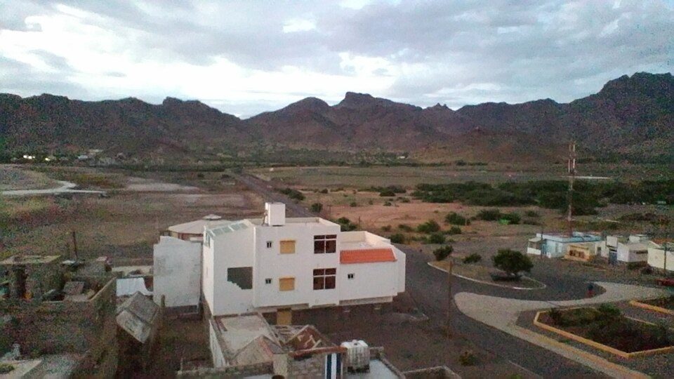
Sao Pedro, Cape Verde is a submarine cable landing point in Cape Verde (coordinates 16.8234°, -25.0608°). It serves 3 submarine cable systems, making it a multi-cable landing site in Cape Verde's international connectivity infrastructure.
São Pedro is a village in the southwestern part of the island of Sao Vicente, Cape Verde. It is situated on the south coast, approximately 10 km southwest of the island capital Mindelo. In 2010 its population was 991. Cesária Évora Airport, the island's international airport is directly north of São Pedro. It was mentioned as a small port as "P. St. Pedro" in the 1747 map by Jacques-Nicolas Bellin. The lighthouse Farol de D. Amélia sits on the Ponta Machado, 3 km west of the village. Wikipedia
Connected submarine cables
| Cable | RFS | Length | Owners |
|---|---|---|---|
| Cabo Verde Telecom Domestic Submarine Cable Phase 3 | 2011 | -1 km | Cabo Verde Telecom (CVT) |
| Cabo Verde Telecom Domestic Submarine Cable Phase 2 | 2002 | -1 km | Cabo Verde Telecom (CVT) |
| Cabo Verde Telecom Domestic Submarine Cable Phase 1 | 1997 | -1 km | Cabo Verde Telecom (CVT) |
Operators landing at Sao Pedro, Cape Verde
Cables landing at Sao Pedro, Cape Verde are operated by 1 distinct consortium partners and carriers, including Cabo Verde Telecom (CVT). Each cable is typically jointly owned by a consortium of tier-one carriers and hyperscale operators who share construction costs and capacity; the operator mix reflects both regional incumbents and global players with interest in the routes served by this landing point.
Connectivity profile
From Sao Pedro, Cape Verde, international traffic can reach 1 countries through 3 cable systems. Destinations include Cape Verde.
Monitoring status
No monitoring incidents were recorded on cables serving Sao Pedro, Cape Verde in the past 90 days - all connected systems remained within normal latency thresholds. Our monitoring network continuously samples latency from external probes to targets reachable via these cables.
About the cables
- Cabo Verde Telecom Domestic Submarine Cable Phase 3 (2011) - Cabo Verde Telecom Domestic Submarine Cable Phase 3 is a domestic submarine cable network within Cape Verde, connecting 8 coastal and island locations including Nova Sintra, Porto Novo, Praia, Sal Rei, Sao Filipe, and 3 more. The system provides essential telecommunications infrastructure for communities that would otherwise depend entirely on satellite or microwave links. Read more →
- Cabo Verde Telecom Domestic Submarine Cable Phase 2 (2002) - Cabo Verde Telecom Domestic Submarine Cable Phase 2 is a submarine cable system operating within Cape Verde, with landing points at Porto Novo, Sao Pedro, Tarrafal de Santiago. It provides dedicated submarine fiber capacity between these locations, supporting telecommunications, internet access, and enterprise connectivity. Read more →
- Cabo Verde Telecom Domestic Submarine Cable Phase 1 (1997) - Cabo Verde Telecom Domestic Submarine Cable Phase 1 is a domestic submarine cable network within Cape Verde, connecting 5 coastal and island locations including Murdeira, Praia, Sal Rei, Sao Pedro, Tarrafal de São Nicolau. The system provides essential telecommunications infrastructure for communities that would otherwise depend entirely on satellite or microwave links. Read more →
What next: Sao Pedro, Cape Verde in the global directory of cable landing points; see surrounding routes on the interactive submarine cable map or follow live network monitoring.
Other Landing Points in Cape Verde
FAQ
Landing Point
- CountryCV Cape Verde
- Coordinates16.8234°N 25.0608°W
- Connected Cables3
See Real Cable Routes
View actual submarine cable routing from Sao Pedro, Cape Verde - with backbone nodes, distance calculations, and latency estimates
Open Calculator →