Punta Cana, Dominican Republic
Landing Point · DO Dominican Republic
Connected Cables
| Cable | Status |
|---|---|
| Alisios | Planned |
| Antillas 1 | Active |
| ARCOS | Active |
| Canoa | Planned |
| Firmina | Active |
| OlaLuz | Planned |
| South America-1 (SAm-1) | Active |
Live Performance
RTT measurements to this landing point from 2026-04-24 through 2026-10-16 - live ICMP round-trip time via our monitoring probes. Recomputed daily. ✓ No anomalies detected in the monitored period.
Measurement sources
| Probe | Location | Samples | Avg |
|---|---|---|---|
| #4429 | control probe | 64 | 275.0 ms |
| #6681 | control probe | 63 | 247.1 ms |
| #1033 | control probe | 21 | 244.1 ms |
| own probe | Minsk BY | 12 | 146.2 ms |
| #6410 own probe | Sao Paulo BR | 9 | 138.2 ms |
| #6427 own probe | Sydney AU | 9 | 251.1 ms |
| own probe | Almaty KZ | 5 | 198.2 ms |
| own probe | Moscow RU | 5 | 152.8 ms |
| own probe | Tbilisi GE | 4 | 167.1 ms |
| own probe | Jerusalem IL | 4 | 166.2 ms |
| #6487 | control probe | 3 | 239.0 ms |
| #1014354 | control probe | 3 | 0.8 ms |
| own probe | Sevastopol UA | 3 | 186.6 ms |
| own probe | Kyiv UA | 3 | 143.2 ms |
| #28779 | control probe | 2 | 159.8 ms |
| #7062 own probe | Cape Town ZA | 1 | 258.6 ms |
| #51981 | control probe | 1 | 4.7 ms |
| #62536 | control probe | 1 | 8.8 ms |
| own probe | Saint Petersburg RU | 1 | 138.7 ms |
About Punta Cana, Dominican Republic
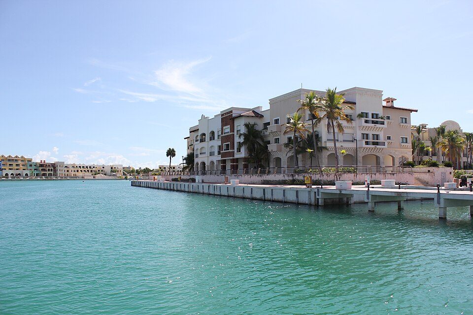
Punta Cana, Dominican Republic is a submarine cable landing point in Dominican Republic (coordinates 18.6213°, -68.4383°). It serves 3 submarine cable systems, making it a multi-cable landing site in Dominican Republic's international connectivity infrastructure.
Punta Cana is a resort town in the easternmost region of the Dominican Republic. It was politically incorporated as the "Verón-Punta Cana Touristic Municipal District" in 2006, and it is subject to the municipality of Higüey. According to the 2022 census, this township or district had a population of 138,919 inhabitants. Wikipedia
Connected submarine cables
| Cable | RFS | Length | Owners |
|---|---|---|---|
| ARCOS | 2001 | 8,704 km | AT&T, Alestra, Bahamas Telecommunications Company, … |
| South America-1 (SAm-1) | 2001 | 25,000 km | Telxius |
| Antillas 1 | 1997 | 601 km | Altice Dominicana, Antelecom, Claro Dominicana (Codetel), … |
Operators landing at Punta Cana, Dominican Republic
Cables landing at Punta Cana, Dominican Republic are operated by 23 distinct consortium partners and carriers, including AT&T, Alestra, Altice Dominicana, Antelecom, Bahamas Telecommunications Company, Belize Telemedia, CANTV, Claro Dominicana (Codetel), Enitel, Hondutel, and 13 others. Each cable is typically jointly owned by a consortium of tier-one carriers and hyperscale operators who share construction costs and capacity; the operator mix reflects both regional incumbents and global players with interest in the routes served by this landing point.
Connectivity profile
From Punta Cana, Dominican Republic, international traffic can reach 19 countries through 3 cable systems. Destinations include Argentina, Bahamas, Belize, Brazil, Chile, Colombia, Costa Rica, Curaçao and 11 more.
Monitoring status
No monitoring incidents were recorded on cables serving Punta Cana, Dominican Republic in the past 90 days - all connected systems remained within normal latency thresholds. Our monitoring network continuously samples latency from external probes to targets reachable via these cables.
About the cables
- ARCOS (2001) - ARCOS is a major intercontinental submarine cable system spanning 14 countries across Central America, South America, North America. With 24 landing points - including Belize City, Bluefields, Cancún, Cartagena, Cat Island, and 19 more - it forms one of the backbone links carrying international internet traffic between continents. Read more →
- South America-1 (SAm-1) (2001) - South America-1 (SAm-1) is a major intercontinental submarine cable system spanning 9 countries across South America, North America. With 16 landing points - including Arica, Barranquilla, Boca Raton, Fortaleza, Las Toninas, and 11 more - it forms one of the backbone links carrying international internet traffic between continents. Read more →
- Antillas 1 (1997) - Antillas 1 is a point-to-point submarine cable linking Dominican Republic and United States. Landing at Cacique, Isla Verde, Punta Cana, it provides a direct fiber-optic path between the two countries, serving as both a primary data route and a redundancy option for neighboring cable systems. Read more →
What next: Punta Cana, Dominican Republic in the global directory of cable landing points; see surrounding routes on the interactive submarine cable map or follow live network monitoring.
Other Landing Points in Dominican Republic
FAQ
Landing Point
- CountryDO Dominican Republic
- Coordinates18.6213°N 68.4383°W
- Connected Cables7
See Real Cable Routes
View actual submarine cable routing from Punta Cana, Dominican Republic - with backbone nodes, distance calculations, and latency estimates
Open Calculator →