Oxwich Bay, United Kingdom
Landing Point · GB United Kingdom
Connected Cables
| Cable | Status |
|---|---|
| Solas | Active |
Live Performance
RTT measurements to this landing point from 2026-04-12 through 2026-10-16 - live ICMP round-trip time via our monitoring probes. Recomputed daily. ✓ No anomalies detected in the monitored period.
Measurement sources
| Probe | Location | Samples | Avg |
|---|---|---|---|
| #2353 | control probe | 46 | 51.6 ms |
| own probe | Minsk BY | 5 | 41.2 ms |
| own probe | Kyiv UA | 4 | 47.4 ms |
| #6427 own probe | Sydney AU | 3 | 256.7 ms |
| #6487 | control probe | 3 | 184.9 ms |
| own probe | Saint Petersburg RU | 2 | 42.3 ms |
| own probe | Odessa UA | 2 | 54.4 ms |
| #7062 own probe | Cape Town ZA | 1 | 141.4 ms |
| own probe | Almaty KZ | 1 | 98.9 ms |
| own probe | Tbilisi GE | 1 | 60.7 ms |
| own probe | Jerusalem IL | 1 | 82.4 ms |
| own probe | Sevastopol UA | 1 | 81.4 ms |
| own probe | Moscow RU | 1 | 47.8 ms |
About Oxwich Bay, United Kingdom
How the Internet Reaches Oxwich Bay
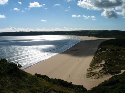
Oxwich Bay is a coastal location on the Gower Peninsula in South Wales, United Kingdom. As a submarine cable landing point, it connects directly to the international internet through a single undersea cable that terminates on its shore. International traffic arriving at Oxwich Bay travels across the Irish Sea from Ireland, making this a direct bilateral link between the United Kingdom and its nearest western neighbour.
Unlike larger UK landing points that serve as junctions for multiple transatlantic or pan-European cables, Oxwich Bay functions as a single-cable terminus. All international submarine traffic entering or leaving through this point flows along one route - across a relatively short stretch of water to the Irish coast.
The Cable Serving Oxwich Bay
The Solas cable is the sole submarine cable landing at Oxwich Bay. Measuring 232 km in length and entering service in 1999, Solas connects the United Kingdom to Ireland, with the Irish end landing at Kilmore Quay on the southeast coast of Ireland. The cable spans the Irish Sea, providing a direct undersea path between the two countries. At 232 km, Solas is considerably shorter than the UK average cable length of 1,451 km, reflecting its role as a focused, short-haul regional link rather than a long-distance intercontinental route.
Regional Context
The United Kingdom hosts 42 submarine cables across 105 landing points, making it one of the most extensively connected countries in Europe. Within this network, Oxwich Bay represents a smaller, single-cable terminus. Nearby landing points carry significantly more cable traffic: Holyhead, also in Wales, serves two cables, while Bude in Cornwall hosts seven cables, functioning as a major international gateway. Blackpool and Southport each serve three cables. Oxwich Bay's single connection places it among the more modestly served landing points in the UK's extensive coastal infrastructure.
What This Means for Connectivity
Because Oxwich Bay is served by only the Solas cable, all international submarine traffic through this landing point flows along a single route to Ireland. An outage on the Solas cable would sever the direct undersea link between this point and Kilmore Quay entirely, with no alternative submarine path available at this location. The destinations reachable via this cable are those accessible through the Irish internet exchange and onward network in Ireland.
The Solas cable is a short-haul, inter-island connection rather than an intercontinental route, illustrating how the UK's 105 landing points serve a range of functions - from major transatlantic gateways to targeted bilateral links between neighbouring nations. Understanding Oxwich Bay's position within that broader picture helps clarify how regional internet traffic is distributed across the Irish Sea corridor.
What next: Oxwich Bay, United Kingdom in the global directory of cable landing points; see surrounding routes on the interactive submarine cable map or follow live network monitoring.
Other Landing Points in United Kingdom
Landing Point
- CountryGB United Kingdom
- Coordinates51.5578°N 4.1696°W
- Connected Cables1
See Real Cable Routes
View actual submarine cable routing from Oxwich Bay, United Kingdom - with backbone nodes, distance calculations, and latency estimates
Open Calculator →