Ocho Rios, Jamaica
Landing Point · JM Jamaica
Connected Cables
| Cable | Status |
|---|---|
| ALBA-1 | Active |
| Cayman-Jamaica Fiber System (CJFS) | Active |
| Fibralink | Active |
Live Performance
RTT measurements to this landing point from 2026-04-12 through 2026-10-07 - live ICMP round-trip time via our monitoring probes. Recomputed daily. ✓ No anomalies detected in the monitored period.
Measurement sources
| Probe | Location | Samples | Avg |
|---|---|---|---|
| #6410 own probe | Sao Paulo BR | 9 | 73.8 ms |
| own probe | Minsk BY | 8 | 60.2 ms |
| #6487 | control probe | 7 | 250.0 ms |
| own probe | Saint Petersburg RU | 5 | 106.8 ms |
| #6427 own probe | Sydney AU | 4 | 1.2 ms |
| own probe | Almaty KZ | 3 | 8.4 ms |
| #1015496 | control probe | 3 | 5.2 ms |
| #1015500 | control probe | 3 | 50.7 ms |
| #1015501 | control probe | 3 | 21.9 ms |
| own probe | Tbilisi GE | 2 | 25.1 ms |
| own probe | Jerusalem IL | 2 | 6.7 ms |
| own probe | Sevastopol UA | 2 | 1.3 ms |
| #6568 own probe | Singapore SG | 1 | 1.2 ms |
| own probe | Moscow RU | 1 | 0.5 ms |
| own probe | Kyiv UA | 1 | 0.5 ms |
About Ocho Rios, Jamaica
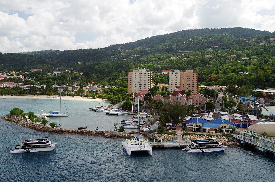
Ocho Rios, Jamaica is a submarine cable landing point in Jamaica (coordinates 18.3986°, -77.1032°). It serves 3 submarine cable systems, making it a multi-cable landing site in Jamaica's international connectivity infrastructure.
Ocho Rios is a town in the parish of Saint Ann on the north coast of Jamaica, and is more widely referred to as Ochi by locals. Beginning as a sleepy fishing village, Ocho Rios has seen explosive growth in recent decades to become a popular tourist destination featuring duty-free shopping, a cruise-ship terminal, tourist attractions and several beaches and acclaimed resorts. In addition to being a port of call for cruise ships, Ocho Rios also hosts cargo ships at the Reynolds Pier for the exportation of sugar, limestone, and in the past, bauxite. The estimated population of the town in 2011 was 16,671, which is nearly 10% of the total population of St. Ann. The town is served by both Sangster International Airport and Ian Fleming International Airport. Scuba diving and other water sports are offered in the town's vicinity. Wikipedia
Connected submarine cables
| Cable | RFS | Length | Owners |
|---|---|---|---|
| ALBA-1 | 2012 | 1,860 km | Telecom Venezuela, Transbit |
| Fibralink | 2006 | 1,102 km | Liberty Networks |
| Cayman-Jamaica Fiber System (CJFS) | 1997 | 1,197 km | CW Cayman, CW Jamaica |
Operators landing at Ocho Rios, Jamaica
Cables landing at Ocho Rios, Jamaica are operated by 5 distinct consortium partners and carriers, including CW Cayman, CW Jamaica, Liberty Networks, Telecom Venezuela, Transbit. Each cable is typically jointly owned by a consortium of tier-one carriers and hyperscale operators who share construction costs and capacity; the operator mix reflects both regional incumbents and global players with interest in the routes served by this landing point.
Connectivity profile
From Ocho Rios, Jamaica, international traffic can reach 6 countries through 3 cable systems. Destinations include Cayman Islands, Cuba, Dominican Republic, Haiti, Jamaica, Venezuela.
Monitoring status
GeoCables recorded 1 monitoring event on cables serving Ocho Rios, Jamaica in the past 90 days. Our monitoring network continuously samples latency from external probes to targets reachable via these cables.
About the cables
- ALBA-1 (2012) - ALBA-1 is a regional submarine cable serving 3 countries: Venezuela, Jamaica, Cuba. With landing points at La Guaira, Ocho Rios, Santiago de Cuba, Siboney, it strengthens regional internet resilience and provides route diversity - crucial when nearby cables experience faults. Read more →
- Fibralink (2006) - Fibralink is a regional submarine cable serving 3 countries: Jamaica, Haiti, Dominican Republic. With landing points at Bull Bay, Kaliko, Montego Bay, Ocho Rios, Puerto Plata, it strengthens regional internet resilience and provides route diversity - crucial when nearby cables experience faults. Read more →
- Cayman-Jamaica Fiber System (CJFS) (1997) - Cayman-Jamaica Fiber System (CJFS) is a point-to-point submarine cable linking Jamaica and Cayman Islands. Landing at Bull Bay, Cayman Brac, Half Moon Bay, Montego Bay, Ocho Rios, and 1 more, it provides a direct fiber-optic path between the two countries, serving as both a primary data route and a redundancy option for neighboring cable systems. Read more →
What next: Ocho Rios, Jamaica in the global directory of cable landing points; see surrounding routes on the interactive submarine cable map or follow live network monitoring.
Incident history
Significant incidents on cables landing here, each with its own report.
Other Landing Points in Jamaica
FAQ
Landing Point
- CountryJM Jamaica
- Coordinates18.3986°N 77.1032°W
- Connected Cables3
See Real Cable Routes
View actual submarine cable routing from Ocho Rios, Jamaica - with backbone nodes, distance calculations, and latency estimates
Open Calculator →