Negril, Jamaica
Landing Point · JM Jamaica
Connected Cables
| Cable | Status |
|---|---|
| Jamaica Submarine Cable Festoon System (JSCFS) | Planned |
Live Performance
RTT measurements to this landing point from 2026-03-03 through 2026-10-12 - live ICMP round-trip time via our monitoring probes. Recomputed daily. ✓ No anomalies detected in the monitored period.
Measurement sources
| Probe | Location | Samples | Avg |
|---|---|---|---|
| own probe | Minsk BY | 15 | 2.0 ms |
| #6410 own probe | Sao Paulo BR | 8 | 0.9 ms |
| #6427 own probe | Sydney AU | 8 | 1.0 ms |
| own probe | Almaty KZ | 7 | 14.9 ms |
| own probe | Tbilisi GE | 7 | 25.7 ms |
| #6487 | control probe | 6 | 0.8 ms |
| own probe | Jerusalem IL | 6 | 18.0 ms |
| own probe | Moscow RU | 6 | 0.5 ms |
| own probe | Saint Petersburg RU | 6 | 6.2 ms |
| own probe | Sevastopol UA | 3 | 1.4 ms |
| #1015503 | control probe | 3 | 2.6 ms |
| #1015504 | control probe | 3 | 48.2 ms |
| #1015505 | control probe | 2 | 21.9 ms |
| #6568 own probe | Singapore SG | 1 | 0.6 ms |
| own probe | Kyiv UA | 1 | 0.5 ms |
About Negril, Jamaica
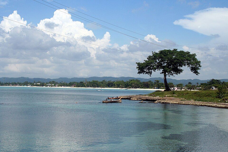
Negril, Jamaica: Submarine Cable Landing Point
Negril is a beach resort town situated at the far western tip of Jamaica, spanning Westmoreland and Hanover parishes approximately 80.8 kilometres southwest of Montego Bay. As a coastal settlement on Jamaica's western extremity, Negril serves as a landing point for submarine cable infrastructure connecting it to the broader Jamaican cable network. One submarine cable lands at Negril, the Jamaica Submarine Cable Festoon System (JSCFS), which links multiple points along the Jamaican coastline in a domestic inter-island festoon arrangement.
The single cable landing at Negril connects the town exclusively within Jamaica, making this a domestic rather than an international terminus. The JSCFS, by its nature as a festoon system, is designed to serve intra-national connectivity, routing cable infrastructure along the Jamaican coast to serve communities at multiple landing points across the island.
Cables Landing at Negril
The Jamaica Submarine Cable Festoon System (JSCFS) is the sole submarine cable landing at Negril. This cable connects landing points exclusively within Jamaica, functioning as a domestic festoon system that runs along the Jamaican coastline. No length, ready-for-service year, or capacity data is available for this cable in the current record. Its other endpoints are located elsewhere in Jamaica, placing Negril as one node within this nationally oriented submarine cable route.
Regional Context
Among Jamaica's submarine cable landing points, Negril is one of the country's smaller nodes, sharing a single-cable status with Black River, Copa Club, and Harbour View. By comparison, Bull Bay and Montego Bay each host three cables, and Ocho Rios hosts two, making those locations more prominent multi-cable hubs on the island. Negril's position at Jamaica's western extremity gives it a geographically distinct role in the domestic festoon network.
Network Role
Negril functions as a single-cable terminus within Jamaica's domestic submarine cable infrastructure. Its connection through the Jamaica Submarine Cable Festoon System links it to other Jamaican landing points along the coast, contributing to the intra-national distribution of submarine cable connectivity across the island. As a festoon endpoint, Negril's role is to extend the reach of this domestic system to Jamaica's western coastline, a region otherwise distant from the more concentrated cable hubs at Montego Bay and Bull Bay.
Within the Jamaican submarine cable graph, Negril represents the westernmost point of cable-served connectivity, ensuring that the festoon system reaches the full geographic breadth of the island rather than remaining concentrated in the north and east.
What next: Negril, Jamaica in the global directory of cable landing points; see surrounding routes on the interactive submarine cable map or follow live network monitoring.
Other Landing Points in Jamaica
Landing Point
- CountryJM Jamaica
- Coordinates18.2787°N 78.3483°W
- Connected Cables1
See Real Cable Routes
View actual submarine cable routing from Negril, Jamaica - with backbone nodes, distance calculations, and latency estimates
Open Calculator →