Muncar, Indonesia
Landing Point · ID Indonesia
2
Connected Cables
ID
Country
8.45°
Latitude
114.31°
Longitude
Ctrl + Scroll to zoom
Connected Cables
| Cable | Status |
|---|---|
| Jalapati | Active |
| Java Bali Cable System (JBCS) | Active |
Live Performance
23
measurements
11
probes
164
days monitored
215.6
ms avg RTT
0
anomalies
RTT measurements to this landing point from 2026-04-17 through 2026-09-29 - live ICMP round-trip time via our monitoring probes. Recomputed daily. ✓ No anomalies detected in the monitored period.
Measurement sources
| Probe | Location | Samples | Avg |
|---|---|---|---|
| own probe | Minsk BY | 4 | 210.8 ms |
| own probe | Almaty KZ | 4 | 270.4 ms |
| own probe | Tbilisi GE | 3 | 248.8 ms |
| own probe | Jerusalem IL | 3 | 221.3 ms |
| own probe | Sevastopol UA | 2 | 229.8 ms |
| own probe | Moscow RU | 2 | 204.8 ms |
| #6410 own probe | Sao Paulo BR | 1 | 371.6 ms |
| #6427 own probe | Sydney AU | 1 | 305.4 ms |
| #7290 | control probe | 1 | 25.9 ms |
| #64431 | control probe | 1 | 28.3 ms |
| #1017744 | control probe | 1 | 23.3 ms |
About Muncar, Indonesia
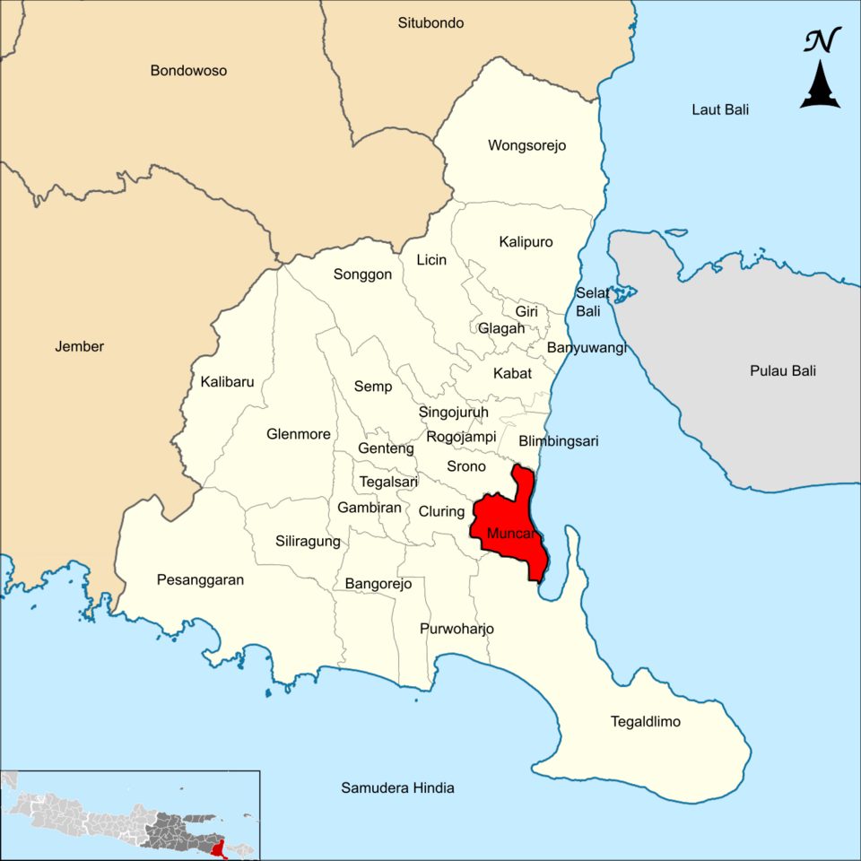
Connectivity at Muncar: A Coastal Link in Indonesia
Muncar, a small town on the southeastern coast of Java, Indonesia, plays a modest yet important role in the country's submarine cable network. With two cables landing here-the Jalapati and the Java Bali Cable System (JBCS)-Muncar serves as a regional node in Indonesia's vast and growing connectivity landscape.Two Domestic Cables, One Coastal Connection
Both cables landing at Muncar are domestic, linking the town to other parts of Indonesia without extending internationally. The Jalapati cable, operational since 2023, spans just 45 kilometers and connects Muncar to Candikusuma, another landing point on Bali. Similarly, the Java Bali Cable System (RFS 2013) also ties Muncar to Candikusuma, forming a localized chain between Java and Bali. These cables are relatively short compared to Indonesia's average submarine cable length of 2,797 kilometers, reflecting their role in stitching together regional connectivity rather than serving as long-haul links.Positioning Muncar in Indonesia's Cable Network
Indonesia hosts 70 submarine cables across 139 landing points, making it one of the most connected archipelagos in the world. However, Muncar, with its two cables, is far from the bustling hubs of Batam (20 cables) or Jakarta (10 cables). It ranks in the top 85% of landing points by cable count, highlighting its smaller scale and regional focus. Unlike Batam or Makassar, which serve as major gateways for international traffic, Muncar's connectivity is entirely domestic. Its role is to ensure seamless communication between Java and Bali, supporting local industries and communities. While it may not be a headline-grabbing hub, its presence is essential for maintaining reliable links in this part of Indonesia.Latency Insights: Reliable but Not Fast
GeoCables' latency measurements provide a unique perspective on Muncar's connectivity. Across 16 completed checks from six source cities, the average round-trip latency to Muncar is 233 milliseconds, with the best observed latency at 205 milliseconds. These numbers suggest that while Muncar's cables are dependable, they are not optimized for ultra-low latency applications. This is consistent with its role as a regional connector rather than a major data transit point.A Coastal Town with a Quiet Role
Muncar may not compete with Indonesia's larger cable landing points, but its two domestic cables ensure that this corner of Java remains connected to Bali and beyond. For residents and businesses in the area, these cables provide the digital infrastructure needed for communication, commerce, and local development. While it might not be a hub for global traffic, Muncar's role in Indonesia's cable network is a reminder that even small landing points contribute to the bigger picture of nationwide connectivity.What next: Muncar, Indonesia in the global directory of cable landing points; see surrounding routes on the interactive submarine cable map or follow live network monitoring.
Other Landing Points in Indonesia
ID Aeng Batu Batu, Indonesia
5.3433°S 119.3846°E
ID Agats, Indonesia
5.5356°S 138.1214°E
ID Alor, Indonesia
8.3207°S 124.4038°E
ID Ambon, Indonesia
3.6554°S 128.1907°E
ID Ancol, Indonesia
6.1290°S 106.8334°E
ID Anyer, Indonesia
6.0737°S 105.8839°E
ID Baa, Indonesia
10.7333°S 123.0353°E
ID Bali, Indonesia
8.4101°S 115.6924°E
ID Balikpapan, Indonesia
1.2654°S 116.8312°E
ID Bandaneria, Indonesia
4.5202°S 129.8721°E
ID Bandar Lampung, Indonesia
5.4092°S 105.2541°E
ID Bangga, Indonesia
1.6003°S 123.5275°E
Landing Point
- CountryID Indonesia
- Coordinates8.4480°S 114.3104°E
- Connected Cables2
See Real Cable Routes
View actual submarine cable routing from Muncar, Indonesia - with backbone nodes, distance calculations, and latency estimates
Open Calculator →
Submarine cables
Land fiber
Live probes