Kendari, Indonesia
Landing Point · ID Indonesia
4
Connected Cables
ID
Country
4.00°
Latitude
122.51°
Longitude
Ctrl + Scroll to zoom
Connected Cables
| Cable | Status |
|---|---|
| Barat Timur Indonesia-2 (BTI-2) | Planned |
| Indonesia Tengah Cable Systems | Planned |
| Palapa Ring Middle | Active |
| SMPCS Packet-1 | Active |
📡 Live Performance
28
measurements
6
probes
83
days monitored
295.1
ms avg RTT
0
anomalies
RTT measurements to this landing point from 2026-03-04 through 2026-05-27 - live ICMP round-trip time via our monitoring probes. Recomputed daily. ✓ No anomalies detected in the monitored period.
Measurement sources
| Probe | Location | Samples | Avg |
|---|---|---|---|
| #1014473 own probe | Minsk BY | 8 | 270.2 ms |
| #1014589 own probe | Almaty KZ | 8 | 321.2 ms |
| #1014597 own probe | Tbilisi GE | 8 | 318.2 ms |
| #1014969 own probe | Jerusalem IL | 2 | 268.6 ms |
| #1015313 own probe | Sevastopol UA | 1 | 239.2 ms |
| #1015523 own probe | Moscow RU | 1 | 209.0 ms |
About Kendari, Indonesia
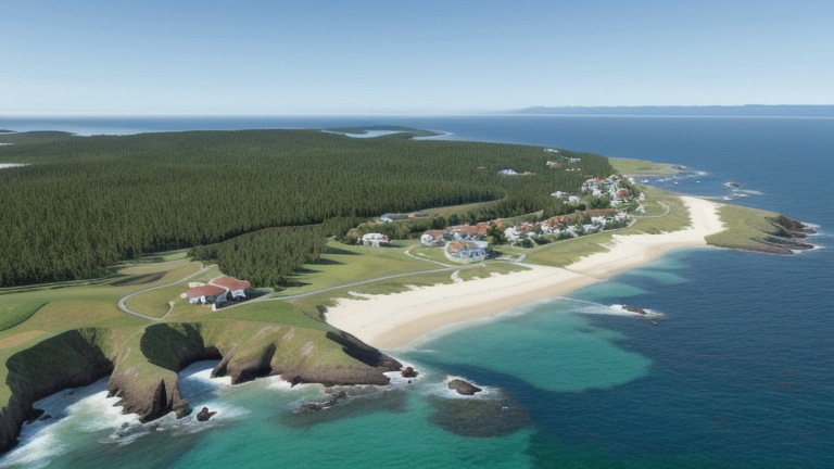
Connectivity in Kendari, Indonesia: A Regional Hub in Southeast Sulawesi
Kendari, the capital city of Southeast Sulawesi, plays a significant role in Indonesia's submarine cable network. With four cables landing here, Kendari is among the top 96% of Indonesia's 143 landing points by cable count. While it may not rival major hubs like Batam (20 cables) or Jakarta (10 cables), Kendari's connectivity is essential for linking the eastern regions of Indonesia to the broader national network.Submarine Cables Landing in Kendari
Kendari hosts four submarine cables, each serving distinct purposes in Indonesia's domestic connectivity: 1. **Barat Timur Indonesia-2 (BTI-2)**: Spanning 11,600 km, this cable connects Kendari to nine other landing points, including major hubs like Batam and Semarang. BTI-2 stitches together Indonesia's vast archipelago, ensuring seamless communication across the country. 2. **SMPCS Packet-1**: Operational since 2015, this 3,156 km cable links Kendari to 11 other locations, including Ambon, Sorong, and Ternate. It strengthens connectivity in eastern Indonesia, a region known for its scattered islands and remote communities. 3. **Indonesia Tengah Cable Systems**: Set to be ready for service in 2027, this 2,641 km cable will connect Kendari to nine other points, including Baubau, Makassar, and Wakatobi. It promises to enhance regional connectivity and support the growing economic activities in Southeast Sulawesi. 4. **Palapa Ring Middle**: Launched in 2018, this 2,100 km cable connects Kendari to 19 other points, such as Manado, Sofifi, and Tahuna. The Palapa Ring project is part of Indonesia's broader initiative to reduce the digital divide by connecting remote areas to the national network.Regional Positioning
While Kendari may not boast the cable density of Batam or Jakarta, its strategic location on Kendari Bay makes it a key node for eastern Indonesia. The cables landing here primarily serve domestic purposes, linking Kendari to other cities and regions within Indonesia. This local focus contrasts with hubs like Batam, which often serve as international gateways. Kendari's neighbors, such as Makassar (6 cables) and Manado (8 cables), also play significant roles in regional connectivity. Together, these landing points form a network that supports the economic and social development of Sulawesi and beyond.Latency Insights
GeoCables' monitoring reveals an average round-trip latency of 295 ms from Kendari, with the best observed latency at 208 ms. These figures highlight the challenges of connecting remote regions, but they also underscore the progress made in reducing delays and improving network performance.Economic and Geographic Context
Kendari is not just a landing point for submarine cables-it is the economic heart of Southeast Sulawesi. With a population of over 350,000 and a strategic location on Kendari Bay, the city serves as a trade center with a major port and airport. The cables landing here support the city's growing economy, enabling businesses to stay connected and competitive in an increasingly digital world.Conclusion
Kendari's four submarine cables play a pivotal role in linking the eastern regions of Indonesia to the national network. While not a major international hub, Kendari's connectivity supports local industries, facilitates communication across the archipelago, and ensures that Southeast Sulawesi remains an integral part of Indonesia's digital future.Other Landing Points in Indonesia
ID Aeng Batu Batu, Indonesia
5.3433°S 119.3846°E
ID Agats, Indonesia
5.5356°S 138.1214°E
ID Alor, Indonesia
8.3207°S 124.4038°E
ID Ambon, Indonesia
3.6554°S 128.1907°E
ID Ancol, Indonesia
6.1290°S 106.8334°E
ID Anyer, Indonesia
6.0737°S 105.8839°E
ID Baa, Indonesia
10.7333°S 123.0353°E
ID Bali, Indonesia
8.4101°S 115.6924°E
ID Balikpapan, Indonesia
1.2654°S 116.8312°E
ID Bandaneria, Indonesia
4.5202°S 129.8721°E
ID Bandar Lampung, Indonesia
5.4092°S 105.2541°E
ID Bangga, Indonesia
1.6003°S 123.5275°E
FAQ
Landing Point
- CountryID Indonesia
- Coordinates3.9984°S 122.5130°E
- Connected Cables4
See Real Cable Routes
View actual submarine cable routing from Kendari, Indonesia - with backbone nodes, distance calculations, and latency estimates
Open Calculator →
🌊 Submarine cables
🛤 Land fiber
📡 Live probes