Fighting Bay, New Zealand
Landing Point · NZ New Zealand
1
Connected Cables
NZ
Country
41.34°
Latitude
174.24°
Longitude
Ctrl + Scroll to zoom
Connected Cables
| Cable | Status |
|---|---|
| Cook Strait | Active |
Live Performance
36
measurements
11
probes
137
days monitored
308.1
ms avg RTT
0
anomalies
RTT measurements to this landing point from 2026-04-22 through 2026-09-07 - live ICMP round-trip time via our monitoring probes. Recomputed daily. ✓ No anomalies detected in the monitored period.
Measurement sources
| Probe | Location | Samples | Avg |
|---|---|---|---|
| own probe | Minsk BY | 6 | 325.5 ms |
| own probe | Almaty KZ | 4 | 369.7 ms |
| own probe | Tbilisi GE | 4 | 343.3 ms |
| own probe | Jerusalem IL | 4 | 344.8 ms |
| own probe | Moscow RU | 4 | 328.0 ms |
| #6427 own probe | Sydney AU | 3 | 41.6 ms |
| #7062 own probe | Cape Town ZA | 3 | 392.2 ms |
| own probe | Sevastopol UA | 3 | 353.8 ms |
| #6487 | control probe | 2 | 132.0 ms |
| own probe | Kyiv UA | 2 | 315.1 ms |
| #6410 own probe | Sao Paulo BR | 1 | 339.7 ms |
About Fighting Bay, New Zealand
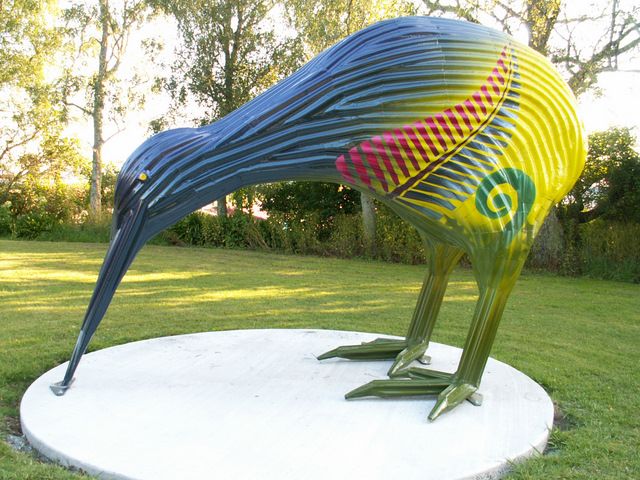
Fighting Bay: A Quiet but Essential Link in New Zealand's Connectivity
Fighting Bay, located on the South Island of New Zealand, is home to a single submarine cable: the Cook Strait cable. Though modest in scale compared to other landing points in New Zealand, Fighting Bay plays a unique role in the country's connectivity landscape. The Cook Strait cable, spanning just 40 kilometers, connects Fighting Bay to Oteranga Bay on the North Island, forming a critical domestic link between the two islands.The Role of the Cook Strait Cable
Unlike international cables that extend thousands of kilometers to connect continents, the Cook Strait cable is purely domestic. Its purpose is to bridge the geographical divide between New Zealand's North and South Islands, ensuring seamless communication and data transfer within the country. This connection is essential for regional networks, allowing local data to flow efficiently to national hubs and beyond. While Fighting Bay hosts only one cable, its importance lies in its position within the chain. The Cook Strait cable ensures that the South Island remains tightly integrated with the North Island's larger network infrastructure, which includes major landing points like Auckland, Takapuna, and Whenuapai. These northern hubs are gateways to international connectivity, but without the Cook Strait cable, the South Island would face significant challenges in accessing those resources.Regional Context: A Smaller Player in a Larger Network
Fighting Bay stands out for its simplicity. With just one cable landing here, it contrasts sharply with busier points like Auckland, which hosts three cables and serves as a major international hub. Even smaller North Island landing points like Raglan and New Plymouth manage two cables each. Yet Fighting Bay's single connection is enough to keep the South Island plugged into the broader network. Christchurch, another South Island landing point, also hosts just one cable, highlighting the region's reliance on streamlined infrastructure. Together, these landing points ensure that the South Island remains connected, even if the scale of its network is smaller than that of the North Island.Latency Insights: Reliable Performance
GeoCables' own latency measurements reveal that Fighting Bay performs reliably within New Zealand's domestic network. Across 35 completed checks from nine source cities, the average round-trip latency to Fighting Bay was 323 milliseconds, with the best observed latency being an impressive 34 milliseconds. These figures underline the efficiency of the Cook Strait cable in maintaining low-latency connections between the islands.A Gateway for Local Connectivity
Fighting Bay may not boast the international reach or high cable count of other landing points, but its role is no less significant. It serves as a key domestic gateway, ensuring that the South Island remains an integral part of New Zealand's national network. From here, data flows northward to Oteranga Bay and onward to larger hubs, supporting everything from local businesses to regional communications. In the quiet waters of Fighting Bay, the Cook Strait cable hums with activity, proving that even the shortest links can have a big impact.What next: Fighting Bay, New Zealand in the global directory of cable landing points; see surrounding routes on the interactive submarine cable map or follow live network monitoring.
Other Landing Points in New Zealand
NZ Auckland, New Zealand
36.8842°S 174.7704°E
NZ Christchurch, New Zealand
43.5321°S 172.6362°E
NZ Greymouth, New Zealand
42.4667°S 171.2000°E
NZ Invercargill, New Zealand
46.4131°S 168.3475°E
NZ Kaikoura, New Zealand
42.4027°S 173.6830°E
NZ Levin, New Zealand
40.6253°S 175.2853°E
NZ Mangawhai, New Zealand
36.1262°S 174.5745°E
NZ Nelson, New Zealand
41.2723°S 173.2840°E
NZ New Plymouth, New Zealand
39.0667°S 174.0833°E
NZ Oara, New Zealand
42.5161°S 173.5061°E
NZ Oteranga Bay, New Zealand
41.3016°S 174.6134°E
NZ Paraparaumu, New Zealand
40.9191°S 174.9975°E
Landing Point
- CountryNZ New Zealand
- Coordinates41.3390°S 174.2360°E
- Connected Cables1
See Real Cable Routes
View actual submarine cable routing from Fighting Bay, New Zealand - with backbone nodes, distance calculations, and latency estimates
Open Calculator →
Submarine cables
Land fiber
Live probes