Dunvegan, United Kingdom
Landing Point · GB United Kingdom
Connected Cables
| Cable | Status |
|---|---|
| BT Highlands and Islands Submarine Cable System | Active |
Live Performance
RTT measurements to this landing point from 2026-07-11 through 2026-10-09 - live ICMP round-trip time via our monitoring probes. Recomputed daily. ✓ No anomalies detected in the monitored period.
Measurement sources
| Probe | Location | Samples | Avg |
|---|---|---|---|
| #6427 own probe | Sydney AU | 3 | 272.3 ms |
| own probe | Minsk BY | 3 | 40.3 ms |
| own probe | Saint Petersburg RU | 3 | 45.8 ms |
| own probe | Kyiv UA | 3 | 46.7 ms |
| #6487 | control probe | 1 | 165.0 ms |
| #6568 own probe | Singapore SG | 1 | 157.9 ms |
| #7062 own probe | Cape Town ZA | 1 | 142.2 ms |
| own probe | Moscow RU | 1 | 45.6 ms |
About Dunvegan, United Kingdom
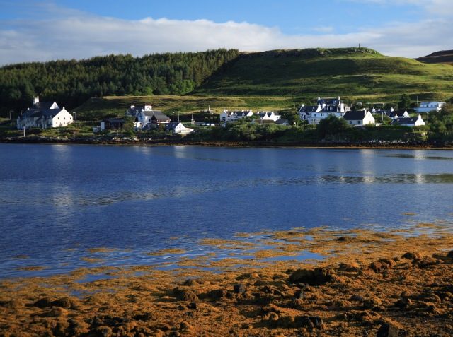
Dunvegan: Submarine Cable Landing Point
Dunvegan is a village on the Isle of Skye, Scotland, situated within the United Kingdom. As an island community, Dunvegan's position as a submarine cable landing point reflects the practical necessity of connecting remote and island-based populations to wider telecommunications networks. One submarine cable lands at Dunvegan, linking it into the broader fabric of United Kingdom submarine cable infrastructure.
The single cable serving Dunvegan is the BT Highlands and Islands Submarine Cable System, a domestic cable that connects communities within the United Kingdom. Rather than serving intercontinental corridors, this cable operates within a regional and inter-island context, providing connectivity between island and mainland communities across Scotland's western and northern reaches.
Cables Landing at Dunvegan
The BT Highlands and Islands Submarine Cable System is a 402-kilometre submarine cable that reached ready-for-service status in 2014. As its name indicates, the cable connects points entirely within the United Kingdom, serving the Highlands and Islands of Scotland. Dunvegan on the Isle of Skye forms one of the landing points on this system, which was developed to deliver improved connectivity to communities in some of the more geographically isolated parts of the British Isles.
Regional Context
Within the United Kingdom's submarine cable landscape - which spans 66 cables across 125 landing points - Dunvegan hosts a single cable, placing it among the more modestly connected of the country's landing points. Major landing points such as Bude (8 cables), Lowestoft (6 cables), and Blackpool (4 cables) serve considerably busier international and domestic corridors, while Dunvegan's single domestic cable reflects its role as a community-scale connection point rather than a large-scale international hub.
Network Role
Dunvegan functions as a single-cable terminus within a domestic United Kingdom submarine cable system. Its role is oriented entirely toward intra-national connectivity, specifically the challenge of delivering reliable telecommunications links to island and Highland communities that cannot be served by terrestrial infrastructure alone. The BT Highlands and Islands Submarine Cable System, landing here in 2014, represents a direct response to that geographic reality.
In the broader submarine cable graph of the United Kingdom, Dunvegan occupies a specialised position: not as a point of international exchange, but as evidence that submarine cable infrastructure serves local connectivity needs as much as global ones. Its presence on the network map illustrates how island communities like those on the Isle of Skye are incorporated into national telecommunications systems through dedicated subsea links.
What next: Dunvegan, United Kingdom in the global directory of cable landing points; see surrounding routes on the interactive submarine cable map or follow live network monitoring.
Other Landing Points in United Kingdom
Landing Point
- CountryGB United Kingdom
- Coordinates57.4363°N 6.5817°W
- Connected Cables1
See Real Cable Routes
View actual submarine cable routing from Dunvegan, United Kingdom - with backbone nodes, distance calculations, and latency estimates
Open Calculator →