Dawu, Taiwan
Landing Point · TW Taiwan
Connected Cables
| Cable | Status |
|---|---|
| Asia United Gateway East (AUG East) | Planned |
| TPU | Active |
Live Performance
RTT measurements to this landing point from 2026-04-20 through 2026-09-23 - live ICMP round-trip time via our monitoring probes. Recomputed daily. ✓ No anomalies detected in the monitored period.
Measurement sources
| Probe | Location | Samples | Avg |
|---|---|---|---|
| own probe | Almaty KZ | 13 | 241.9 ms |
| #6410 own probe | Sao Paulo BR | 9 | 297.3 ms |
| #6427 own probe | Sydney AU | 9 | 206.5 ms |
| #6487 | control probe | 9 | 76.3 ms |
| #7062 own probe | Cape Town ZA | 9 | 273.7 ms |
| #61925 | control probe | 4 | 29.4 ms |
| #64407 | control probe | 4 | 17.7 ms |
| #61615 | control probe | 3 | 12.1 ms |
| own probe | Minsk BY | 3 | 215.1 ms |
| own probe | Tbilisi GE | 3 | 391.3 ms |
| own probe | Jerusalem IL | 3 | 54.2 ms |
| own probe | Moscow RU | 2 | 237.2 ms |
| #64229 | control probe | 1 | 13.5 ms |
| own probe | Sevastopol UA | 1 | 245.8 ms |
About Dawu, Taiwan
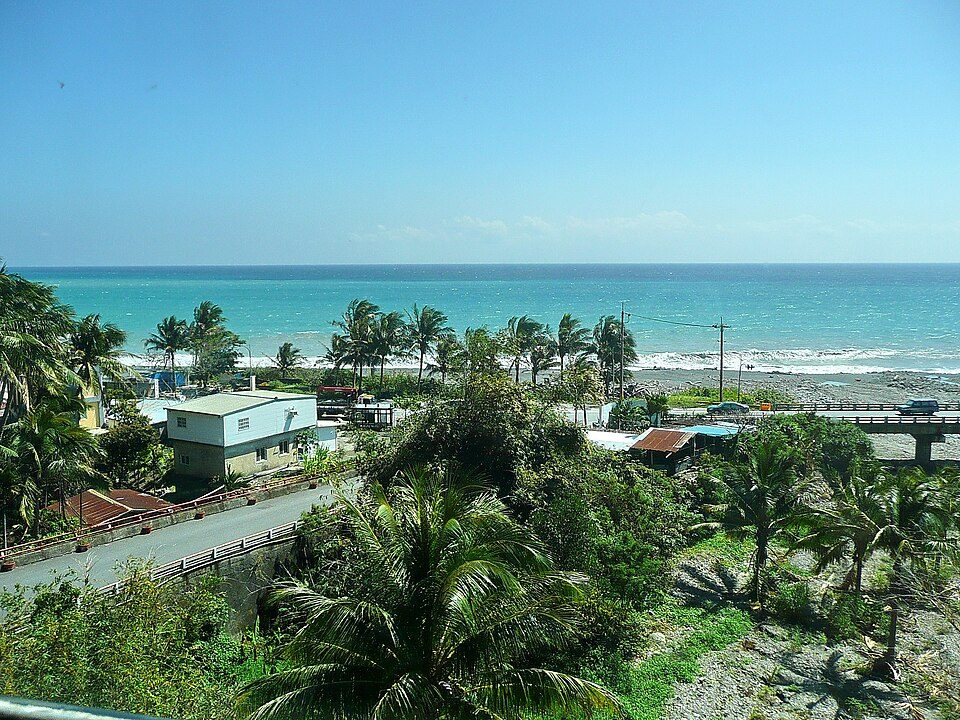
Dawu, Taiwan: Submarine Cable Landing Point
Dawu is a rural township in Taitung County, on the southeastern coast of Taiwan. As a submarine cable landing point, it connects Taiwan's eastern seaboard to an international network spanning the Indo-Pacific region. Two submarine cables are planned to land at Dawu, both currently in draft status, making it an emerging node in Taiwan's submarine cable infrastructure.
The cables landing at Dawu extend Taiwan's connectivity across two distinct corridors: one reaching northeast toward the United States and the Pacific island territories of Guam and the Northern Mariana Islands, and another linking southward and westward into the heart of Southeast Asia, connecting countries including Japan, the Philippines, Singapore, Malaysia, Indonesia, and Brunei. Together, these two systems position Dawu as a landing point that bridges both transpacific and intra-Asian cable routes from Taiwan's eastern shore.
Cables Landing at Dawu
TPU is a submarine cable system with a total length of 13,470 km, with a ready-for-service date scheduled for 2026. In addition to Dawu, Taiwan, TPU connects to landing points in Guam, the Northern Mariana Islands, the Philippines, and the United States. The system represents a transpacific link from Taiwan's southeastern coast, extending eastward across the Pacific Ocean toward North America and its island territories.
Asia United Gateway East (AUG East) is a submarine cable system with a total length of 8,900 km, with a ready-for-service date scheduled for 2029. In addition to Dawu, Taiwan, AUG East connects to landing points in Brunei, Indonesia, Japan, Malaysia, the Philippines, and Singapore. This system forms part of the broader Asia United Gateway network and establishes Dawu as a terminus for a wide-ranging Southeast Asian cable corridor that spans much of the maritime region between East Asia and Southeast Asia.
Regional Context
Among the 21 submarine cable landing points across Taiwan, Dawu's two cables place it alongside Fangshan, Huxi Township, and Nangan as a smaller landing point by cable count, while larger hubs such as Toucheng and Tanshui host nine and eight cables respectively. Dawu ranks within the top 86 percent of Taiwanese landing points by cable count, reflecting a growing but still relatively modest footprint in the country's overall submarine cable geography.
Network Role
Dawu serves as a dual-cable landing point connecting Taiwan simultaneously to the transpacific corridor via TPU and to the Southeast Asian regional network via AUG East. Once both systems reach their respective ready-for-service dates, Dawu will provide onward connectivity to at least eight other countries - Guam, the Northern Mariana Islands, the Philippines, the United States, Brunei, Indonesia, Japan, Malaysia, and Singapore - from a single township on Taiwan's eastern coast.
Both cables at Dawu are currently in draft status, meaning the landing point's international connectivity is scheduled to come online between 2026 and 2029. Within the broader submarine cable graph of the Indo-Pacific, Dawu's combination of a transpacific system and a Southeast Asian regional system gives this eastern Taiwanese landing point a geographically diverse reach that complements the cable concentrations found at Taiwan's more established western and northern landing points.
What next: Dawu, Taiwan in the global directory of cable landing points; see surrounding routes on the interactive submarine cable map or follow live network monitoring.
Other Landing Points in Taiwan
Landing Point
- CountryTW Taiwan
- Coordinates22.3405°N 120.8898°E
- Connected Cables2
See Real Cable Routes
View actual submarine cable routing from Dawu, Taiwan - with backbone nodes, distance calculations, and latency estimates
Open Calculator →