Huxi Township, Taiwan
Landing Point · TW Taiwan
Connected Cables
| Cable | Status |
|---|---|
| Taiwan Penghu Kinmen Matsu No.2 (TPKM2) | Active |
| Taiwan Penghu Kinmen Matsu No.3 (TPKM3) | Active |
Live Performance
RTT measurements to this landing point from 2026-06-02 through 2026-10-10 - live ICMP round-trip time via our monitoring probes. Recomputed daily. ✓ No anomalies detected in the monitored period.
Measurement sources
| Probe | Location | Samples | Avg |
|---|---|---|---|
| #6410 own probe | Sao Paulo BR | 7 | 265.0 ms |
| #7062 own probe | Cape Town ZA | 7 | 276.4 ms |
| own probe | Almaty KZ | 7 | 248.3 ms |
| #6487 | control probe | 5 | 58.5 ms |
| #7485 | control probe | 5 | 32.1 ms |
| #7492 | control probe | 5 | 9.9 ms |
| #50278 | control probe | 5 | 21.7 ms |
| own probe | Tbilisi GE | 5 | 293.9 ms |
| #6427 own probe | Sydney AU | 3 | 161.8 ms |
| #6568 own probe | Singapore SG | 1 | 56.6 ms |
| own probe | Ekaterinburg RU | 1 | 207.4 ms |
About Huxi Township, Taiwan
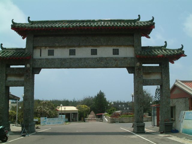
Huxi Township: Submarine Cable Landing Point
Huxi Township is a rural township in Penghu County, located on the eastern part of the Penghu Main Island - the largest township in Penghu County. As an island community sitting off the western coast of Taiwan proper, Huxi Township is served by submarine cable infrastructure that connects it directly into Taiwan's broader telecommunications network. Two submarine cables land at this point, making it a dedicated landing site for intra-Taiwan connectivity.
Both cables landing at Huxi Township operate entirely within Taiwan, linking the Penghu archipelago and other outlying island groups - including Kinmen and Matsu - to the main island. This configuration places Huxi Township within a corridor of domestic inter-island connectivity rather than intercontinental or international capacity, reflecting its geographic role as a gateway for Taiwan's offshore territories.
Cables Landing at Huxi Township
Taiwan Penghu Kinmen Matsu No.3 (TPKM3) spans approximately 510 km and reached ready-for-service status in 2013. The cable connects landing points entirely within Taiwan, linking Penghu and the other named island groups - Kinmen and Matsu - to the Taiwanese mainland network. It is the more recent of the two cable systems at Huxi Township and extends the redundancy available for inter-island domestic communications.
Taiwan Penghu Kinmen Matsu No.2 (TPKM2) stretches 467 km and was the first of the two systems at this landing point to enter service, with an RFS year of 2000. Like TPKM3, it operates entirely within Taiwan, serving the same inter-island corridor between Penghu, Kinmen, Matsu, and Taiwan's main island. TPKM2 represents the earliest submarine cable infrastructure at Huxi Township and provided the foundational domestic link for the township upon its commissioning.
Regional Context
Among Taiwan's 21 submarine cable landing points, Huxi Township hosts 2 cables, placing it in the same tier as Dawu, Fangshan, and Nangan - each of which also lands 2 cables. Major hubs such as Toucheng (9 cables) and Tanshui (8 cables) handle considerably more traffic diversity, while Dongyin (3 cables) sits just above Huxi Township by cable count. Huxi Township's role is therefore more specialised than the country's principal landing points, focused specifically on domestic inter-island links.
Network Role
Huxi Township functions as a dual-cable terminus for intra-Taiwan submarine connectivity, hosting two systems - TPKM2 and TPKM3 - that together span a combined route length of 977 km entirely within Taiwanese territory. The presence of two cables at this single landing point provides a degree of path redundancy for the Penghu Main Island's connection to the broader Taiwanese network and to the island territories of Kinmen and Matsu. Both systems serve the same domestic corridor, which distinguishes Huxi Township from Taiwan's international-facing landing points.
Within the regional submarine cable graph, Huxi Township represents a specialised node: it does not participate in intercontinental routing, but instead anchors the offshore island segments of Taiwan's domestic cable infrastructure, ensuring that geographically dispersed Taiwanese island communities maintain dedicated undersea links to the main island.
What next: Huxi Township, Taiwan in the global directory of cable landing points; see surrounding routes on the interactive submarine cable map or follow live network monitoring.
Other Landing Points in Taiwan
Landing Point
- CountryTW Taiwan
- Coordinates23.5736°N 119.6562°E
- Connected Cables2
See Real Cable Routes
View actual submarine cable routing from Huxi Township, Taiwan - with backbone nodes, distance calculations, and latency estimates
Open Calculator →