Conil de la Frontera, Spain
Landing Point · ES Spain
Connected Cables
| Cable | Status |
|---|---|
| Canalink | Active |
| Pencan-8 | Active |
Live Performance
RTT measurements to this landing point from 2026-04-05 through 2026-10-07 - live ICMP round-trip time via our monitoring probes. Recomputed daily. ✓ No anomalies detected in the monitored period.
Measurement sources
| Probe | Location | Samples | Avg |
|---|---|---|---|
| own probe | Minsk BY | 11 | 65.9 ms |
| #6427 own probe | Sydney AU | 8 | 275.2 ms |
| own probe | Odessa UA | 8 | 71.3 ms |
| #6487 | control probe | 3 | 184.2 ms |
| own probe | Tbilisi GE | 3 | 76.2 ms |
| own probe | Jerusalem IL | 3 | 93.6 ms |
| own probe | Kyiv UA | 3 | 54.7 ms |
| #27388 | control probe | 2 | 16.6 ms |
| own probe | Almaty KZ | 2 | 114.4 ms |
| own probe | Moscow RU | 2 | 64.6 ms |
| #6568 own probe | Singapore SG | 1 | 170.1 ms |
| #21570 | control probe | 1 | 10.6 ms |
| #23581 | control probe | 1 | 9.1 ms |
About Conil de la Frontera, Spain
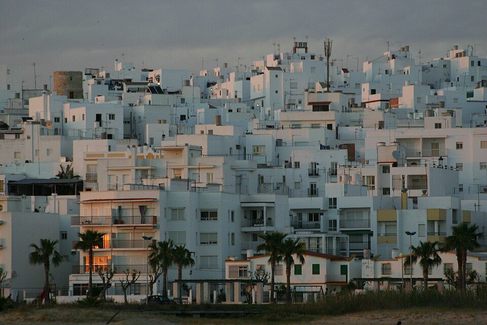
Conil de la Frontera: Submarine Cable Landing Point
Conil de la Frontera is a town on the Atlantic coast of Andalusia, in the province of Cádiz, in southern Spain. Its coastal position along the Atlantic seaboard makes it a natural landfall site for submarine cables operating in the waters between the Iberian Peninsula, North Africa, and the Spanish archipelagos. Two submarine cables land at Conil de la Frontera, connecting the town to Morocco and to other Spanish territories.
The two cables that come ashore here - Canalink and Pencan-8 - together establish connections that span both cross-strait and inter-island corridors. Canalink links Spain and Morocco, bridging the short but significant stretch between continental Europe and the African continent. Pencan-8 operates as an intra-Spanish connection, tying Conil de la Frontera into the network of cables serving Spanish territories. Both cables reached ready-for-service status in 2011.
Cables Landing at Conil de la Frontera
Canalink is a submarine cable measuring 1,835 km in length, which became ready for service in 2011. It connects Spain and Morocco, with Conil de la Frontera serving as one of its Spanish landing points. The cable provides a direct submarine link between the southern tip of continental Spain and the Moroccan coast across the Strait of Gibraltar region and adjacent Atlantic waters.
Pencan-8 is a submarine cable measuring 1,400 km in length, also reaching ready-for-service status in 2011. Its endpoints are located entirely within Spain, making it an intra-national submarine connection. Conil de la Frontera is one of the landing points on this cable, which links different Spanish coastal or island locations along its route.
Regional Context
Within Spain's submarine cable landscape - which encompasses 34 cables across 46 landing points - Conil de la Frontera ranks among the smaller hubs, hosting 2 cables compared to peers such as Barcelona, Bilbao, Valencia, Granadilla de Abona, Alta Vista, and Santa Cruz de La Palma, each of which accommodates 3 cables. Its position nonetheless places it within the active tier of Spanish landing points rather than among the single-cable termini.
Network Role
Conil de la Frontera functions as a two-cable landing point serving distinct corridor types simultaneously: a cross-border link to Morocco via Canalink, and an intra-Spanish connection via Pencan-8. This combination means the location serves both international and domestic submarine traffic, even if its overall cable count remains modest relative to Spain's busier landing hubs.
As a landing point where a cross-strait international cable and a domestic inter-Spanish cable converge, Conil de la Frontera occupies a specific position in the southern Spanish submarine cable graph - one that connects the Iberian coast southward to Africa and inward across Spanish waters, contributing to the redundancy and reach of Spain's broader submarine network.
What next: Conil de la Frontera, Spain in the global directory of cable landing points; see surrounding routes on the interactive submarine cable map or follow live network monitoring.
Our measurements to Conil de la Frontera
Traceroutes from our own measurement points over the last 30 days: usual delay and number of network hops on the way to Conil de la Frontera.
- From RIPE Atlas probes: 26 ms, 15 hops, 9 traces
Last trace: 2026-10-17. Live network map
Other Landing Points in Spain
Landing Point
- CountryES Spain
- Coordinates36.2766°N 6.0872°W
- Connected Cables2
See Real Cable Routes
View actual submarine cable routing from Conil de la Frontera, Spain - with backbone nodes, distance calculations, and latency estimates
Open Calculator →