Tirat Carmel, Israel
Landing Point · IL Israel
Connected Cables
| Cable | Status |
|---|---|
| Exelera North | Active |
| MedNautilus Submarine System | Active |
Live Performance
RTT measurements to this landing point from 2026-03-28 through 2026-10-15 - live ICMP round-trip time via our monitoring probes. Recomputed daily. ✓ No anomalies detected in the monitored period.
Measurement sources
| Probe | Location | Samples | Avg |
|---|---|---|---|
| #22322 | control probe | 79 | 91.2 ms |
| #6427 own probe | Sydney AU | 63 | 251.5 ms |
| own probe | Jerusalem IL | 61 | 5.8 ms |
| own probe | Tbilisi GE | 58 | 114.2 ms |
| own probe | Balancer IL | 10 | 8.9 ms |
| #6410 own probe | Sao Paulo BR | 5 | 269.9 ms |
| own probe | DVM IL | 2 | 9.6 ms |
| #583 | control probe | 1 | 48.4 ms |
About Tirat Carmel, Israel
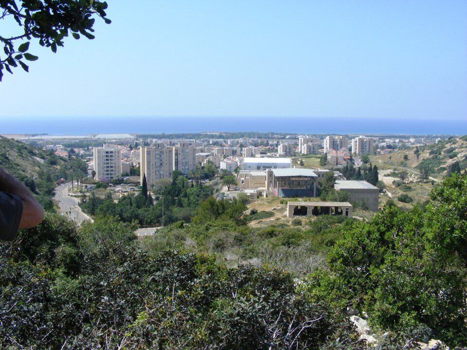
Tirat Carmel: Submarine Cable Landing Point
Tirat Carmel is a city in the Haifa District on the Mediterranean coast of Israel. As a submarine cable landing point, it connects Israel to broader Mediterranean telecommunications infrastructure, with two submarine cables making landfall here. These cables extend westward across the Mediterranean, linking Tirat Carmel to Cyprus, Greece, Italy, and Turkey, enabling both regional Mediterranean connectivity and longer intercontinental routing.
The two cables landing at Tirat Carmel serve distinct corridor roles. One reaches across the wider Mediterranean basin to connect multiple Southern European and Eastern Mediterranean nations, while the other provides a shorter, dedicated link to Cyprus. Together, they position Tirat Carmel as a meaningful node within Israel's submarine cable geography.
Cables Landing at Tirat Carmel
MedNautilus Submarine System is a 7,000 km cable that reached ready-for-service status in 2001. It connects landing points across Cyprus, Greece, Israel, Italy, and Turkey, forming a multi-country Mediterranean ring. Tirat Carmel represents the Israeli terminus of this system, which spans the breadth of the Eastern and Central Mediterranean.
Exelera North is a 345 km cable that became ready for service in 2012. It links Israel directly to Cyprus, making it a shorter, bilateral connection compared to the MedNautilus system. At 345 km, Exelera North reflects the relatively modest geographic distance between the two countries across the Eastern Mediterranean.
Regional Context
Within Israel's eight submarine cable landing points, Tirat Carmel hosts two cables, placing it alongside Ashkelon, Haifa, and Netanya as a landing point of comparable scale. Tel Aviv leads Israel's landing point infrastructure with four cables, while Herzeliyya and Nahariyya each host a single cable. Tirat Carmel therefore sits in the middle tier of Israel's cable geography, sharing its two-cable status with several other Israeli coastal cities.
Network Role
Tirat Carmel functions as a dual-cable landing point, connecting Israel both to the wider Mediterranean corridor through the MedNautilus Submarine System and to Cyprus specifically through Exelera North. The MedNautilus system draws Tirat Carmel into a network that spans Turkey, Greece, and Italy, while Exelera North reinforces the direct bilateral link between Israel and Cyprus. This combination means the landing point supports both multi-lateral Mediterranean routing and a dedicated shorter-haul connection.
As one of several Israeli landing points sharing a comparable cable count, Tirat Carmel contributes to the distributed character of Israel's coastal submarine cable infrastructure. Its presence in the regional submarine cable graph ensures that Mediterranean routing into Israel is not concentrated solely at a single landing point, providing geographic distribution across the Israeli coastline.
What next: Tirat Carmel, Israel in the global directory of cable landing points; see surrounding routes on the interactive submarine cable map or follow live network monitoring.
Other Landing Points in Israel
Landing Point
- CountryIL Israel
- Coordinates32.7617°N 34.9719°E
- Connected Cables2
See Real Cable Routes
View actual submarine cable routing from Tirat Carmel, Israel - with backbone nodes, distance calculations, and latency estimates
Open Calculator →