Pasacao, Philippines
Landing Point · PH Philippines
Connected Cables
| Cable | Status |
|---|---|
| Converge Domestic Submarine Cable Network (CDSCN) | Active |
| Philippine Domestic Submarine Cable Network (PDSCN) | Active |
Live Performance
RTT measurements to this landing point from 2026-05-02 through 2026-10-16 - live ICMP round-trip time via our monitoring probes. Recomputed daily. ✓ No anomalies detected in the monitored period.
Measurement sources
| Probe | Location | Samples | Avg |
|---|---|---|---|
| own probe | Almaty KZ | 11 | 312.4 ms |
| #6410 own probe | Sao Paulo BR | 7 | 373.9 ms |
| #6427 own probe | Sydney AU | 7 | 181.7 ms |
| #7062 own probe | Cape Town ZA | 7 | 306.8 ms |
| #6487 | control probe | 6 | 46.9 ms |
| #65433 | control probe | 5 | 49.8 ms |
| #1013973 | control probe | 5 | 63.8 ms |
| #1015468 | control probe | 5 | 79.0 ms |
| own probe | Minsk BY | 3 | 251.2 ms |
| own probe | Tbilisi GE | 3 | 241.8 ms |
| own probe | Jerusalem IL | 3 | 306.4 ms |
| own probe | Moscow RU | 3 | 241.8 ms |
| #6568 own probe | Singapore SG | 1 | 56.7 ms |
| #53161 | control probe | 1 | 189.1 ms |
| own probe | Sevastopol UA | 1 | 279.6 ms |
About Pasacao, Philippines
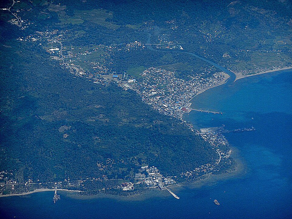
Pasacao: Submarine Cable Landing Point
Pasacao is a municipality in Camarines Sur province, on the coast of the Philippines. As a submarine cable landing point, it connects to two domestic submarine cable systems, both of which link various points within the Philippine archipelago. Because both cables serve exclusively domestic endpoints, Pasacao functions as a node within the Philippines' internal inter-island connectivity network rather than as a gateway for international or intercontinental traffic.
The two cables landing at Pasacao - the Philippine Domestic Submarine Cable Network (PDSCN) and the Converge Domestic Submarine Cable Network (CDSCN) - together represent a combined route length of approximately 3,800 kilometres of undersea fiber infrastructure dedicated to domestic service. This pairing positions Pasacao as a meaningful contributor to the Philippines' internal submarine cable map, which spans 26 cables across 71 landing points nationwide.
Cables Landing at Pasacao
Philippine Domestic Submarine Cable Network (PDSCN) is a domestic submarine cable system with a total length of 2,500 kilometres. It reached ready-for-service (RFS) status in 2023 and connects multiple landing points within the Philippines. Pasacao is one of the terminals on this network, which operates entirely within Philippine territory.
Converge Domestic Submarine Cable Network (CDSCN) is a domestic submarine cable system stretching 1,300 kilometres, with an RFS year of 2021. Like the PDSCN, all endpoints on this cable are located within the Philippines. The CDSCN predates the PDSCN by two years and represents an earlier expansion of domestic undersea connectivity to Pasacao.
Regional Context
Within the Philippines' 71 submarine cable landing points, Pasacao hosts two cables, placing it in the top 82 percent of landing points by cable count. Several other Philippine landing points - including Batangas, Cagayan de Oro, Davao, and Taytay - each serve four cables, while Baler and Boracay each serve three. Pasacao's two cables reflect a focused domestic role rather than the broader multi-cable connectivity seen at the country's busiest landing points.
Network Role
Pasacao serves as a two-cable domestic landing point, enabling inter-island submarine connectivity within the Philippine archipelago through both the PDSCN and CDSCN systems. Both cables are oriented entirely toward domestic routing, meaning Pasacao contributes to bridging the many islands of the Philippines rather than to any international submarine corridor. The CDSCN, operational since 2021, and the PDSCN, active since 2023, give this municipality two independent subsea paths for domestic data traffic.
Within the broader Philippine submarine cable graph - which first recorded a landing in 1997 and now encompasses 26 cables - Pasacao represents a domestically focused two-cable hub that reflects the continued buildout of intra-archipelago connectivity in provinces such as Camarines Sur.
What next: Pasacao, Philippines in the global directory of cable landing points; see surrounding routes on the interactive submarine cable map or follow live network monitoring.
Other Landing Points in Philippines
FAQ
Landing Point
- CountryPH Philippines
- Coordinates13.5478°N 122.9507°E
- Connected Cables2
See Real Cable Routes
View actual submarine cable routing from Pasacao, Philippines - with backbone nodes, distance calculations, and latency estimates
Open Calculator →