Palma, Spain
Landing Point · ES Spain
Connected Cables
| Cable | Status |
|---|---|
| Balalink | Active |
Live Performance
RTT measurements to this landing point from 2026-04-03 through 2026-09-11 - live ICMP round-trip time via our monitoring probes. Recomputed daily. ✓ No anomalies detected in the monitored period.
Measurement sources
| Probe | Location | Samples | Avg |
|---|---|---|---|
| own probe | Minsk BY | 17 | 76.9 ms |
| own probe | Odessa UA | 12 | 79.0 ms |
| #6427 own probe | Sydney AU | 11 | 279.1 ms |
| own probe | Almaty KZ | 5 | 113.3 ms |
| own probe | Tbilisi GE | 5 | 79.0 ms |
| own probe | Jerusalem IL | 5 | 90.7 ms |
| own probe | Sevastopol UA | 3 | 98.3 ms |
| own probe | Kyiv UA | 3 | 57.4 ms |
| #6487 | control probe | 2 | 180.5 ms |
| #6410 own probe | Sao Paulo BR | 1 | 208.4 ms |
| own probe | Moscow RU | 1 | 62.9 ms |
About Palma, Spain
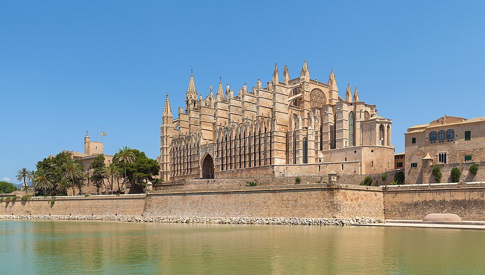
Palma, Spain: Submarine Cable Landing Point
Palma, also known as Palma de Mallorca, is the capital and largest city of the Balearic Islands, an autonomous community of Spain. Situated on the south coast of Mallorca on the Bay of Palma, the city serves as the principal urban centre of the island archipelago in the western Mediterranean. As an island capital, Palma depends on submarine cable connectivity to maintain data links with the Spanish mainland and other territories.
One submarine cable lands at Palma: Balalink. This short cable, at 274 kilometres, operates within a Spain-to-Spain corridor, connecting Palma to another point within Spain rather than bridging to a foreign country. This makes Balalink a domestic inter-island link rather than an intercontinental route, reflecting the geographic reality of the Balearic Islands' position relative to the Iberian Peninsula.
Cables Landing at Palma, Spain
Balalink is a 274-kilometre submarine cable that reached ready-for-service status in 2001, with a draft designation. Both of its endpoints fall within Spain, making it a domestic cable. Its short length is consistent with a route connecting the Balearic Islands to the Spanish mainland coast or another point within Spanish territory. Balalink represents Palma's sole submarine cable connection and establishes the city's direct link to the broader terrestrial and submarine network of Spain.
Regional Context
Within Spain's submarine cable infrastructure, which spans 34 cables across 46 landing points, Palma hosts a single cable and ranks in the top 56 percent of Spanish landing points by cable count. Several other Spanish landing points - including Barcelona, Valencia, Bilbao, Alta Vista, Granadilla de Abona, and Santa Cruz de La Palma - each host three cables, giving them greater redundancy and connectivity diversity than Palma currently provides. Palma's position as a single-cable landing point reflects its role as an island terminus served by a short domestic link rather than a major interchange node on international cable routes.
Network Role
Palma functions as a single-cable terminus, with Balalink providing a domestic submarine connection within Spain. This configuration means the city's submarine cable infrastructure is oriented entirely toward maintaining island-to-mainland or inter-island data links rather than participating in longer intercontinental or regional international cable systems. There is no redundancy at the submarine cable level from Palma at present, as the landing point is served by one route alone.
Within the broader Spanish and Mediterranean submarine cable graph, Palma represents an endpoint node - a location that receives connectivity from the network rather than one that routes traffic onward to multiple destinations. Its single domestic cable nonetheless anchors the Balearic Islands to Spain's wider connectivity infrastructure, making it a meaningful point in the topology of Spanish island telecommunications.
What next: Palma, Spain in the global directory of cable landing points; see surrounding routes on the interactive submarine cable map or follow live network monitoring.
Other Landing Points in Spain
Landing Point
- CountryES Spain
- Coordinates39.5523°N 2.6052°E
- Connected Cables1
See Real Cable Routes
View actual submarine cable routing from Palma, Spain - with backbone nodes, distance calculations, and latency estimates
Open Calculator →