Mamoudzou, Mayotte
Landing Point · YT Mayotte
1
Connected Cables
YT
Country
12.78°
Latitude
45.23°
Longitude
Ctrl + Scroll to zoom
Connected Cables
| Cable | Status |
|---|---|
| Avassa | Active |
Live Performance
144
measurements
10
probes
189
days monitored
111.1
ms avg RTT
0
anomalies
RTT measurements to this landing point from 2026-04-10 through 2026-10-17 - live ICMP round-trip time via our monitoring probes. Recomputed daily. ✓ No anomalies detected in the monitored period.
Measurement sources
| Probe | Location | Samples | Avg |
|---|---|---|---|
| #7062 own probe | Cape Town ZA | 83 | 70.3 ms |
| own probe | Jerusalem IL | 46 | 215.0 ms |
| own probe | Tbilisi GE | 3 | 35.5 ms |
| #6410 own probe | Sao Paulo BR | 2 | 1.4 ms |
| #6427 own probe | Sydney AU | 2 | 0.9 ms |
| own probe | Minsk BY | 2 | 13.5 ms |
| own probe | Almaty KZ | 2 | 5.5 ms |
| own probe | Sevastopol UA | 2 | 40.5 ms |
| own probe | Moscow RU | 1 | 36.8 ms |
| own probe | Balancer IL | 1 | 3.0 ms |
About Mamoudzou, Mayotte
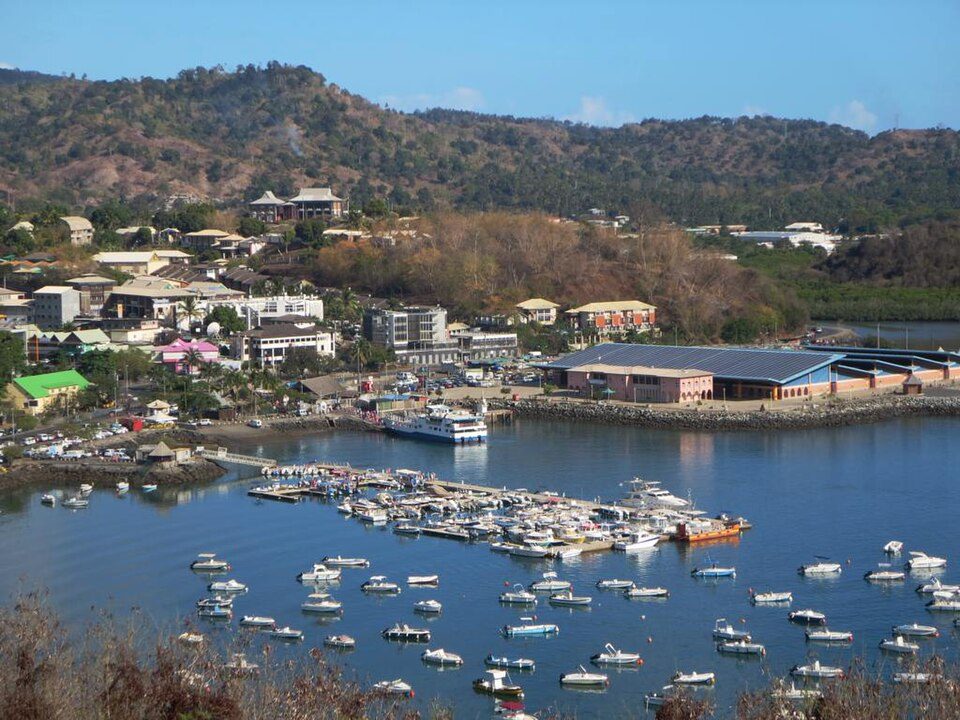
Mamoudzou: Mayotte’s Gateway to Regional Connectivity
Mamoudzou, the capital of Mayotte, serves as a key landing point for the Avassa submarine cable, connecting this French overseas territory to neighboring Comoros. While Mayotte’s overall submarine cable infrastructure consists of three cables spread across two landing points, Mamoudzou stands out as the sole host of the Avassa cable, a relatively short 260 km link that began operation in 2016.The Avassa Cable: Linking Mayotte to Comoros
The Avassa cable connects Mamoudzou to three other landing points: Chindini, Moroni, and Mutsamudu, all located in Comoros. This regional cable does not extend beyond the Indian Ocean, making it a domestic and regional connector rather than a direct link to global networks. The cable’s role is to ensure reliable communication between Mayotte and its closest neighbors, supporting local and regional needs. Mamoudzou’s position as a landing point is notable because it contrasts with Kaweni, Mayotte’s other cable hub, which hosts two cables and connects Mayotte to longer international routes. While Kaweni plays a larger role in linking Mayotte to the broader world, Mamoudzou’s single cable focuses on fostering regional ties. This division of roles reflects the strategic importance of Mamoudzou in maintaining Mayotte’s connectivity within its immediate geographic area.Latency Insights: A Reliable Connection
GeoCables’ latency monitoring reveals that Mamoudzou’s connectivity through the Avassa cable performs consistently well. Across 136 completed checks from 12 source cities, the average round-trip latency to Mamoudzou is 131 ms, with the best observed latency being an impressive 1 ms. These measurements highlight the efficiency of the Avassa cable in serving regional communication needs, ensuring that Mamoudzou remains well-connected to its neighbors despite its limited cable infrastructure.Why Mamoudzou Matters
As Mayotte’s most populated municipality and its administrative capital, Mamoudzou is a hub of activity on Grande-Terre, the main island. The presence of the Avassa cable here ensures that the city can maintain essential ties with Comoros, supporting both everyday communication and broader regional collaboration. While Kaweni handles the heavier international traffic, Mamoudzou’s role is no less significant in anchoring Mayotte’s place in the Indian Ocean’s network of islands. Mamoudzou’s connectivity story is one of balance. With just one cable landing here, the city plays a focused role in regional communication, complementing Kaweni’s international reach. Together, these landing points form the core of Mayotte’s submarine cable infrastructure, ensuring that this island territory remains connected to both its neighbors and the world.What next: Mamoudzou, Mayotte in the global directory of cable landing points; see surrounding routes on the interactive submarine cable map or follow live network monitoring.
Other Landing Points in Mayotte
Landing Point
- CountryYT Mayotte
- Coordinates12.7833°S 45.2333°E
- Connected Cables1
See Real Cable Routes
View actual submarine cable routing from Mamoudzou, Mayotte - with backbone nodes, distance calculations, and latency estimates
Open Calculator →
Submarine cables
Land fiber
Live probes