Maasin, Philippines
Landing Point · PH Philippines
Connected Cables
| Cable | Status |
|---|---|
| Philippine Domestic Submarine Cable Network (PDSCN) | Active |
| Submarine Cable in the Philippines (SCiP) | Active |
Live Performance
RTT measurements to this landing point from 2026-05-15 through 2026-09-25 - live ICMP round-trip time via our monitoring probes. Recomputed daily. ✓ No anomalies detected in the monitored period.
Measurement sources
| Probe | Location | Samples | Avg |
|---|---|---|---|
| #6410 own probe | Sao Paulo BR | 6 | 330.7 ms |
| #6427 own probe | Sydney AU | 6 | 188.1 ms |
| #7062 own probe | Cape Town ZA | 6 | 305.8 ms |
| own probe | Almaty KZ | 6 | 310.0 ms |
| #6487 | control probe | 4 | 46.9 ms |
| #6887 | control probe | 4 | 0.1 ms |
| #19092 | control probe | 4 | 60.3 ms |
| #51974 | control probe | 4 | 27.8 ms |
| own probe | Minsk BY | 2 | 260.2 ms |
| own probe | Tbilisi GE | 2 | 245.9 ms |
| own probe | Jerusalem IL | 2 | 313.1 ms |
| own probe | Moscow RU | 2 | 244.1 ms |
About Maasin, Philippines
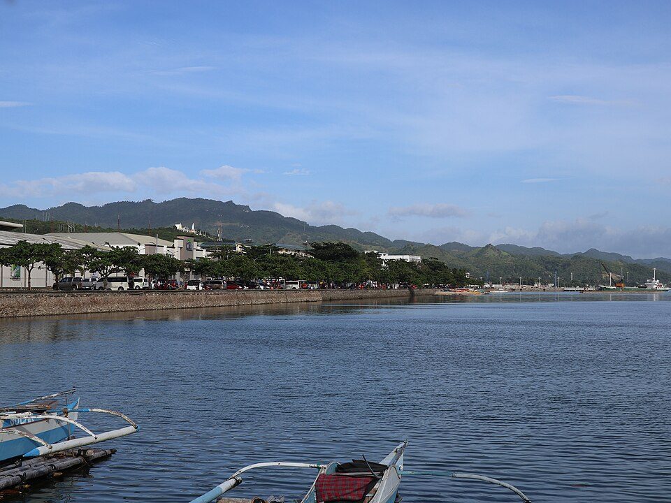
Maasin, Philippines: Submarine Cable Landing Point
Maasin is the capital city of Southern Leyte province in the Philippines, situated on the island of Leyte in the Visayas region. As a coastal city, it forms part of the broader Philippine submarine cable network, which spans 26 cables across 71 landing points throughout the archipelago. Two submarine cables land at Maasin, connecting it to the domestic cable infrastructure that links the many islands of the Philippines.
Both cables serving Maasin are domestic in scope, linking Philippine landing points to one another rather than reaching international destinations. The Philippine Domestic Submarine Cable Network (PDSCN) and the Submarine Cable in the Philippines (SCiP) together position Maasin as a node in the intra-island connectivity framework that supports communications across the Philippine archipelago. These two cables reflect the country's ongoing investment in inter-island submarine links, with both systems entering service in the early 2020s.
Cables Landing at Maasin
The Philippine Domestic Submarine Cable Network (PDSCN) is a domestic submarine cable system with a total length of 2,500 km. It reached ready-for-service (RFS) status in 2023 and connects multiple landing points within the Philippines. Maasin is one of the terminals on this network, which operates entirely within Philippine territory.
The Submarine Cable in the Philippines (SCiP) is a domestic submarine cable with a total length of 1,638 km. It achieved RFS status in 2022 and likewise connects landing points situated within the Philippines. Together with the PDSCN, SCiP extends inter-island cable capacity to Maasin, making the city a point of access on two separate domestic cable systems.
Regional Context
Among the 71 submarine cable landing points in the Philippines, Maasin ranks in the top 82 percent by cable count, hosting 2 cables. This places it behind higher-density hubs such as Batangas, Cagayan de Oro, Davao, and Taytay - each of which serves four cables - as well as Baler and Boracay, which each host three. Maasin nonetheless represents a meaningful node in the archipelago's distributed domestic cable infrastructure.
Network Role
Maasin functions as a dual-cable domestic terminus within the Philippine inter-island submarine cable graph. Both the PDSCN and SCiP connect it exclusively to other points within the country, meaning the landing point's role is oriented entirely toward supporting communications across the Philippine archipelago rather than toward international traffic. With two recently commissioned systems - one entering service in 2022 and the other in 2023 - Maasin benefits from relatively modern domestic cable infrastructure compared to the country's first submarine cable, which entered service in 1997.
As a landing point served by two distinct domestic cable systems, Maasin offers a degree of path diversity for inter-island connectivity in the Southern Leyte area. Within the broader Philippine submarine cable map, where the average cable length reaches approximately 4,995 km and international systems dominate much of the cable count, Maasin's shorter-reach domestic cables illustrate the continued expansion of intra-archipelago cable links to provincial and island communities.
What next: Maasin, Philippines in the global directory of cable landing points; see surrounding routes on the interactive submarine cable map or follow live network monitoring.
Other Landing Points in Philippines
Landing Point
- CountryPH Philippines
- Coordinates10.1786°N 124.8422°E
- Connected Cables2
See Real Cable Routes
View actual submarine cable routing from Maasin, Philippines - with backbone nodes, distance calculations, and latency estimates
Open Calculator →