Limbe, Cameroon
Landing Point · CM Cameroon
Connected Cables
| Cable | Status |
|---|---|
| West Africa Cable System (WACS) | Active |
Live Performance
RTT measurements to this landing point from 2026-03-12 through 2026-10-14 - live ICMP round-trip time via our monitoring probes. Recomputed daily. ✓ No anomalies detected in the monitored period.
Measurement sources
| Probe | Location | Samples | Avg |
|---|---|---|---|
| own probe | Jerusalem IL | 14 | 238.9 ms |
| #6427 own probe | Sydney AU | 11 | 254.1 ms |
| #7062 own probe | Cape Town ZA | 10 | 381.2 ms |
| own probe | Balancer IL | 10 | 238.7 ms |
| own probe | Almaty KZ | 8 | 261.0 ms |
| #6487 | control probe | 7 | 259.6 ms |
| #60163 | control probe | 6 | 292.5 ms |
| #7050 | control probe | 5 | 350.2 ms |
| #65635 | control probe | 5 | 284.2 ms |
| own probe | Minsk BY | 5 | 205.1 ms |
| own probe | Tbilisi GE | 5 | 231.6 ms |
| #6568 own probe | Singapore SG | 1 | 305.2 ms |
| own probe | Sevastopol UA | 1 | 255.1 ms |
| own probe | Moscow RU | 1 | 213.5 ms |
| own probe | Odessa UA | 1 | 216.6 ms |
| own probe | DVM IL | 1 | 231.0 ms |
About Limbe, Cameroon
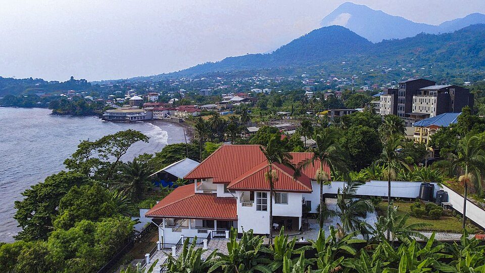
Limbe, Cameroon: Submarine Cable Landing Point
Limbe is a seaside city located in the South-West Region of Cameroon, positioned along the Atlantic coast of Central Africa. As a submarine cable landing point, Limbe connects Cameroon to a broad arc of African nations through a single international cable system. That cable links Limbe directly into the wider West African coastal corridor, extending connectivity from Central Africa northward and southward along the continent's Atlantic seaboard.
One submarine cable lands at Limbe: the West Africa Cable System (WACS). This cable connects Cameroon to a range of West and Southern African nations, establishing Limbe as a node within an extensive Africa-facing regional network. While Limbe hosts a single cable, that system spans more than 14,000 kilometres, giving the landing point reach well beyond its immediate sub-regional geography.
Cables Landing at Limbe
The West Africa Cable System (WACS) is a submarine cable measuring 14,530 kilometres in length, with a ready-for-service date of 2012. In addition to Limbe, WACS lands in Angola, Cape Verde, Côte d'Ivoire, the Democratic Republic of the Congo, Ghana, and Namibia. The cable traces the Atlantic coastline of Africa, connecting nations across Central, West, and Southern Africa into a single continuous system. Limbe's position on WACS places Cameroon within a network that spans from the equatorial Atlantic coast down to Southern Africa and northward to the island of Cape Verde in the mid-Atlantic.
Regional Context
Cameroon has five submarine cables landing across three landing points: Limbe, Kribi, and Douala. Kribi is the country's most cable-rich landing point with three systems, while both Limbe and Douala each host a single cable. Limbe's share of Cameroon's submarine cable infrastructure is therefore modest, though its connection to WACS ensures it participates in one of the longer cable systems active along the African Atlantic coast.
Network Role
Limbe functions as a single-cable terminus, serving as Cameroon's point of entry onto the WACS system. Through WACS, Limbe enables connectivity across a corridor that encompasses multiple African nations from Namibia in the south to Cape Verde in the north, including major economies such as Ghana, Côte d'Ivoire, and Angola. The cable's 2012 ready-for-service date places Limbe's integration into this system within the period of significant submarine cable expansion along the West African coast.
As a one-cable landing point within a three-node national infrastructure, Limbe occupies a defined but specialised role in Cameroon's submarine connectivity. Its presence on the WACS route means that the city contributes a distinct geographic access point into the national cable network, complementing the multi-cable hub at Kribi and the single-cable landing at Douala, and collectively giving Cameroon three separate physical entry points into the broader African submarine cable graph.
What next: Limbe, Cameroon in the global directory of cable landing points; see surrounding routes on the interactive submarine cable map or follow live network monitoring.
Other Landing Points in Cameroon
Landing Point
- CountryCM Cameroon
- Coordinates4.0145°N 9.2085°E
- Connected Cables1
See Real Cable Routes
View actual submarine cable routing from Limbe, Cameroon - with backbone nodes, distance calculations, and latency estimates
Open Calculator →