Kavos, Greece
Landing Point · GR Greece
Connected Cables
| Cable | Status |
|---|---|
| Thetis | Active |
Live Performance
RTT measurements to this landing point from 2026-04-06 through 2026-09-30 - live ICMP round-trip time via our monitoring probes. Recomputed daily. ✓ No anomalies detected in the monitored period.
Measurement sources
| Probe | Location | Samples | Avg |
|---|---|---|---|
| own probe | Minsk BY | 3 | 51.4 ms |
| own probe | Almaty KZ | 3 | 109.1 ms |
| own probe | Tbilisi GE | 3 | 82.3 ms |
| own probe | Jerusalem IL | 3 | 97.9 ms |
| #6410 own probe | Sao Paulo BR | 2 | 275.6 ms |
| #6427 own probe | Sydney AU | 2 | 330.4 ms |
| own probe | Odessa UA | 2 | 82.1 ms |
| own probe | Kyiv UA | 2 | 55.2 ms |
| own probe | Sevastopol UA | 1 | 135.8 ms |
| own probe | Moscow RU | 1 | 64.4 ms |
| own probe | Balancer IL | 1 | 98.5 ms |
About Kavos, Greece
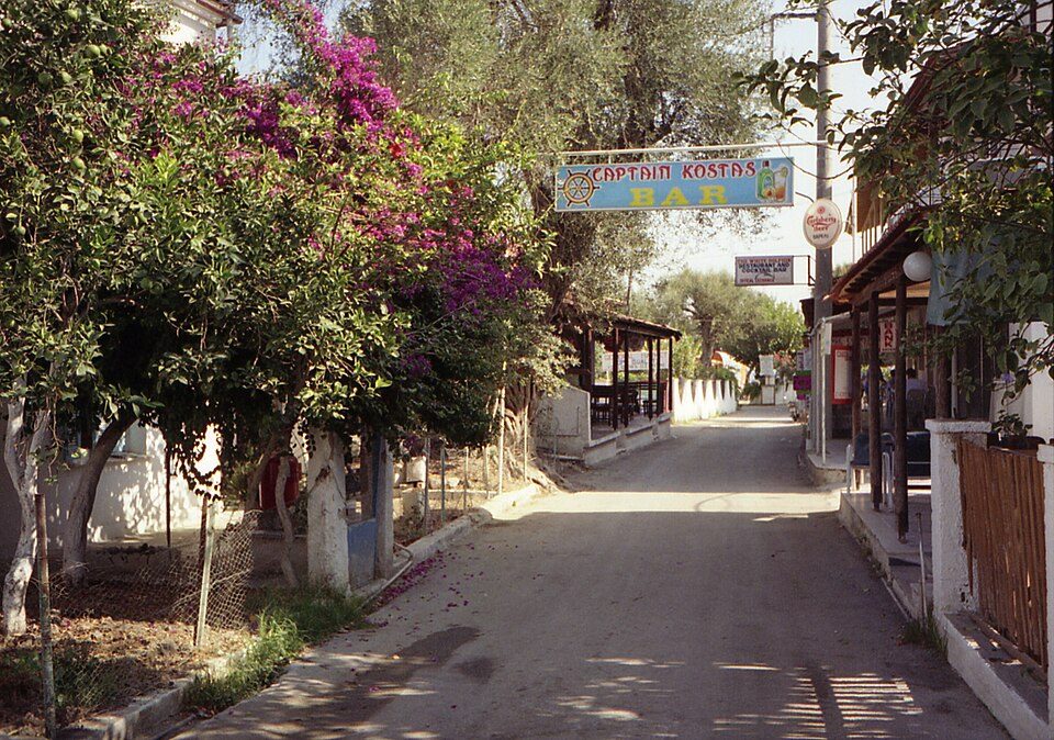
Kavos, Greece: Submarine Cable Landing Point
Kavos is a seaside village at the southern tip of Corfu, one of Greece's prominent Ionian islands. As a submarine cable landing point, Kavos connects Corfu to the broader Greek submarine cable network, hosting one submarine cable that links it to other points within Greece. While modest in scale compared to larger Greek landing points, Kavos represents a meaningful node in the domestic connectivity fabric of the country.
The single cable landing at Kavos is the Thetis system, a domestic Greek cable that ties this Ionian island location into a wider intra-country network. The corridor enabled by this cable is primarily inter-island or intra-national in character, reflecting the geographic reality of Greece as a nation with numerous inhabited islands requiring dedicated submarine cable links to maintain connectivity.
Cables Landing at Kavos
Thetis is a submarine cable system spanning 660 kilometres, with a ready-for-service date recorded as 2022 on a draft basis. All landing points on the Thetis cable fall within Greece, making it a purely domestic system. Kavos serves as one of the Greek endpoints on this intra-national route, connecting this southern Corfu village to other locations across the Greek island and mainland network.
Regional Context
Within Greece's submarine cable infrastructure, which spans 36 landing points hosting 20 cables in total, Kavos falls among the more lightly served locations, hosting a single cable. Leading Greek landing points by cable count include Chania with five cables, Athens with four, and Tympaki with four, positioning Kavos in the lower tier of Greece's landing point hierarchy. Nevertheless, its presence on the Thetis system places Corfu's southern coast within the national submarine cable graph that spans the Greek archipelago.
Network Role
Kavos functions as a single-cable terminus rather than a multi-cable hub, serving primarily to extend domestic Greek submarine connectivity to the southern end of Corfu. The Thetis cable, entirely contained within Greece, positions Kavos as a node in the intra-national network that links Greek islands and mainland points to one another rather than facilitating intercontinental or even regional international traffic.
For a geographically dispersed country like Greece - where island communities depend on submarine cables for connectivity - landing points such as Kavos at Corfu's southern tip play a direct role in ensuring that even peripheral island locations participate in the national cable network. Kavos thus occupies a defined, if specialised, position in the Greek submarine cable graph as the westernmost Ionian entry point on the Thetis system.
What next: Kavos, Greece in the global directory of cable landing points; see surrounding routes on the interactive submarine cable map or follow live network monitoring.
Other Landing Points in Greece
Landing Point
- CountryGR Greece
- Coordinates39.3854°N 20.1129°E
- Connected Cables1
See Real Cable Routes
View actual submarine cable routing from Kavos, Greece - with backbone nodes, distance calculations, and latency estimates
Open Calculator →