Butuan City, Philippines
Landing Point · PH Philippines
Connected Cables
| Cable | Status |
|---|---|
| PLDT Domestic Fiber Optic Network (DFON) | Active |
| Submarine Cable in the Philippines (SCiP) | Active |
Live Performance
RTT measurements to this landing point from 2026-06-05 through 2026-10-08 - live ICMP round-trip time via our monitoring probes. Recomputed daily. ✓ No anomalies detected in the monitored period.
Measurement sources
| Probe | Location | Samples | Avg |
|---|---|---|---|
| #6410 own probe | Sao Paulo BR | 8 | 330.0 ms |
| #6427 own probe | Sydney AU | 8 | 180.5 ms |
| #7062 own probe | Cape Town ZA | 8 | 302.8 ms |
| own probe | Almaty KZ | 8 | 321.3 ms |
| #6487 | control probe | 5 | 48.6 ms |
| #61654 | control probe | 5 | 32.2 ms |
| #64631 | control probe | 4 | 41.7 ms |
| #61349 | control probe | 3 | 39.0 ms |
| #7633 | control probe | 2 | 34.4 ms |
| own probe | Tbilisi GE | 2 | 303.3 ms |
| #6568 own probe | Singapore SG | 1 | 57.0 ms |
About Butuan City, Philippines
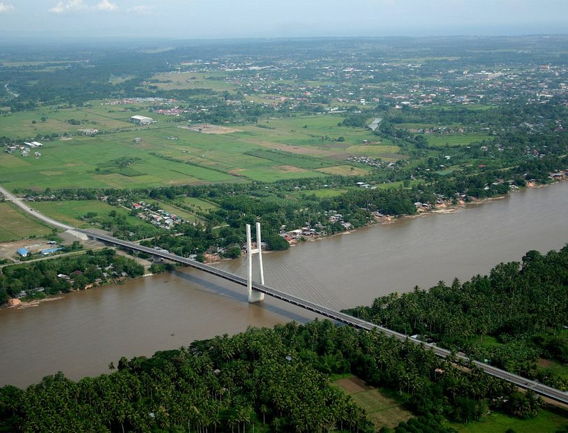
Butuan City: Submarine Cable Landing Point
Butuan City is a highly urbanized city located in the Caraga region of the Philippines, serving as the regional center of that area. As an island nation, the Philippines depends extensively on submarine cable infrastructure to maintain domestic connectivity between its many islands, and Butuan City participates in this network as a landing point for two submarine cables. Both cables serving Butuan City operate entirely within Philippine waters, positioning this landing point as a node within the country's domestic submarine connectivity framework rather than an international gateway.
The two cables landing at Butuan City are the PLDT Domestic Fiber Optic Network (DFON) and the Submarine Cable in the Philippines (SCiP). Together, they link Butuan City into a broader intra-archipelago network, enabling inter-island data transmission across routes that connect multiple Philippine landing points. The domestic orientation of both cables reflects the geographic realities of the Philippine archipelago, where overland connectivity between islands is impossible and submarine links serve as the primary means of high-capacity data transfer between population centers.
Cables Landing at Butuan City
The PLDT Domestic Fiber Optic Network (DFON) is a domestic submarine cable system with a total length of 11,100 kilometers, reaching its ready-for-service status in 1997. All endpoints on this cable are located within the Philippines, making it an extensive intra-national system. With its 1997 RFS date, DFON holds the distinction of being among the earliest submarine cables deployed in the Philippines, coinciding with the beginning of the country's submarine cable era.
The Submarine Cable in the Philippines (SCiP) is a more recent domestic cable system, with a length of 1,638 kilometers and a ready-for-service date of 2022. Like DFON, all of SCiP's endpoints are situated within the Philippines. Its significantly shorter length compared to DFON suggests a more targeted regional routing, and its 2022 RFS date reflects continued investment in expanding and modernizing the Philippines' domestic submarine cable capacity.
Regional Context
Within the Philippines, which hosts 26 submarine cables across 71 landing points, Butuan City's count of two cables places it in the top 82 percent of Philippine landing points by cable count. Several other Philippine cities carry heavier cable loads: Batangas, Cagayan de Oro, Davao, and Taytay each host four cables, while Baler and Boracay each host three. Butuan City thus occupies a secondary but established tier within the national submarine cable landscape.
Network Role
Butuan City functions as a domestic inter-island connectivity point, served entirely by cables that operate within Philippine territory. With two cables landing here - one dating to 1997 and one to 2022 - it represents both an original node in the country's early domestic fiber network and a beneficiary of more recent infrastructure development. This combination gives the city redundancy within the domestic cable system through two distinct cable routes.
As a multi-cable landing point on the island of Mindanao, Butuan City contributes to the resilience and distribution of intra-Philippine submarine connectivity, ensuring that Caraga's regional center maintains more than a single physical path within the national cable graph.
What next: Butuan City, Philippines in the global directory of cable landing points; see surrounding routes on the interactive submarine cable map or follow live network monitoring.
Other Landing Points in Philippines
Landing Point
- CountryPH Philippines
- Coordinates8.9476°N 125.5406°E
- Connected Cables2
See Real Cable Routes
View actual submarine cable routing from Butuan City, Philippines - with backbone nodes, distance calculations, and latency estimates
Open Calculator →