Baie-Mahault, Guadeloupe
Landing Point · GP Guadeloupe
Connected Cables
| Cable | Status |
|---|---|
| Southern Caribbean Fiber | Active |
Live Performance
RTT measurements to this landing point from 2026-07-15 through 2026-07-31 - live ICMP round-trip time via our monitoring probes. Recomputed daily. ✓ No anomalies detected in the monitored period.
Measurement sources
| Probe | Location | Samples | Avg |
|---|---|---|---|
| #6410 own probe | Sao Paulo BR | 4 | 110.4 ms |
| #6427 own probe | Sydney AU | 3 | 238.5 ms |
| #6487 | control probe | 3 | 263.4 ms |
| own probe | Minsk BY | 3 | 162.6 ms |
| own probe | Odessa UA | 2 | 194.5 ms |
| own probe | Kyiv UA | 2 | 189.4 ms |
| #17762 | control probe | 1 | 92.1 ms |
| #50091 | control probe | 1 | 38.2 ms |
| #52710 | control probe | 1 | 58.0 ms |
| own probe | Saint Petersburg RU | 1 | 143.3 ms |
About Baie-Mahault, Guadeloupe
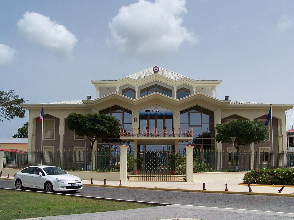
How the Internet Reaches Baie-Mahault
Baie-Mahault is a commune on the northwest coast of Guadeloupe, an overseas department and region of France situated in the Lesser Antilles of the eastern Caribbean. As part of an island territory, all international internet traffic arriving in Baie-Mahault travels entirely by submarine cable - there is no terrestrial connection to the wider global network. The commune sits within the urban area of Pointe-à-Pitre and hosts Guadeloupe's largest industrial zone at Jarry, making it a significant hub of economic activity on the island.
International internet traffic reaches Baie-Mahault through a single submarine cable landing point served by the Southern Caribbean Fiber cable. This makes Baie-Mahault one of nine cable landing points distributed across Guadeloupe, a territory that is served by four submarine cables in total. The Southern Caribbean Fiber is the sole cable terminating at Baie-Mahault, meaning this particular landing point functions as a single-cable terminus rather than a node along a multi-cable corridor.
The Cable Serving Baie-Mahault
The Southern Caribbean Fiber cable spans approximately 3,000 km and entered service in 2006. From Baie-Mahault, this cable connects Guadeloupe to Antigua and Barbuda, Barbados, Dominica, Grenada, Martinique, Montserrat, Saint Barthélemy, and Saint Kitts and Nevis, among other destinations. Other landing points along the cable include Baillif in Guadeloupe, Basseterre in Saint Kitts and Nevis, Bunkum Bay in Montserrat, Canefield in Dominica, and Chaguaramas in Trinidad and Tobago. The cable effectively stitches together the chain of Lesser Antilles islands, carrying regional traffic across the eastern Caribbean.
Regional Context
Guadeloupe hosts four submarine cables across nine landing points, with the first cable in service since 1995. Baie-Mahault accounts for one of those nine landing points, served exclusively by Southern Caribbean Fiber. Other landing points on the island include Baillif - which benefits from two cables - as well as Beausejour, Capesterre-Belle-Eau, Jarry, and Pointe-à-Pitre, each served by one cable. Baillif's dual-cable status makes it the most redundant individual landing point within Guadeloupe's cable infrastructure.
What This Means for Connectivity
Because Baie-Mahault is served by a single submarine cable, all international traffic flowing through this landing point depends entirely on Southern Caribbean Fiber. Any disruption to that cable would affect every external service routed through the Baie-Mahault terminus specifically. The cable's reach across the eastern Caribbean - connecting Guadeloupe to over a dozen island nations including Trinidad and Tobago, Barbados, and Dominica - means that traffic from Baie-Mahault is primarily regional in character, linking the Lesser Antilles rather than providing a direct intercontinental route.
Understanding Baie-Mahault's position within Guadeloupe's broader nine-point landing infrastructure illustrates how submarine connectivity is distributed across an island territory: no single commune carries the full load, and regional redundancy is built through geographic spread rather than cable diversity at any one landing site.
What next: Baie-Mahault, Guadeloupe in the global directory of cable landing points; see surrounding routes on the interactive submarine cable map or follow live network monitoring.
Other Landing Points in Guadeloupe
Landing Point
- CountryGP Guadeloupe
- Coordinates16.2445°N 61.5717°W
- Connected Cables1
See Real Cable Routes
View actual submarine cable routing from Baie-Mahault, Guadeloupe - with backbone nodes, distance calculations, and latency estimates
Open Calculator →