Sri Vijaya Puram, India
Landing Point · IN India
Connected Cables
| Cable | Status |
|---|---|
| Chennai-Andaman & Nicobar Islands Cable (CANI) | Active |
📡 Live Performance
RTT measurements to this landing point from 2026-04-19 through 2026-07-11 - live ICMP round-trip time via our monitoring probes. Recomputed daily. ✓ No anomalies detected in the monitored period.
Measurement sources
| Probe | Location | Samples | Avg |
|---|---|---|---|
| #1014589 own probe | Almaty KZ | 3 | 236.2 ms |
| #1014597 own probe | Tbilisi GE | 3 | 250.4 ms |
| #1014969 own probe | Jerusalem IL | 3 | 236.1 ms |
| #6410 own probe | Sao Paulo BR | 1 | 406.9 ms |
| #6487 own probe | Singapore SG | 1 | 56.0 ms |
| #7062 own probe | Cape Town ZA | 1 | 299.9 ms |
| #1014473 own probe | Minsk BY | 1 | 205.5 ms |
| #1015313 own probe | Sevastopol UA | 1 | 208.8 ms |
About Sri Vijaya Puram, India
Sri Vijaya Puram: Submarine Cable Landing Point
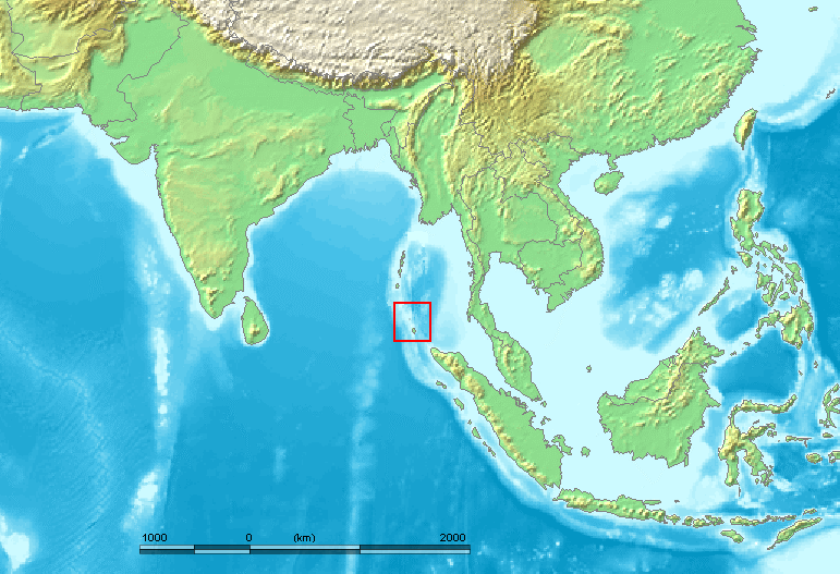
Sri Vijaya Puram, the capital of India's union territory of Andaman and Nicobar Islands, sits on South Andaman Island between the Bay of Bengal to the west and the Andaman Sea to the east. Located approximately 1,190 km from Chennai on the Indian mainland, the city occupies a geographically isolated position that makes submarine cable connectivity the primary means of high-capacity data transmission to and from the islands. One submarine cable lands at Sri Vijaya Puram, connecting the Andaman and Nicobar Islands directly to mainland India.
That cable is the Chennai–Andaman & Nicobar Islands Cable (CANI), an entirely domestic link that runs between the island territory and the Indian mainland. Its presence establishes Sri Vijaya Puram as the island-side terminus of an inter-island and island-to-mainland corridor within Indian territory. The connection is an intra-country link rather than an international one, reflecting the administrative and geographic relationship between the Andaman and Nicobar Islands and the Indian mainland.
Cables Landing at Sri Vijaya Puram
The Chennai–Andaman & Nicobar Islands Cable (CANI) is a 2,300 km submarine cable that reached ready-for-service status in 2020. As its name indicates, the cable links Sri Vijaya Puram in the Andaman and Nicobar Islands with Chennai on the southeastern coast of mainland India. Both endpoints lie within India, making CANI a domestic submarine cable system. Its 2,300 km length reflects the considerable maritime distance separating the island chain from the Indian subcontinent, a gap that previously made robust digital connectivity to Sri Vijaya Puram a challenge.
Regional Context
Within India's submarine cable landscape, which spans 26 landing points hosting a total of 21 cables, Sri Vijaya Puram hosts a single cable. Major Indian landing points such as Mumbai (18 cables) and Chennai (9 cables) host far larger concentrations of submarine infrastructure, while Kochi hosts 2. Sri Vijaya Puram is comparable in cable count to other single-cable Indian landing points such as Agatti, Amini, and Andrott, each of which also hosts one cable, suggesting a pattern of targeted domestic links serving outlying island territories.
Network Role
Sri Vijaya Puram functions as a single-cable terminus rather than a multi-cable hub. Its sole connection, the CANI cable, provides a dedicated submarine pathway between the Andaman and Nicobar Islands and the Indian mainland, with Chennai serving as the mainland anchor. The corridor this enables is entirely domestic in character, linking an isolated island union territory to one of India's most connected coastal cities.
Within the regional submarine cable graph, Sri Vijaya Puram represents an endpoint node—a location served by one dedicated domestic link rather than a convergence point for international traffic. Its role is to extend India's submarine cable network outward to a geographically remote island group, ensuring that Sri Vijaya Puram, as the only notified town in the union territory, has a direct high-capacity undersea connection to the rest of the country.
What next: Sri Vijaya Puram, India in the global directory of cable landing points; see surrounding routes on the interactive submarine cable map or follow live network monitoring.
Other Landing Points in India
Landing Point
- CountryIN India
- Coordinates11.6234°N 92.7265°E
- Connected Cables1
See Real Cable Routes
View actual submarine cable routing from Sri Vijaya Puram, India - with backbone nodes, distance calculations, and latency estimates
Open Calculator →